MyTopo
Oak Park Georgia US Topo Map
Couldn't load pickup availability
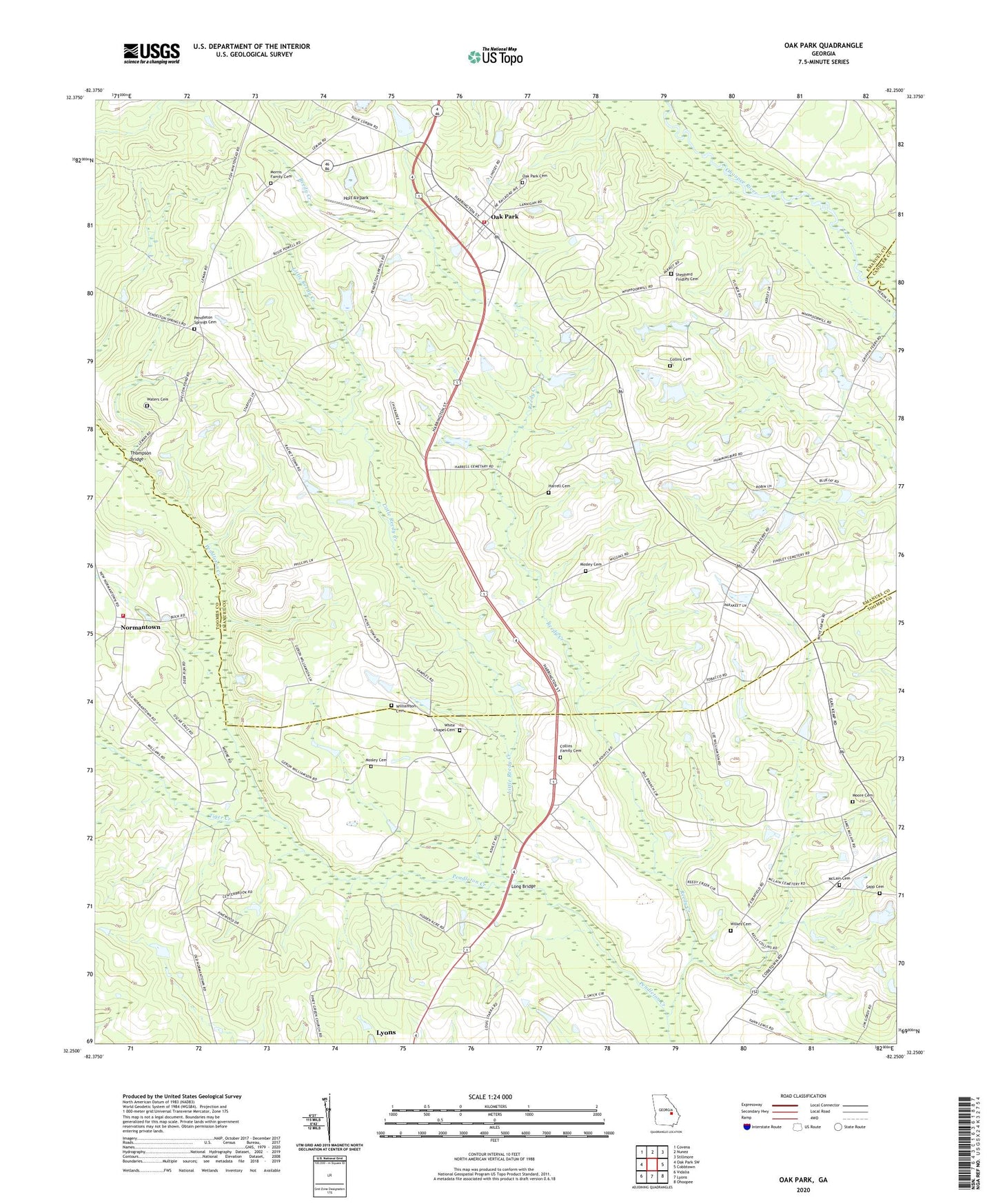
2024 topographic map quadrangle Oak Park in the state of Georgia. Scale: 1:24000. Based on the newly updated USGS 7.5' US Topo map series, this map is in the following counties: Emanuel, Toombs, Candler. The map contains contour data, water features, and other items you are used to seeing on USGS maps, but also has updated roads and other features. This is the next generation of topographic maps. Printed on high-quality waterproof paper with UV fade-resistant inks.
Quads adjacent to this one:
West: Oak Park SW
Northwest: Covena
North: Nunez
Northeast: Stillmore
East: Cobbtown
Southeast: Ohoopee
South: Lyons
Southwest: Vidalia
This map covers the same area as the classic USGS quad with code o32082c3.
Contains the following named places: Collins Cemetery, Collins Family Cemetery, Corinth Church, Elisha Mosley Cemetery, Emanuel County Fire Department Station 06, Harrell Cemetery, Holt Airpark, Lane Chapel, Little Reedy Creek, Long Bridge, Marietta Church, McLain Cemetery, Moore Cemetery, Morris Family Cemetery, Mosley Cemetery, Mount Chapel, Mount Zion Church, Normantown, Normantown Volunteer Fire Department, Oak Park, Oak Park Cemetery, Oak Park Church, Oak Park City Fire Department, Oak Park Division, Pendleton Church, Pendleton Springs Cemetery, Pendleton Springs Church, Piney Green Church, Reedy Creek, Sapp Cemetery, Shepherd Findley Cemetery, Thompson Bridge, Tiger Creek, Town of Oak Park, Waters Cemetery, White Chapel, White Chapel Cemetery, Wilkes Cemetery, Williamson Cemetery