MyTopo
Macclenny NE Georgia US Topo Map
Couldn't load pickup availability
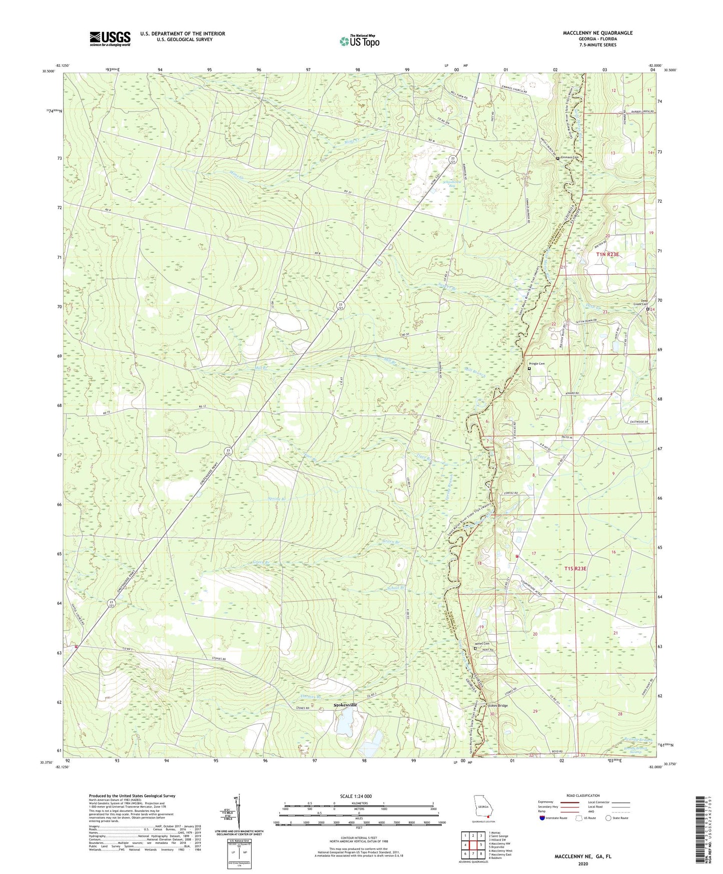
2024 topographic map quadrangle Macclenny NE in the states of Florida, Georgia. Scale: 1:24000. Based on the newly updated USGS 7.5' US Topo map series, this map is in the following counties: Charlton, Nassau. The map contains contour data, water features, and other items you are used to seeing on USGS maps, but also has updated roads and other features. This is the next generation of topographic maps. Printed on high-quality waterproof paper with UV fade-resistant inks.
Quads adjacent to this one:
West: Macclenny NW
Northwest: Moniac
North: Saint George
Northeast: Hilliard SW
East: Bryceville
Southeast: Baldwin
South: Macclenny East
Southwest: Macclenny West
This map covers the same area as the classic USGS quad with code o30082d1.
Contains the following named places: Brandy Branch, Charlton County Fire Department Station 4, Chism School, Deep Creek, Deep Creek Cemetery, Emmaus Cemetery, Emmaus Church, Green Branch, Mill Branch, Motes Cemetery, Nassau County Fire and Rescue Station 6, Pringle Cemetery, Saucer Branch, School Branch, Schoolhouse Bay, Spring Branch, Stokes Bridge, Stokes School, Stokesville, Suggs Still, Thomas Branch, Tiger Branch