MyTopo
Mershon Georgia US Topo Map
Couldn't load pickup availability
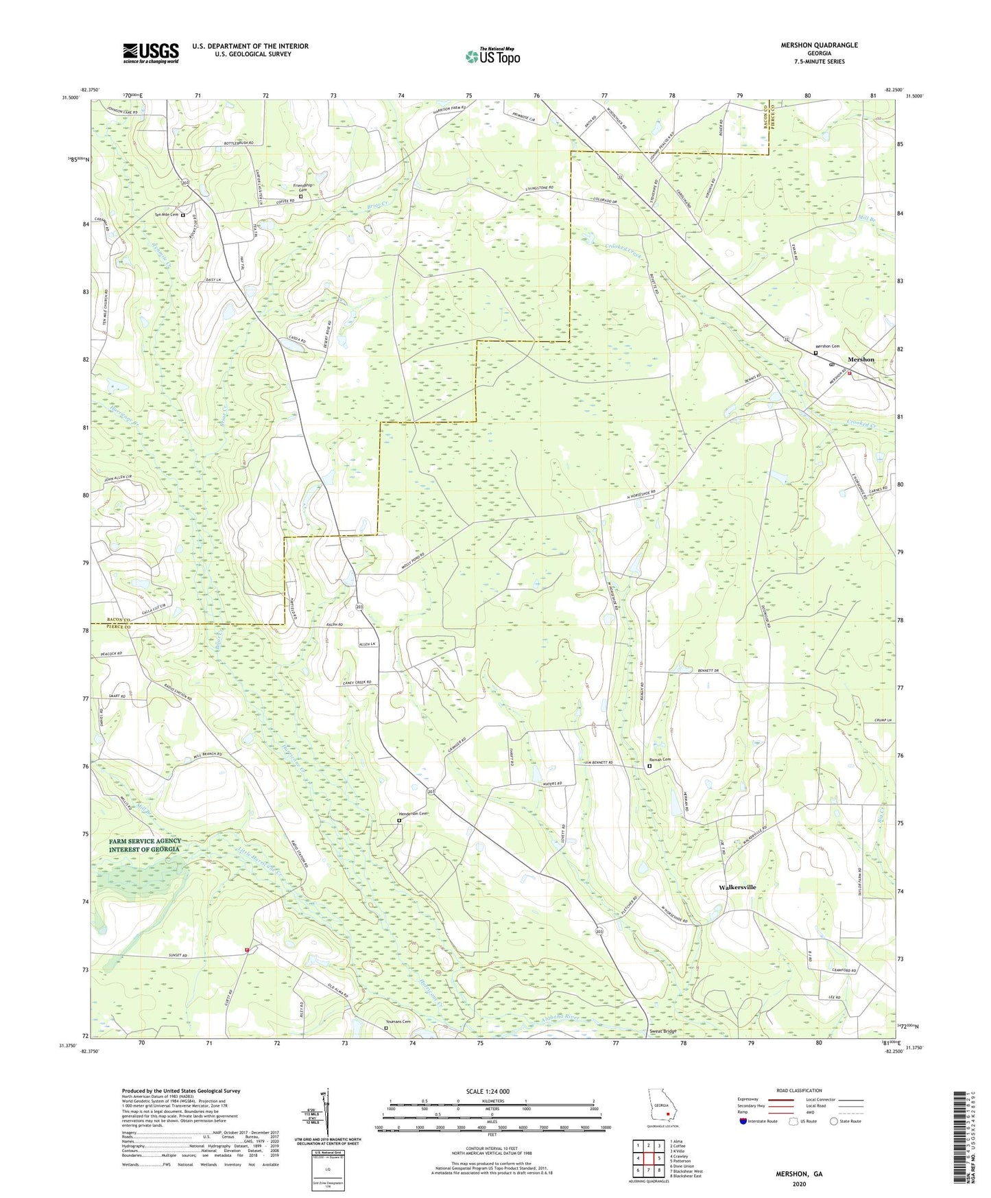
2024 topographic map quadrangle Mershon in the state of Georgia. Scale: 1:24000. Based on the newly updated USGS 7.5' US Topo map series, this map is in the following counties: Pierce, Bacon. The map contains contour data, water features, and other items you are used to seeing on USGS maps, but also has updated roads and other features. This is the next generation of topographic maps. Printed on high-quality waterproof paper with UV fade-resistant inks.
Quads adjacent to this one:
West: Crawley
Northwest: Alma
North: Coffee
East: Patterson
Southeast: Blackshear East
South: Blackshear West
Southwest: Dixie Union
This map covers the same area as the classic USGS quad with code o31082d3.
Contains the following named places: Briar Creek, Bristol Division, Byrum Siding, Friendship Cemetery, Friendship Church, Henderson Cemetery, Hurricane Creek, Little Hurricane Creek, Mershon, Mershon Baptist Church, Mershon Cemetery, Mershon Census Designated Place, Mershon Post Office, Mill Branch, Northside Volunteer Fire Department, Ramah Cemetery, Ramah Church, Ramah School, Shady Grove Baptist Church, Shady Grove Church, Sumner Ford, Sunset Volunteer Fire Department, Sweat Bridge, Sweat Ford, Ten Mile Cemetery, Tenmile Creek, Tenmile Creek Church, Walkersville, Walkerville Church, Youmans Cemetery, ZIP Code: 31551