MyTopo
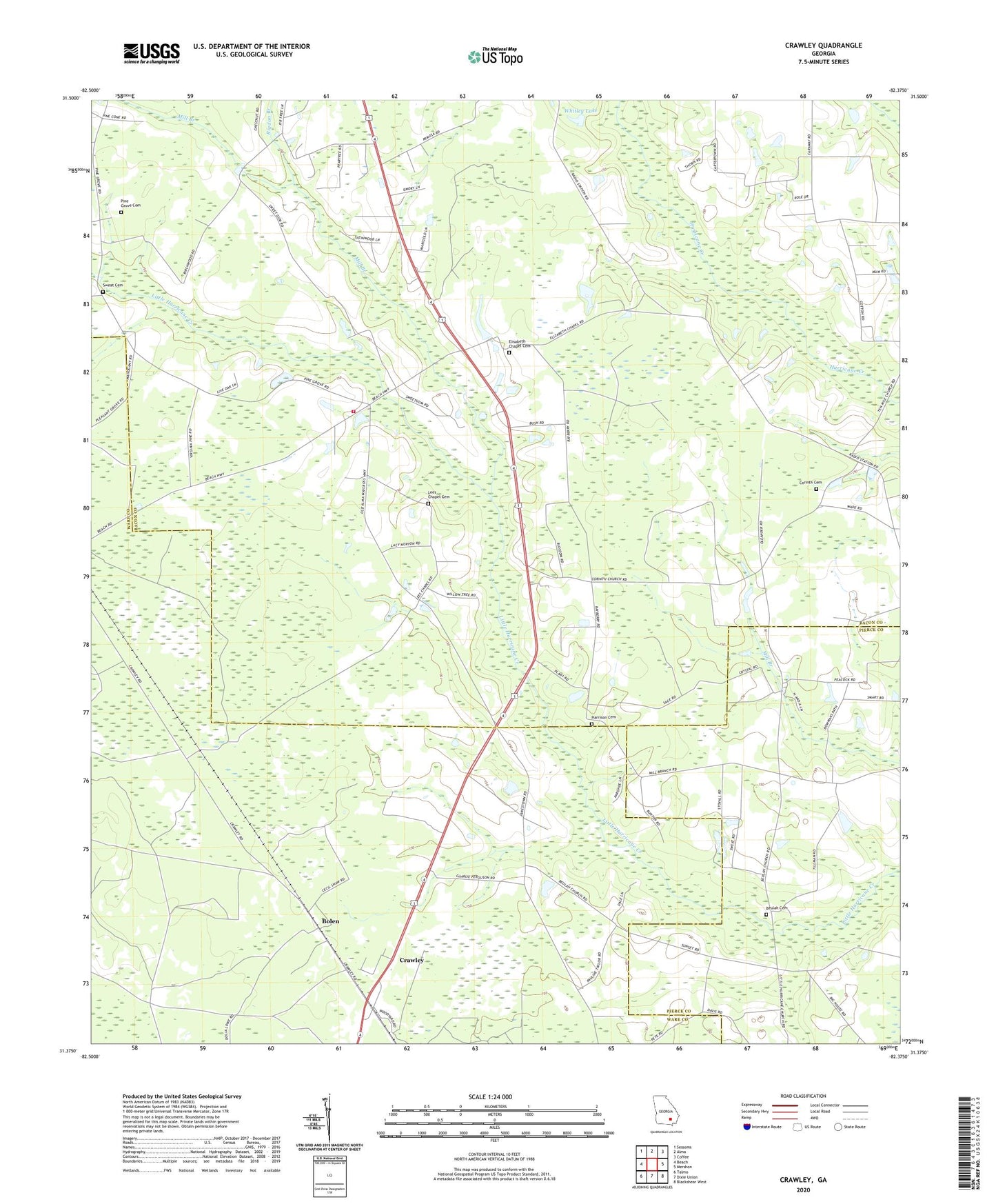
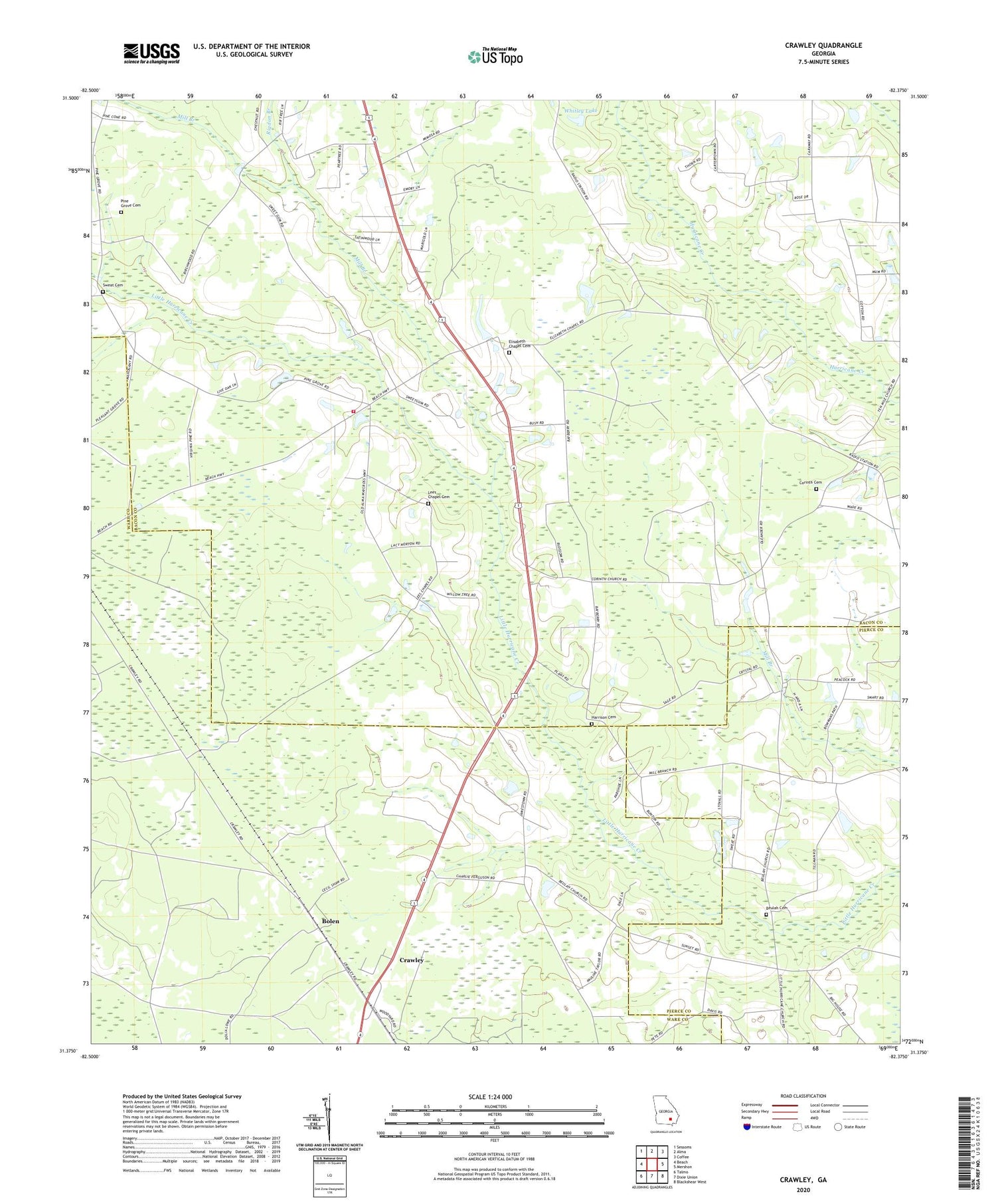
Crawley Georgia US Topo Map
Couldn't load pickup availability
2024 topographic map quadrangle Crawley in the state of Georgia. Scale: 1:24000. Based on the newly updated USGS 7.5' US Topo map series, this map is in the following counties: Bacon, Ware, Pierce. The map contains contour data, water features, and other items you are used to seeing on USGS maps, but also has updated roads and other features. This is the next generation of topographic maps. Printed on high-quality waterproof paper with UV fade-resistant inks.
Quads adjacent to this one:
West: Beach
Northwest: Sessoms
North: Alma
Northeast: Coffee
East: Mershon
Southeast: Blackshear West
South: Dixie Union
Southwest: Talmo
This map covers the same area as the classic USGS quad with code o31082d4.
Contains the following named places: Adventist Church, Beulah Church, Beulah Church Cemetery, Big Branch, Bolen, Chatham School, Corinth Baptist Church Cemetery, Corinth Church, Crawley, Elisabeth Chapel Cemetery, Elizabeth Chapel, Harrison Cemetery, Hurricane School, Lee Chapel, Lees Chapel Cemetery, Marys Chapel, Mill Branch, Moody Dairy Farm, New Pleasant Grove Baptist Church, Old Pine Grove Church, Old Pine Grove Church Cemetery, Rigdon Branch, Sweat Cemetery, Ware Volunteer Fire Station, Whitley Lake, Whitley Lake Dam