MyTopo
Needmore Georgia US Topo Map
Couldn't load pickup availability
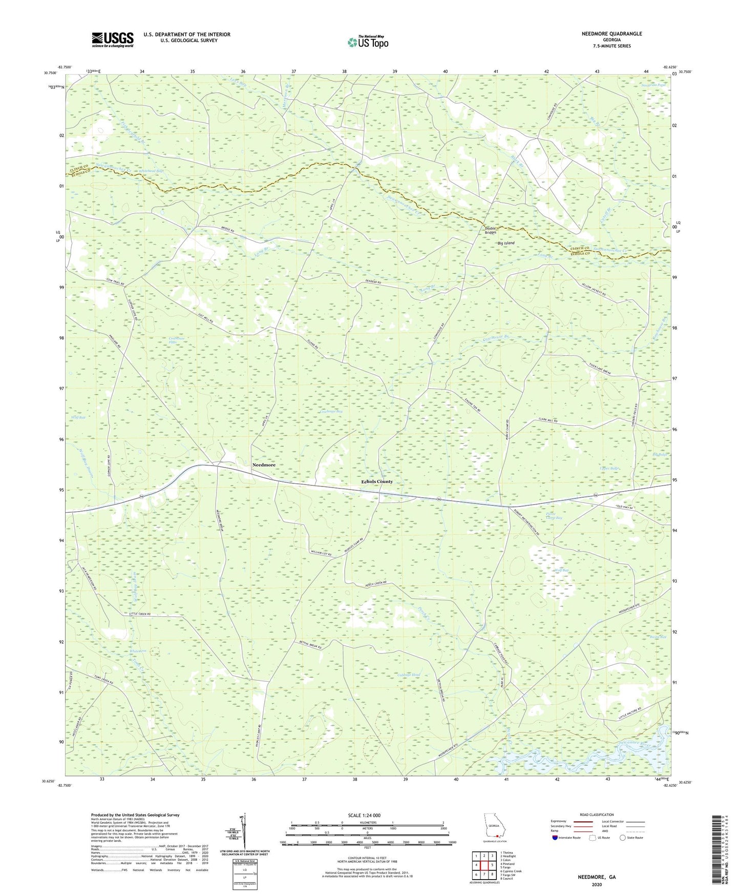
2024 topographic map quadrangle Needmore in the state of Georgia. Scale: 1:24000. Based on the newly updated USGS 7.5' US Topo map series, this map is in the following counties: Echols, Clinch. The map contains contour data, water features, and other items you are used to seeing on USGS maps, but also has updated roads and other features. This is the next generation of topographic maps. Printed on high-quality waterproof paper with UV fade-resistant inks.
Quads adjacent to this one:
West: Pineland
Northwest: Thelma
North: Headlight
Northeast: Colon
East: Fargo
Southeast: Council
South: Fargo SW
Southwest: Cypress Creek
This map covers the same area as the classic USGS quad with code o30082f6.
Contains the following named places: Bethel Church, Big Bulge, Big Island, Bills Pond, Bivins Bay, Black Branch, Cabbage Head, Cowhouse Bay, Cowhouse Flats, Cutoff Branch, Double Bridges, Fish Scaffold Branch, Lees Bay, Little Creek, Log Landing, Long Branch, Mattox Ford, Morrison Branch, Needmore, Perch Creek, Pierce Camp, Pierce Camp Bay, Sawgrass Pond, Upper Bulge, Weatherington Camp, Wolf Bay, Wolf Bay Drain, ZIP Code: 31631