MyTopo
Headlight Georgia US Topo Map
Couldn't load pickup availability
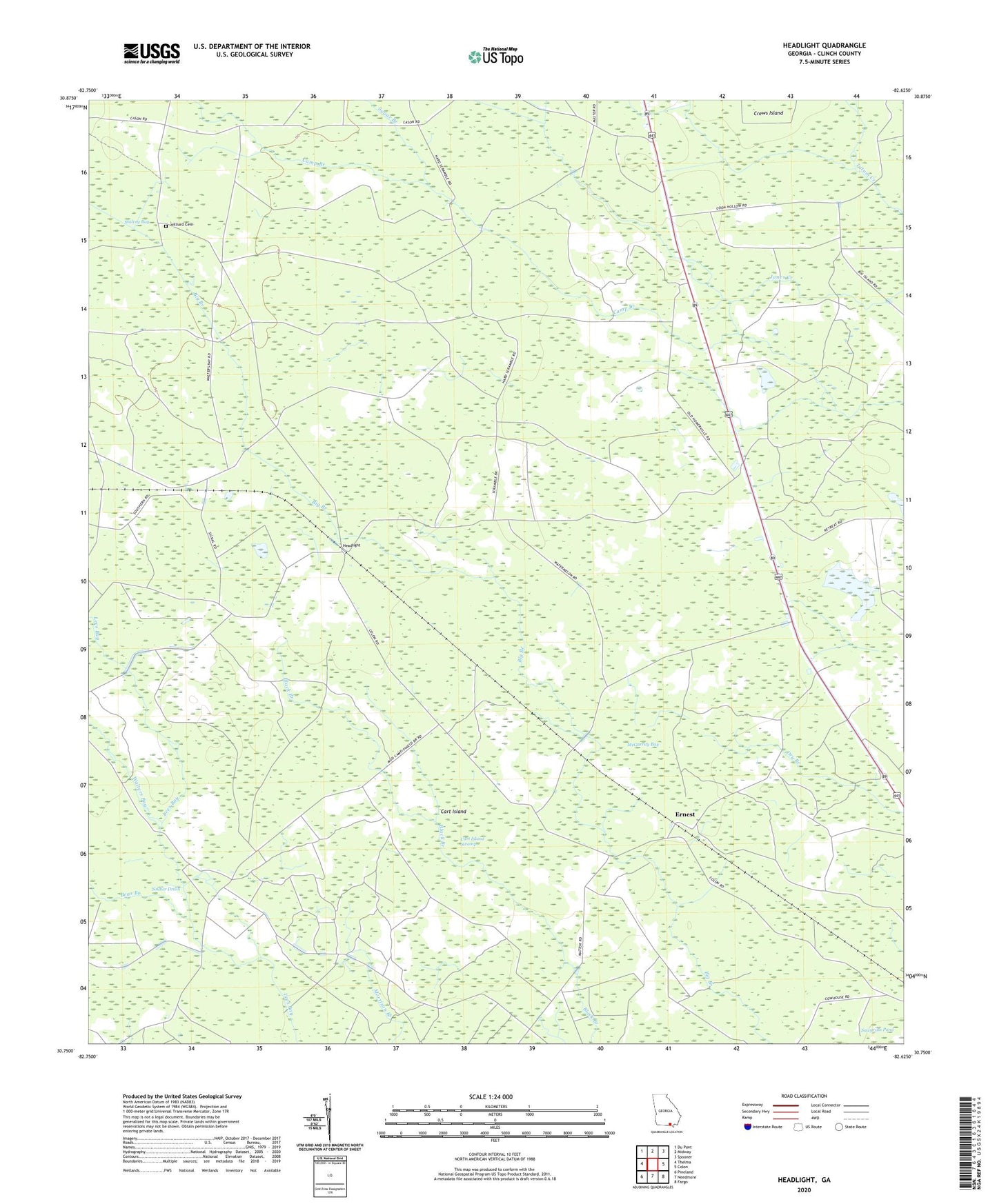
2024 topographic map quadrangle Headlight in the state of Georgia. Scale: 1:24000. Based on the newly updated USGS 7.5' US Topo map series, this map is in the following counties: Clinch. The map contains contour data, water features, and other items you are used to seeing on USGS maps, but also has updated roads and other features. This is the next generation of topographic maps. Printed on high-quality waterproof paper with UV fade-resistant inks.
Quads adjacent to this one:
West: Thelma
Northwest: Du Pont
North: Midway
Northeast: Spooner
East: Colon
Southeast: Fargo
South: Needmore
Southwest: Pineland
This map covers the same area as the classic USGS quad with code o30082g6.
Contains the following named places: Bear Branch, Camp Branch, Cart Island, Cart Island Swamp, Crews Island, Ernest, Fargo Division, Headlight, Hilliard Cemetery, McGarrity Bay, Sugar Branch, Walters Bay