MyTopo
Colon Georgia US Topo Map
Couldn't load pickup availability
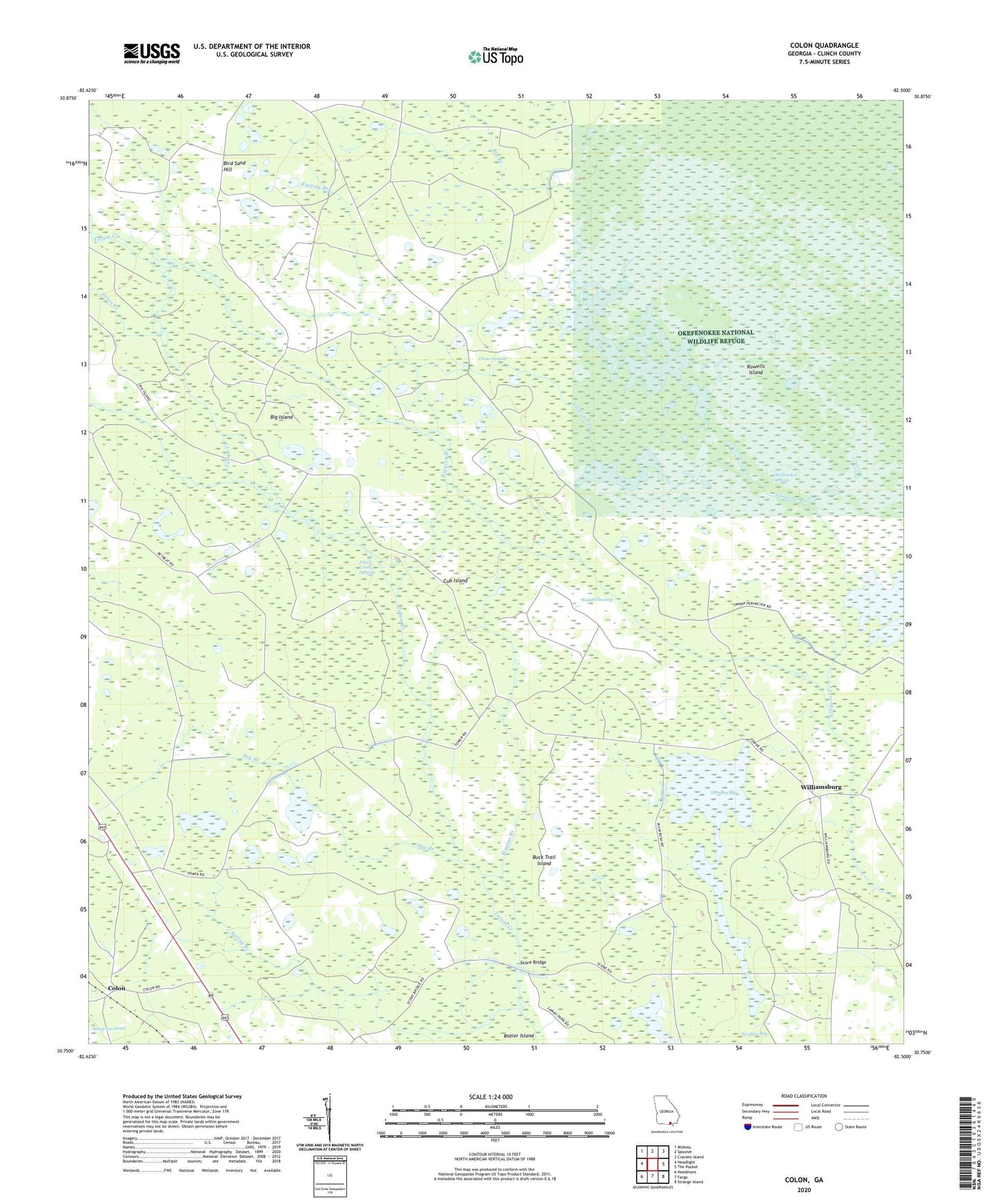
2024 topographic map quadrangle Colon in the state of Georgia. Scale: 1:24000. Based on the newly updated USGS 7.5' US Topo map series, this map is in the following counties: Clinch. The map contains contour data, water features, and other items you are used to seeing on USGS maps, but also has updated roads and other features. This is the next generation of topographic maps. Printed on high-quality waterproof paper with UV fade-resistant inks.
Quads adjacent to this one:
West: Headlight
Northwest: Midway
North: Spooner
Northeast: Cravens Island
East: The Pocket
Southeast: Strange Island
South: Fargo
Southwest: Needmore
This map covers the same area as the classic USGS quad with code o30082g5.
Contains the following named places: Big Branch, Big Island, Bird Sand Hill, Branch Canal, Buck Trail Island, Colon, Cross Swamp, Cub Island, Cypress Log Pond, Dry Branch, Indian Swamp, Jones Creek Swamp, Riggins Branch, Rowells Island, Score Bridge, Steedley Bay, Tatum Creek, Vessels Ford, Williamsburg