MyTopo
Perry East Georgia US Topo Map
Couldn't load pickup availability
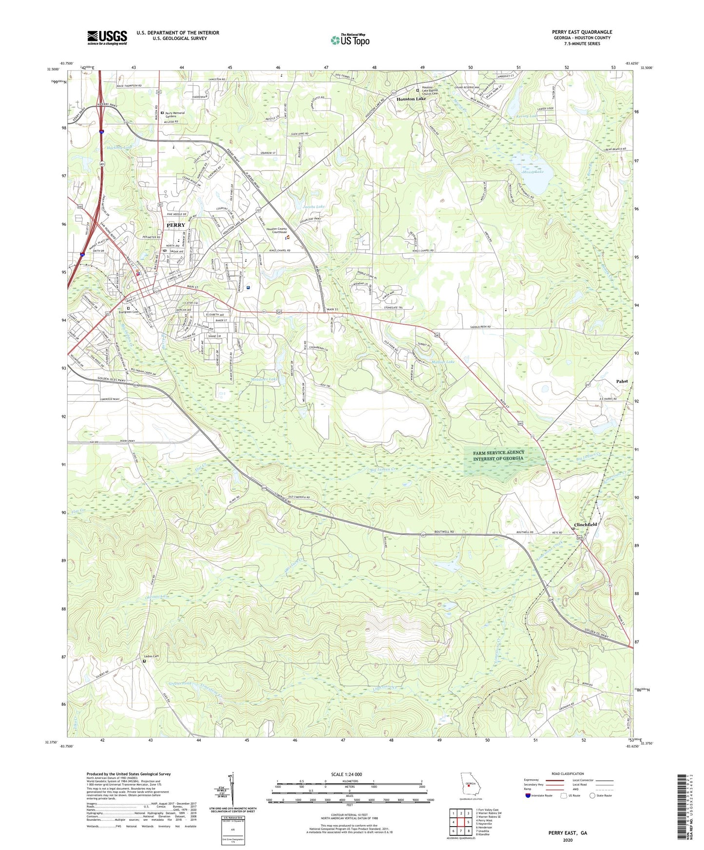
2024 topographic map quadrangle Perry East in the state of Georgia. Scale: 1:24000. Based on the newly updated USGS 7.5' US Topo map series, this map is in the following counties: Houston. The map contains contour data, water features, and other items you are used to seeing on USGS maps, but also has updated roads and other features. This is the next generation of topographic maps. Printed on high-quality waterproof paper with UV fade-resistant inks.
Quads adjacent to this one:
West: Perry West
Northwest: Fort Valley East
North: Warner Robins SW
Northeast: Warner Robins SE
East: Hayneville
Southeast: Klondike
South: Unadilla
Southwest: Henderson
This map covers the same area as the classic USGS quad with code o32083d6.
Contains the following named places: Barbara Calhoun Park, Bear Branch, Berry Branch, Bonners Camp, City of Perry, Clinchfield, Clinchfield Post Office, Clinchfield Presbyterian Church, Creekwood Park, Crossroads Church, Devonwood, Eastgate Shopping Center, Elem School, Elko Division, Evergreen Cemetery, First Baptist Church, Flat Creek, Fox Ridge Estates, Full Gospel Lighthouse, Georgia National Fairgrounds and Agricenter, Georgia State Patrol Troop H Post 15 Perry, Greater Union Baptist Church, Greens Pond, Grove Park, Hackney Lake, Hackney Lake Dam, Houston County, Houston County Courthouse, Houston County Detention Center, Houston County Sheriff's Office, Houston Female College, Houston Lake, Houston Lake Baptist Church, Houston Lake Baptist Church Cemetery, Houston Lake Dam, Jacobs Lake, Jacobs Lake Dam, Kersey Lake, Kersey Lake Dam, Kings Chapel, Kings Chapel School, Ladies Cemetery, Laidler Cemetery, Laidler Springs Church, Laidler Springs School, Lea Glen, McEver Probation Detention Center, Meadows Lake, Meadows Lake Dam, Memorial Heights Church, Morningside Elementary School, Mossy Lake, Mossy Lake Dam, Mount Nebo Church, Mount Nebo School, Mullins Lake, Mullins Lake Dam, New Hope School, Oak Grove School, Oak Level Church, Okeetuck Creek, Old Field Baptist Church, Pabst, Perry, Perry Academy, Perry City Hall, Perry Country Club, Perry Division, Perry Elementary School, Perry Fire Department, Perry High School, Perry Hospital, Perry Market Place Shopping Center, Perry Memorial Gardens, Perry Middle School, Perry Police Department, Perry Post Office, Perry United Methodist Church, Perry Village Shopping Center, Perry-Houston County Library, Plaza Shopping Center, Redding Branch, Rozar Park, Saint Christophers Episcopal Church, Saint Patricks Catholic Church, Second Memorial Baptist Church, Tucker School, Wildwood Estates, Willow Run, WPGA-AM (Perry), ZIP Code: 31069