MyTopo
Perry West Georgia US Topo Map
Couldn't load pickup availability
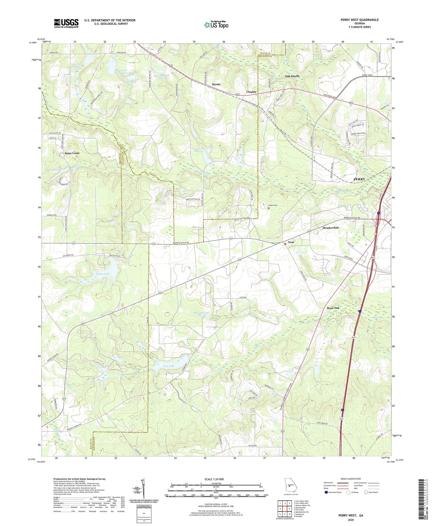
2024 topographic map quadrangle Perry West in the state of Georgia. Scale: 1:24000. Based on the newly updated USGS 7.5' US Topo map series, this map is in the following counties: Houston, Macon, Peach. The map contains contour data, water features, and other items you are used to seeing on USGS maps, but also has updated roads and other features. This is the next generation of topographic maps. Printed on high-quality waterproof paper with UV fade-resistant inks.
Quads adjacent to this one:
West: Marshallville
Northwest: Fort Valley West
North: Fort Valley East
Northeast: Warner Robins SW
East: Perry East
Southeast: Unadilla
South: Henderson
Southwest: Marshallville SW
This map covers the same area as the classic USGS quad with code o32083d7.
Contains the following named places: Baptist Creek, Bay Creek, Beaver Creek, Belvin Church, Browns Chapel, Camp Hope, Clopine, Davis Chapel, Davis Chapel School, Davis-Felton Plantation, Dumas Lake, Dumas Lake Dam, Forbes Dam, Forbes Lake, Free Lake, Free Lake Dam, Hoses Cemetery, Houston County Fire Department Station 8, John Schofeld Dam, John Schofeld Lake, Lake Blue Bird, Lake Blue Bird Dam, Lake Clopine, Lake Clopine Dam, Lake Lasseter, Lake Lasseter Dam, Louis Newberry Dam, Louis Newberry Lake, Lucy Giles Dam, Lucy Giles Lake, Marthan Church, Meadowdale, Midway Church, Moss Oak, Mount Zion Church, Myrtle, Neal, Oak Knolls, Perry Industrial Park, Richland Church, Saint Louis, Saint Louis Church, Westfield School