MyTopo
Pineview NW Georgia US Topo Map
Couldn't load pickup availability
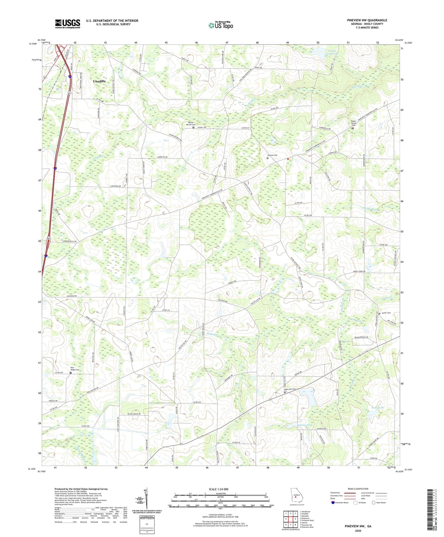
2024 topographic map quadrangle Pineview NW in the state of Georgia. Scale: 1:24000. Based on the newly updated USGS 7.5' US Topo map series, this map is in the following counties: Dooly. The map contains contour data, water features, and other items you are used to seeing on USGS maps, but also has updated roads and other features. This is the next generation of topographic maps. Printed on high-quality waterproof paper with UV fade-resistant inks.
Quads adjacent to this one:
West: Pinehurst
Northwest: Henderson
North: Unadilla
Northeast: Klondike
East: Finleyson West
Southeast: Pineview West
South: Pineview SW
Southwest: Vienna
This map covers the same area as the classic USGS quad with code o32083b6.
Contains the following named places: Alligator Pond, Bratcher Creek, Brown Pond, Brown Pond Dam, Browns Chapel, Daniels Pond, Daniels Pond Dam, Dooly County Fire Department Third District Station, Dunaway School, Griggs South Dam, Griggs South Lake, Harmony Baptist Church, Holly Grove Church, Joiner Cemetery, Layfield Pond, Mars Hill Church, Mars Hill Church Cemetery, Mars Hill Crossroads, Mars Hill School, McCallay, Mount Moriah Cemetery, Mount Moriah Church, Peavy Dam, Peavy Lake, Pine Ridge Cemetery, Pine Ridge Primitive Baptist Church, Pocosin Pond, Poplar Spring Cemetery, Poplar Springs Church, Posey Airport, Saint Pauls Church, Smyrna Cemetery, Smyrna Church, Unadilla Division, Union High School, Wallace Branch, Wildcat Creek, Williams School, ZIP Code: 31091