MyTopo
Pineview SW Georgia US Topo Map
Couldn't load pickup availability
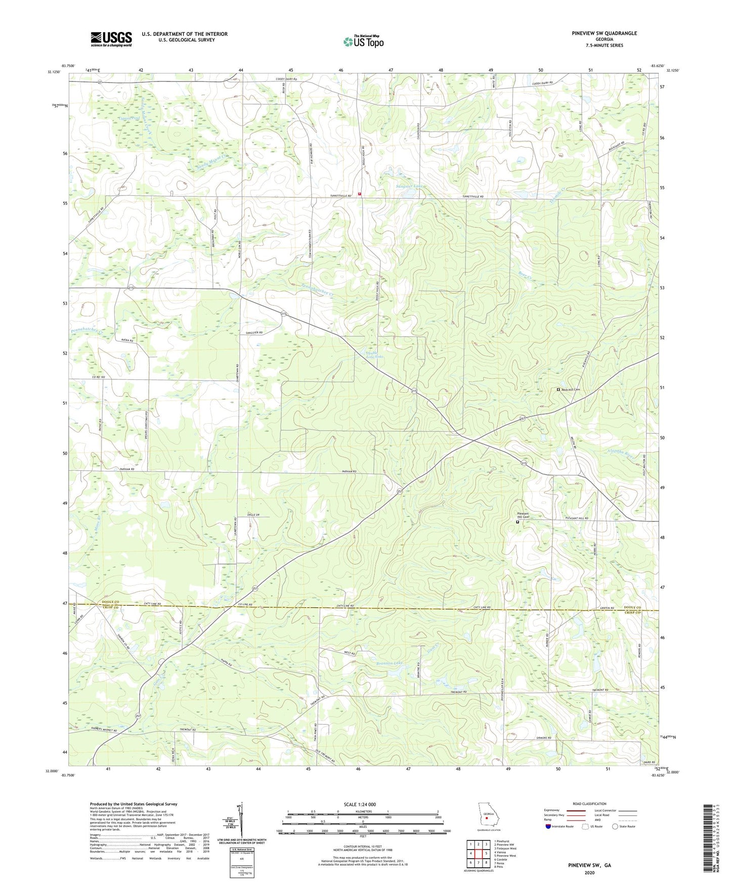
2024 topographic map quadrangle Pineview SW in the state of Georgia. Scale: 1:24000. Based on the newly updated USGS 7.5' US Topo map series, this map is in the following counties: Dooly, Crisp. The map contains contour data, water features, and other items you are used to seeing on USGS maps, but also has updated roads and other features. This is the next generation of topographic maps. Printed on high-quality waterproof paper with UV fade-resistant inks.
Quads adjacent to this one:
West: Vienna
Northwest: Pinehurst
North: Pineview NW
Northeast: Finleyson West
East: Pineview West
Southeast: Pitts
South: Penia
Southwest: Cordele
This map covers the same area as the classic USGS quad with code o32083a6.
Contains the following named places: Atkins School, Brannon Lake, Brannon Lake Dam, Cypress Pond, Dooly County Fire Department Dooly High Station, Dpuble Lime Sinks, George Walton Experimental Station, King School, Lamb Town, Lebanon Primitive Baptist Church, Love Chapel, New Mount Zion Church, Pine Level Church, Pleasant Hill Church, Pleasant Hill Church Cemetery, Pleasant Hill Free Will Baptist Church, Rock Hill Cemetery, Rock Hill Primitive Baptist Church, Rock Hill School, Sangster Dam, Sangster Lake, Sharon Church, Sharon School, Smyrna Church, Tremont, Tremont School, Walton Lookout Tower, Zion Hill Church, Zion Hill School