MyTopo
Putney Georgia US Topo Map
Couldn't load pickup availability
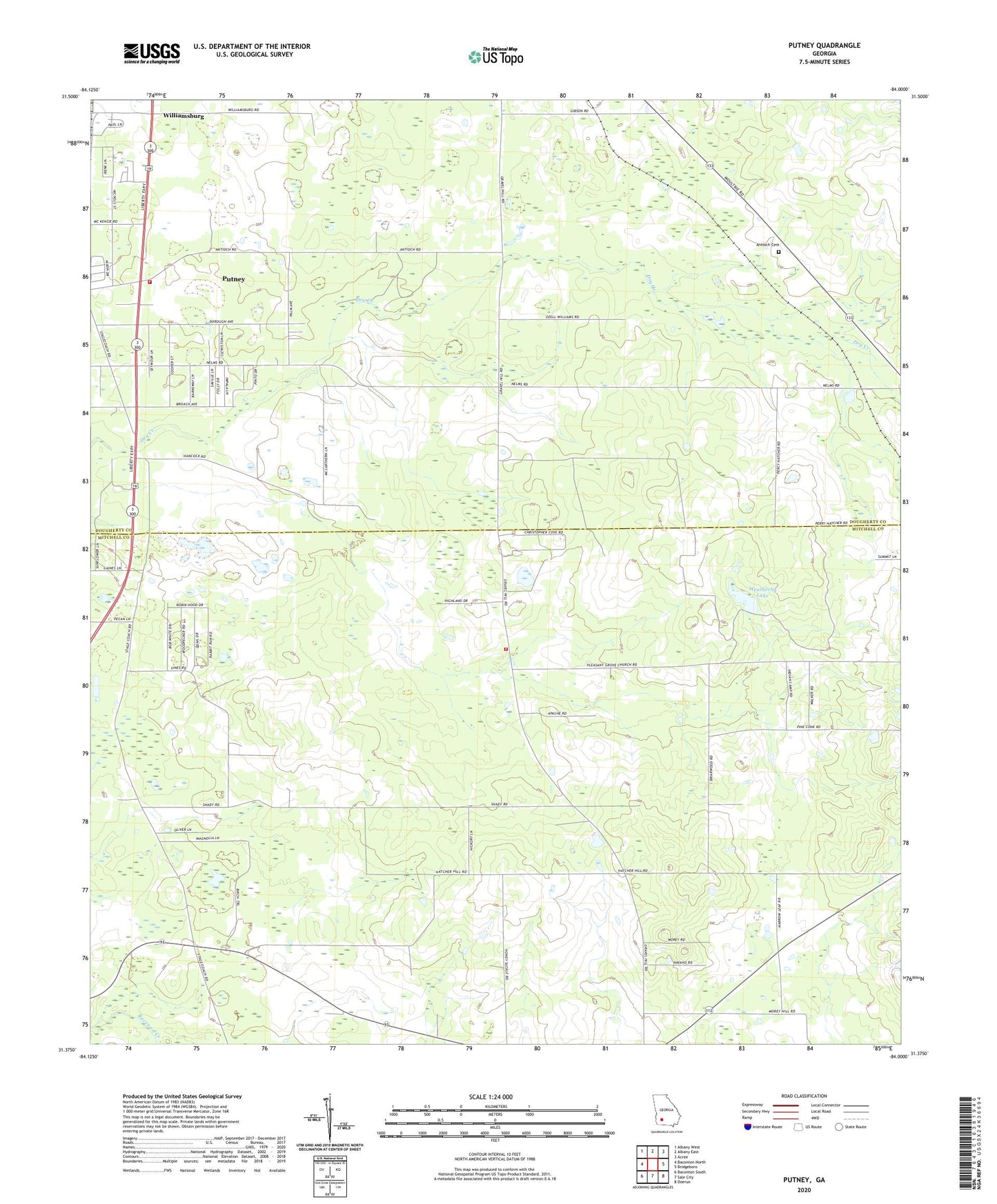
2024 topographic map quadrangle Putney in the state of Georgia. Scale: 1:24000. Based on the newly updated USGS 7.5' US Topo map series, this map is in the following counties: Mitchell, Dougherty. The map contains contour data, water features, and other items you are used to seeing on USGS maps, but also has updated roads and other features. This is the next generation of topographic maps. Printed on high-quality waterproof paper with UV fade-resistant inks.
Quads adjacent to this one:
West: Baconton North
Northwest: Albany West
North: Albany East
Northeast: Acree
East: Bridgeboro
Southeast: Doerun
South: Sale City
Southwest: Baconton South
This map covers the same area as the classic USGS quad with code o31084d1.
Contains the following named places: Albany Fire Department Station 9, Antioch Baptist Church, Antioch Cemetery, Baconton Division, Hollands Folly, Loretta Heights, Mount Calvary Church, Mount Enon Church, Mount Moriah Number 2 Church, Nelms, New Salem Church, Piney Grove Church, Pleasant Grove Church, Pleasant Grove Volunteer Fire Department, Putney, Putney Census Designated Place, Rocky Hill Church, Saint Mary Church, Weatherby Lake, Weatherby Lake Dam, Williams Spring Church, Williamsburg