MyTopo
Baconton North Georgia US Topo Map
Couldn't load pickup availability
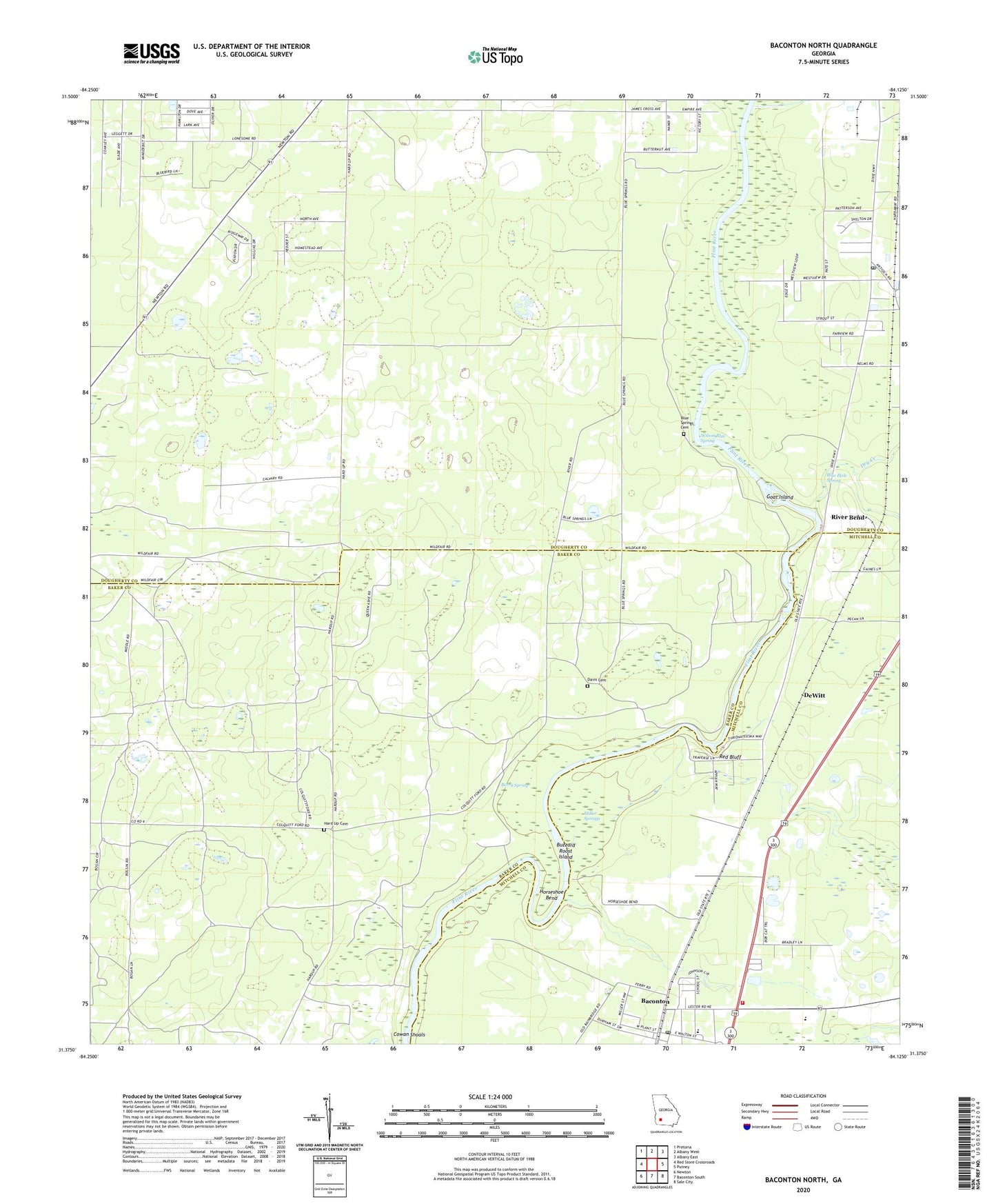
2024 topographic map quadrangle Baconton North in the state of Georgia. Scale: 1:24000. Based on the newly updated USGS 7.5' US Topo map series, this map is in the following counties: Dougherty, Baker, Mitchell. The map contains contour data, water features, and other items you are used to seeing on USGS maps, but also has updated roads and other features. This is the next generation of topographic maps. Printed on high-quality waterproof paper with UV fade-resistant inks.
Quads adjacent to this one:
West: Red Store Crossroads
Northwest: Pretoria
North: Albany West
Northeast: Albany East
East: Putney
Southeast: Sale City
South: Baconton South
Southwest: Newton
This map covers the same area as the classic USGS quad with code o31084d2.
Contains the following named places: Baconton, Baconton Post Office, Baconton Volunteer Fire Department, Berry Spring, Bethel Church, Blue Hole Spring, Blue Springs Cemetery, Buzzard Roost Island, City of Baconton, Cowan Shoals, Davis Cemetery, DeWitt, Dry Creek, Ephesus Church, First Baptist Church, First Bethesda Church, Goat Island, Hard Up Cemetery, Horseshoe Bend, Miller Springs, Pleasant Grove Church, Potter Community Center, Putney Post Office, Red Bluff, River Bend, Saint James Chuch, Second Bethesda Church, Weldon Spring Church, Wilson Blue Spring