MyTopo
Doerun Georgia US Topo Map
Couldn't load pickup availability
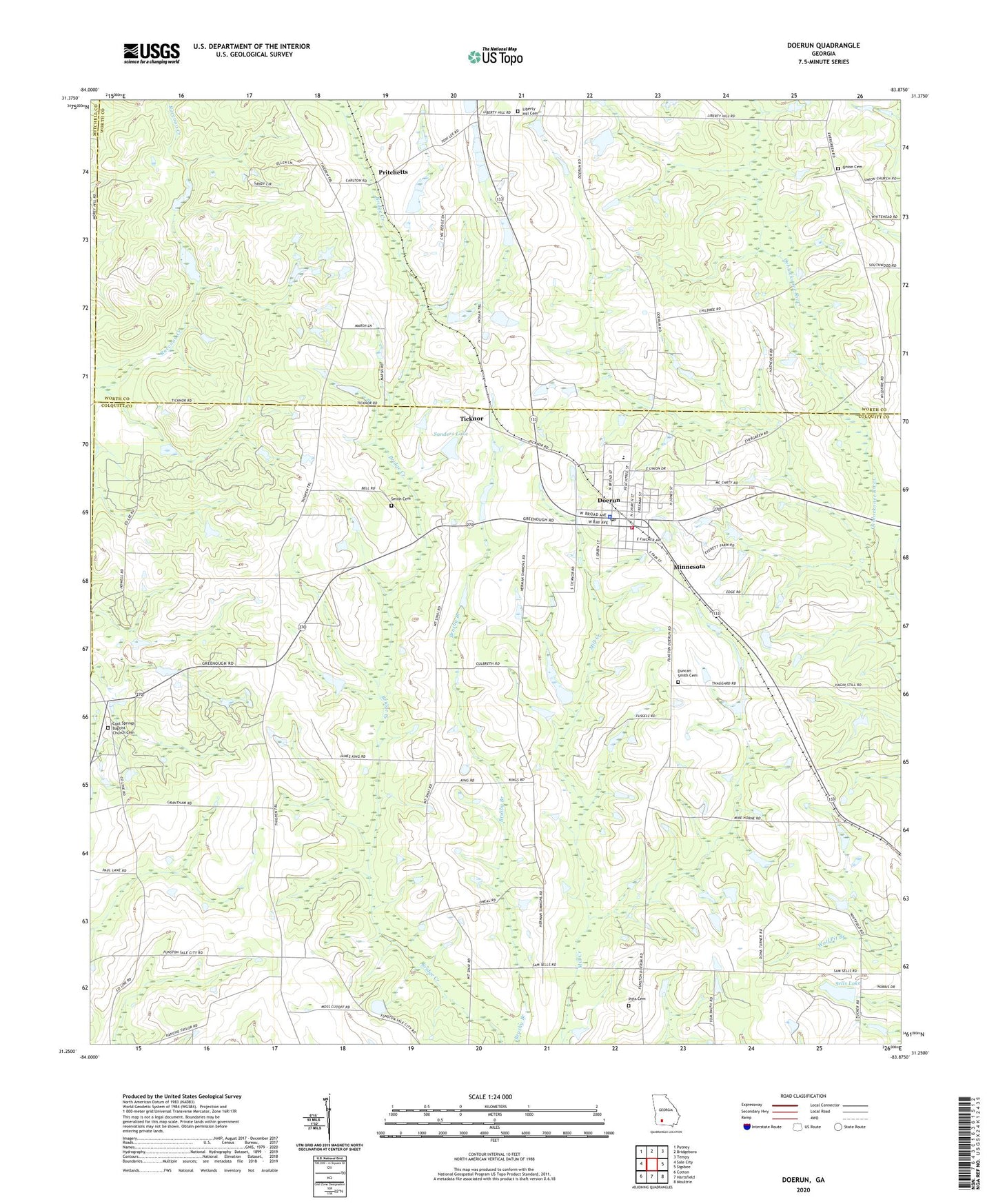
2024 topographic map quadrangle Doerun in the state of Georgia. Scale: 1:24000. Based on the newly updated USGS 7.5' US Topo map series, this map is in the following counties: Colquitt, Worth, Mitchell. The map contains contour data, water features, and other items you are used to seeing on USGS maps, but also has updated roads and other features. This is the next generation of topographic maps. Printed on high-quality waterproof paper with UV fade-resistant inks.
Quads adjacent to this one:
West: Sale City
Northwest: Putney
North: Bridgeboro
Northeast: Tempy
East: Sigsbee
Southeast: Moultrie
South: Hartsfield
Southwest: Cotton
This map covers the same area as the classic USGS quad with code o31083c8.
Contains the following named places: Bailey Chapel African Methodist Episcopal Church, Beulah Grove Church, City of Doerun, Coleman School, Colquitt County Volunteer Firefighters Association Fire Station 62 Doerun, Cool Springs Baptist Church Cemetery, Cool Springs Church, Doerun, Doerun Baptist Church, Doerun City Cemetery, Doerun Division, Doerun Elementary School, Doerun High School, Doerun Police Dept, Doerun Post Office, Doerun Public School, Duncan Smith Cemetery, First Methodist Church, Grace Church, Herring School, Hillcrest School, Liberty Hill Baptist Church, Liberty Hill Cemetery, Little Ochlockonee River, Minnesota, Mitchell Grove Church, Mitchell Grove School, Mount Sinai Cemetery, Mount Sinai Church, New Light Church, Pitts Cemetery, Poplar Arbor Church, Pritchetts, Sanders Lake, Sanders Lake Dam, Sells Lake, Sells Lake Dam, Smith Cemetery, Terrace, Ticknor, Union Cemetery, Union Church, ZIP Code: 31744