MyTopo
Red Store Crossroads Georgia US Topo Map
Couldn't load pickup availability
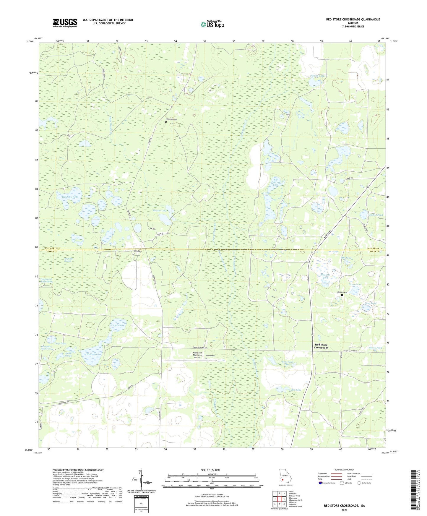
2024 topographic map quadrangle Red Store Crossroads in the state of Georgia. Scale: 1:24000. Based on the newly updated USGS 7.5' US Topo map series, this map is in the following counties: Dougherty, Baker. The map contains contour data, water features, and other items you are used to seeing on USGS maps, but also has updated roads and other features. This is the next generation of topographic maps. Printed on high-quality waterproof paper with UV fade-resistant inks.
Quads adjacent to this one:
West: Bermuda
Northwest: Holt
North: Pretoria
Northeast: Albany West
East: Baconton North
Southeast: Baconton South
South: Newton
Southwest: Elmodel
This map covers the same area as the classic USGS quad with code o31084d3.
Contains the following named places: Adams Pond, Alligator Pond, Baptizing Pond, Big Cypress Lake, Cassidy Pond, Chance Pond, Chapel Hill Church, Clifton Cemetery, Geer Pond, Goat Pond, Grass Pond, Halls Pond, Halls Slough, Hunter Lake, Hunter Lake Dam, Lawton Pond, Long Pond, Mill Pond, Pine Bloom Plantation, Pinebloom Plantation Airport, Piney Woods Branch, Red Store Crossroads, Rex Lake, Reynolds Swamp, Spring Lake, Tarva Cemetery, Trinity Cemetery, Wallington Plantation Airport, Whitehill Cemetery, Windmill Pond