MyTopo
Pretoria Georgia US Topo Map
Couldn't load pickup availability
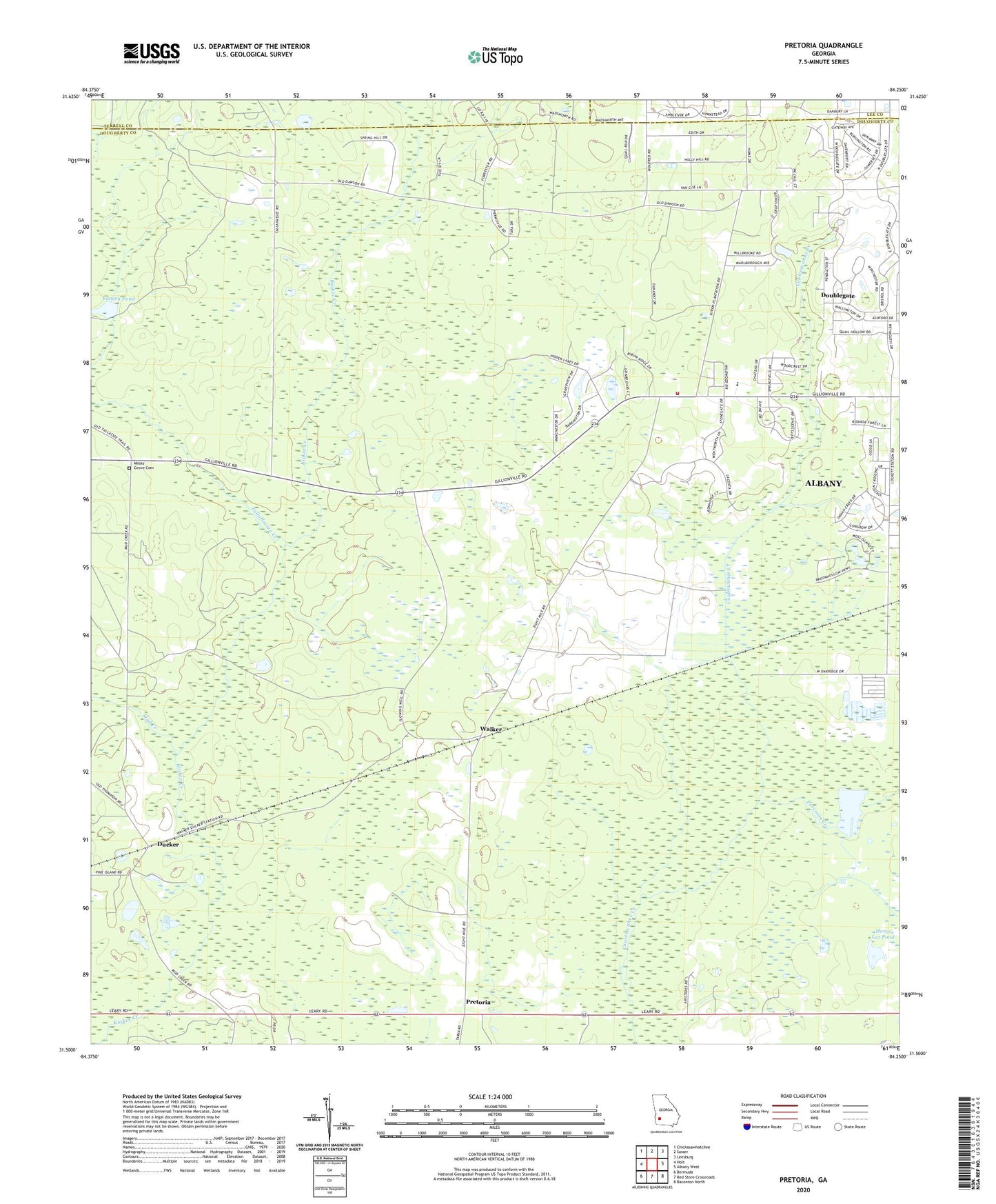
2024 topographic map quadrangle Pretoria in the state of Georgia. Scale: 1:24000. Based on the newly updated USGS 7.5' US Topo map series, this map is in the following counties: Dougherty, Terrell, Lee. The map contains contour data, water features, and other items you are used to seeing on USGS maps, but also has updated roads and other features. This is the next generation of topographic maps. Printed on high-quality waterproof paper with UV fade-resistant inks.
Quads adjacent to this one:
West: Holt
Northwest: Chickasawhatchee
North: Sasser
Northeast: Leesburg
East: Albany West
Southeast: Baconton North
South: Red Store Crossroads
Southwest: Bermuda
This map covers the same area as the classic USGS quad with code o31084e3.
Contains the following named places: Albany Fire Department Station 10, Brookhollow, Cedar Lake, Doublegate, Doublegate Country Club, Ducker, Gillionville Church, Gillionville Forest, Hopewell Church Cemetery, Horse Lot Pond, Indian Creek, Lockett Crossing, Mossy Grove Church, Mud Creek, New Hope Church, New Zion Hill Church, Oak Grove Church, Oak Hill Church, Percosin Creek, Pine Knoll Landing Field, Pretoria, Rush Pond, Springfield, Tallahassee Creek, Vancise, Walker, West Dougherty Community House, West Dougherty Division, Yancey Pond, YMCA Sports Park, ZIP Code: 31721