MyTopo
Reed Creek Georgia US Topo Map
Couldn't load pickup availability
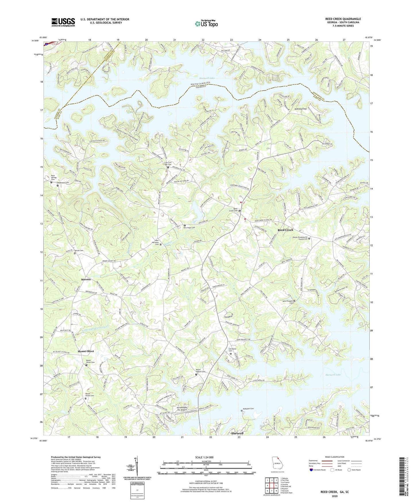
2024 topographic map quadrangle Reed Creek in the states of Georgia, South Carolina. Scale: 1:24000. Based on the newly updated USGS 7.5' US Topo map series, this map is in the following counties: Hart, Anderson, Oconee. The map contains contour data, water features, and other items you are used to seeing on USGS maps, but also has updated roads and other features. This is the next generation of topographic maps. Printed on high-quality waterproof paper with UV fade-resistant inks.
Quads adjacent to this one:
West: Lavonia
Northwest: Oakway
North: Fair Play
Northeast: La France
East: Hartwell NE
Southeast: Hartwell Dam
South: Hartwell
Southwest: Royston
Contains the following named places: Airnautique Inc Airport, Averys Ferry, Beaverdam Creek, Byrum Cemetery, Chandlers Ferry, Cleveland Cemetery, Cole Civil War Cemetery, Coles Ferry, Fair Play Creek, Gum Branch, Hart County Fire Department Station 2 Red Creek, Hart State Park, Hatton Shoals, Henley Store, Hurricane Creek, Little Lightwood Log Creek, Maretts, McMullan Cemetery, Mount Hebron Cemetery, Mount Hebron Church, Mount Olivet, Mount Olivet Cemetery, Mount Olivet Church, Mount Olivet Elementary School, Mustang Field, New Harmony Cemetery, New Harmony Methodist Church, New Hope Cemetery, New Hope Church, New Prospect Cemetery, New Prospect Church, Paynes Creek, Reed Creek, Reed Creek Cemetery, Reed Creek Census Designated Place, Reed Creek Church, Reed Creek Division, Reed Creek School, Robertson Cemetery, Rock Springs Cemetery, Rock Springs Church, Sharon Church, Sharon Presbyterian Church Cemetery, Vernon Church, Weldon Island, Wolf Creek