MyTopo
Hartwell NE South Carolina US Topo Map
Couldn't load pickup availability
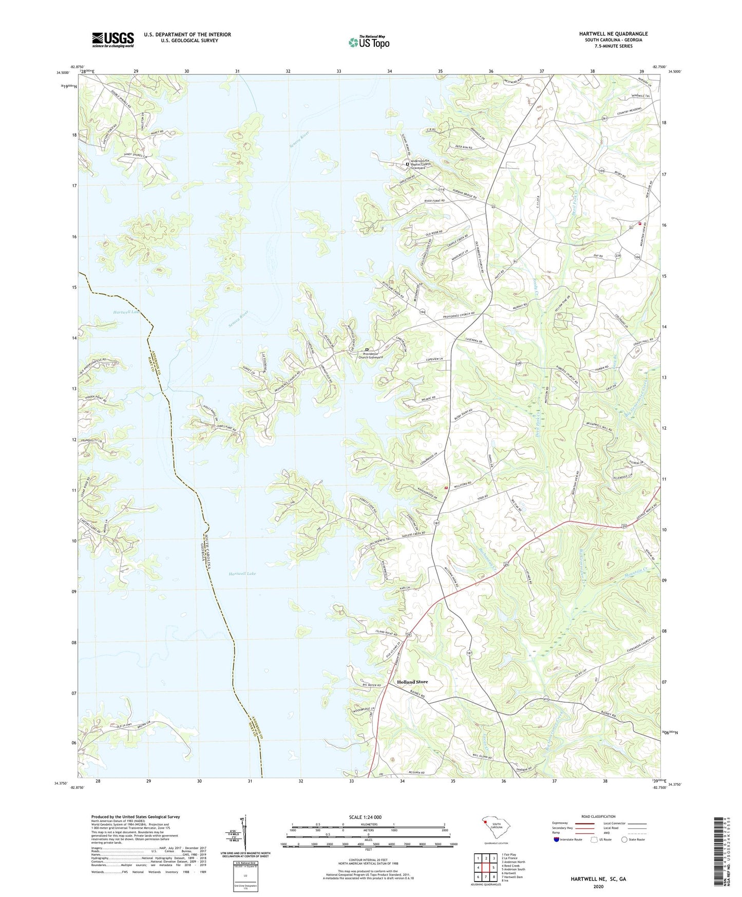
2024 topographic map quadrangle Hartwell NE in the states of South Carolina, Georgia. Scale: 1:24000. Based on the newly updated USGS 7.5' US Topo map series, this map is in the following counties: Anderson, Hart. The map contains contour data, water features, and other items you are used to seeing on USGS maps, but also has updated roads and other features. This is the next generation of topographic maps. Printed on high-quality waterproof paper with UV fade-resistant inks.
Quads adjacent to this one:
West: Reed Creek
Northwest: Fair Play
North: La France
Northeast: Anderson North
East: Anderson South
Southeast: Iva
South: Hartwell Dam
Southwest: Hartwell
This map covers the same area as the classic USGS quad with code o34082d7.
Contains the following named places: Alfords Bridge, Allendale, Anderson County Fire Department Center Rock Station 11, Anderson County Fire Department Williford Station 27, Andersonville, Andersonville Baptist Church, Andersonville Baptist Church Graveyard, Andersonville Ferry, Browns Ferry, Buchannan Creek, Cooleys Ferry, Crawfords Ferry, Devil Fork Creek, Double Spring School, Evergreen Church, Evergreen School, Generostee Church, Generostee School, Hatton Ford, Holland Store, Hollands Store Post Office, Lakefront, Lazy Branch, Lightwood Log Creek, Little Beaverdam Creek, Lyle Memorial Church, Maylors Mill, McGee Pond Dam D-3103, McLees School, McMullins Island, Mill Town School, Morris Shoals School, Mount Sinai Church, Mount Zion Church, Mountain Creek, New Hope Church, Oak Bower, Price, Prophecy Church, Providence Church, Providence Church Graveyard, RBE Pond Dam Number One D-3105, RBE Pond Dam Number Three D-3104, RBE Pond Dam Number Two D-3106, Reedy Creek, Roberts Church, Roberts Post Office, Roberts School, Rock Mills Post Office, Ruhamah Church, Saddlers Creek Post Office, Sadler, Sadlers Creek, Sadlers Creek State Park, Seneca River, Shiloh Baptist Church, Shiloh School, Sinai School, Sloans Fery, Springfield Church, Springfield School, Starr Division, Tugaloo River, Williford School, ZIP Code: 29626