MyTopo
Rocky Ford Georgia US Topo Map
Couldn't load pickup availability
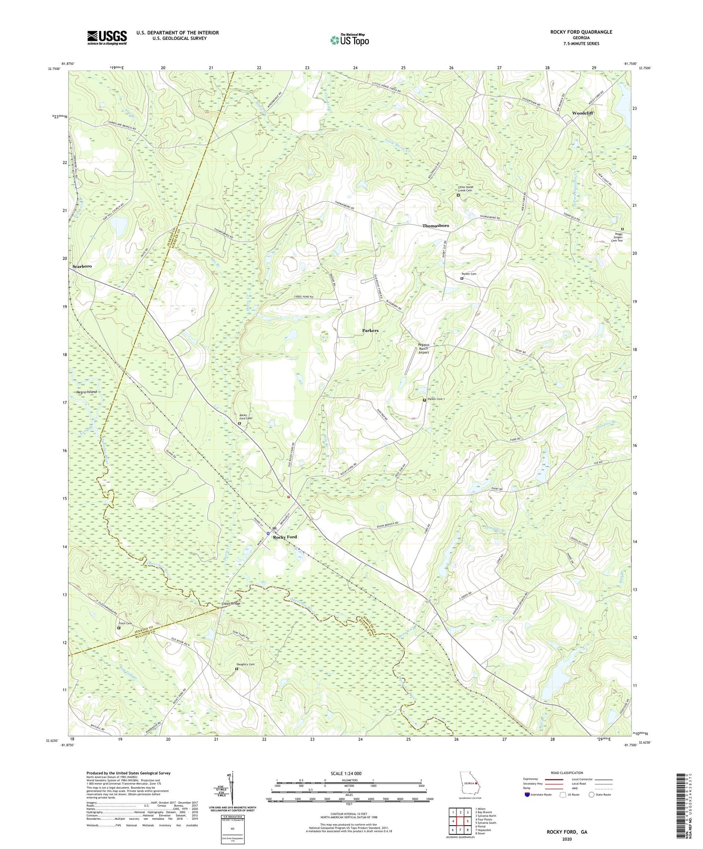
2024 topographic map quadrangle Rocky Ford in the state of Georgia. Scale: 1:24000. Based on the newly updated USGS 7.5' US Topo map series, this map is in the following counties: Screven, Jenkins, Bulloch. The map contains contour data, water features, and other items you are used to seeing on USGS maps, but also has updated roads and other features. This is the next generation of topographic maps. Printed on high-quality waterproof paper with UV fade-resistant inks.
Quads adjacent to this one:
West: Four Points
Northwest: Millen
North: Bay Branch
Northeast: Sylvania North
East: Sylvania South
Southeast: Dover
South: Hopeulikit
Southwest: Portal
This map covers the same area as the classic USGS quad with code o32081f7.
Contains the following named places: Bible Fellowship Church, Burke School, Copps Bridge, Crooked Creek, Daughtry Cemetery, Daughtry School, Dixon Branch Church, Douglas Branch, Douglas Branch Church, Finch Cemetery, Flat Branch, Free Chapel School, Horse Creek, Hurricane Branch Church, Little Horse Creek, Little Horse Creek Cemetery, Little Horse Creek Church, Little Horse Creek School, Long Branch, Mile Branch, Negro Island, New Light Church, Parker Cemetery, Parker Cemetery 1, Parker Grove Church, Parkers, Pegasus Ranch Airport, Peggy Zeigler Cemetery Two, Rocky Ford, Rocky Ford Baptist Church, Rocky Ford Cemetery, Rocky Ford Police Department Headquarters, Rocky Ford Post Office, Saint Johns Church, Scarboro School, Screven County Fire Department Station 6, Thomasboro, Town of Rocky Ford, WMKO-FM (Millen), Woodcliff, ZIP Code: 30455