MyTopo
Sharon Georgia US Topo Map
Couldn't load pickup availability
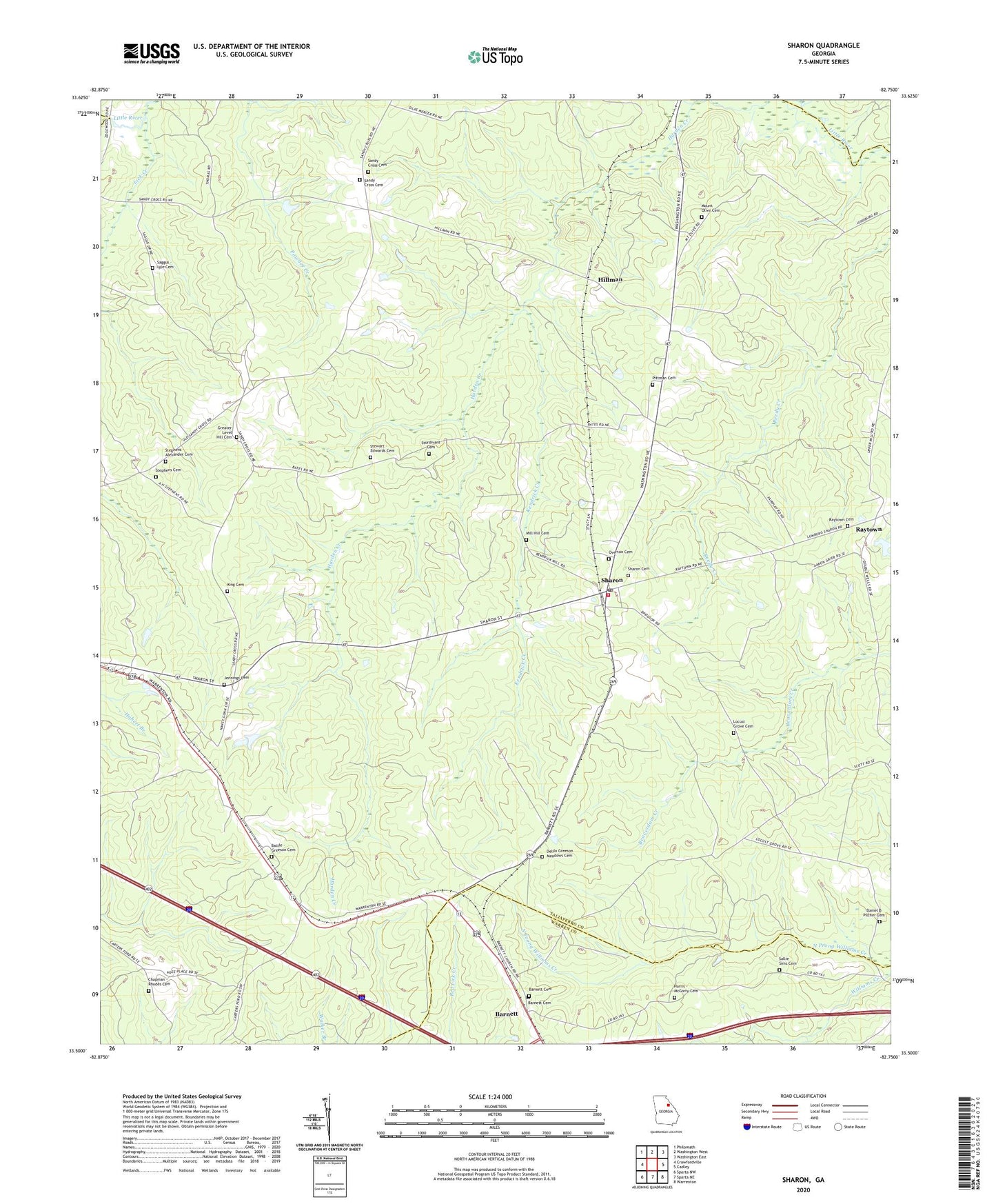
2024 topographic map quadrangle Sharon in the state of Georgia. Scale: 1:24000. Based on the newly updated USGS 7.5' US Topo map series, this map is in the following counties: Taliaferro, Warren, Wilkes. The map contains contour data, water features, and other items you are used to seeing on USGS maps, but also has updated roads and other features. This is the next generation of topographic maps. Printed on high-quality waterproof paper with UV fade-resistant inks.
Quads adjacent to this one:
West: Crawfordville
Northwest: Philomath
North: Washington West
Northeast: Washington East
East: Cadley
Southeast: Warrenton
South: Sparta NE
Southwest: Sparta NW
This map covers the same area as the classic USGS quad with code o33082e7.
Contains the following named places: Barnett, Barnett Cemetery, Barnett Church, Battle - Greeson Cemetery, Chapman - Rhodes Cemetery, City of Sharon, Daniel B Pilcher Cemetery, Delila Greeson Meadows Cemetery, Greater Level Hill Cemetery, Harris - McGinty Cemetery, Hillman, Jennings Cemetery, Jennings Church, Kendrick Creek, King Cemetery, Level Hill Church, Lick Creek, Locust Grove Cemetery, Mill Hill Cemetery, Mount Olive Cemetery, Mount Olive Church, Overton Cemetery, Pittman Cemetery, Raytown, Raytown Baptist Church, Raytown Cemetery, Saggus - Lyle Cemetery, Sallie Sims Cemetery, Sandy Cross, Sandy Cross Baptist Church, Sandy Cross Cemetery, Sandy Cross Methodist Church, Sharon, Sharon Cemetery, Sharon Division, Sharon Methodist Church, Sharon Post Office, Stephens - Alexander Cemetery, Stephens Cemetery, Stewart - Edwards Cemetery, Sturdivant Cemetery, Taliaferro Volunteer County Fire Department Station 3, ZIP Code: 30664