MyTopo
Sparta NE Georgia US Topo Map
Couldn't load pickup availability
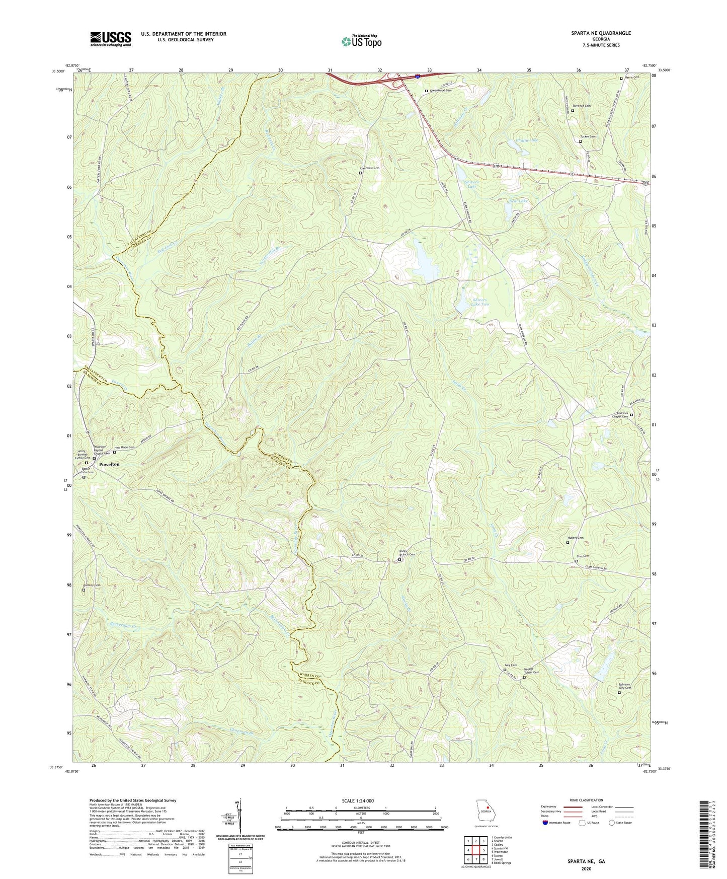
2024 topographic map quadrangle Sparta NE in the state of Georgia. Scale: 1:24000. Based on the newly updated USGS 7.5' US Topo map series, this map is in the following counties: Warren, Hancock, Taliaferro. The map contains contour data, water features, and other items you are used to seeing on USGS maps, but also has updated roads and other features. This is the next generation of topographic maps. Printed on high-quality waterproof paper with UV fade-resistant inks.
Quads adjacent to this one:
West: Sparta NW
Northwest: Crawfordville
North: Sharon
Northeast: Cadley
East: Warrenton
Southeast: Beall Springs
South: Jewell
Southwest: Sparta
This map covers the same area as the classic USGS quad with code o33082d7.
Contains the following named places: Andrews Chapel, Andrews Chapel Cemetery, Barnett Lookout Tower, Battle - Cato Cemetery, Battle Branch, Beaverdam Creek, Burnley Cemetery, Chafin Dam, Chafin Lake, Chapman Branch, Crenshaw Cemetery, Elim Baptist Church, Elim Cemetery, Ephraim Ivey Cemetery, George Turner Cemetery, Greenwood Cemetery, Greenwood Church, Harris Cemetery, Henry - Burnley Family Cemetery, Hubert Cemetery, Ivey Cemetery, Neal Lake, Neal Lake Dam, New Hope Cemetery, New Hope Church, Norwood Division, Pilgrim Church, Potato Hill Branch, Powell Creek, Powelton, Powelton Baptist Church, Powelton Baptist Church Cemetery, Powelton School, Red Lick Creek, Reservoir Lake, Reservoir Lake Dam, Rocky Branch, Rocky Branch Cemetery, Rocky Branch Church, Shivers Dam Number One, Shivers Dam Two, Shivers Lake, Shivers Lake Dam, Shivers Lake Number One, Shivers Lake Two, Torrence Cemetery, Tucker Cemetery, Walker Branch, Whiteheads Mill, William Rabun Monument