MyTopo
Cadley Georgia US Topo Map
Couldn't load pickup availability
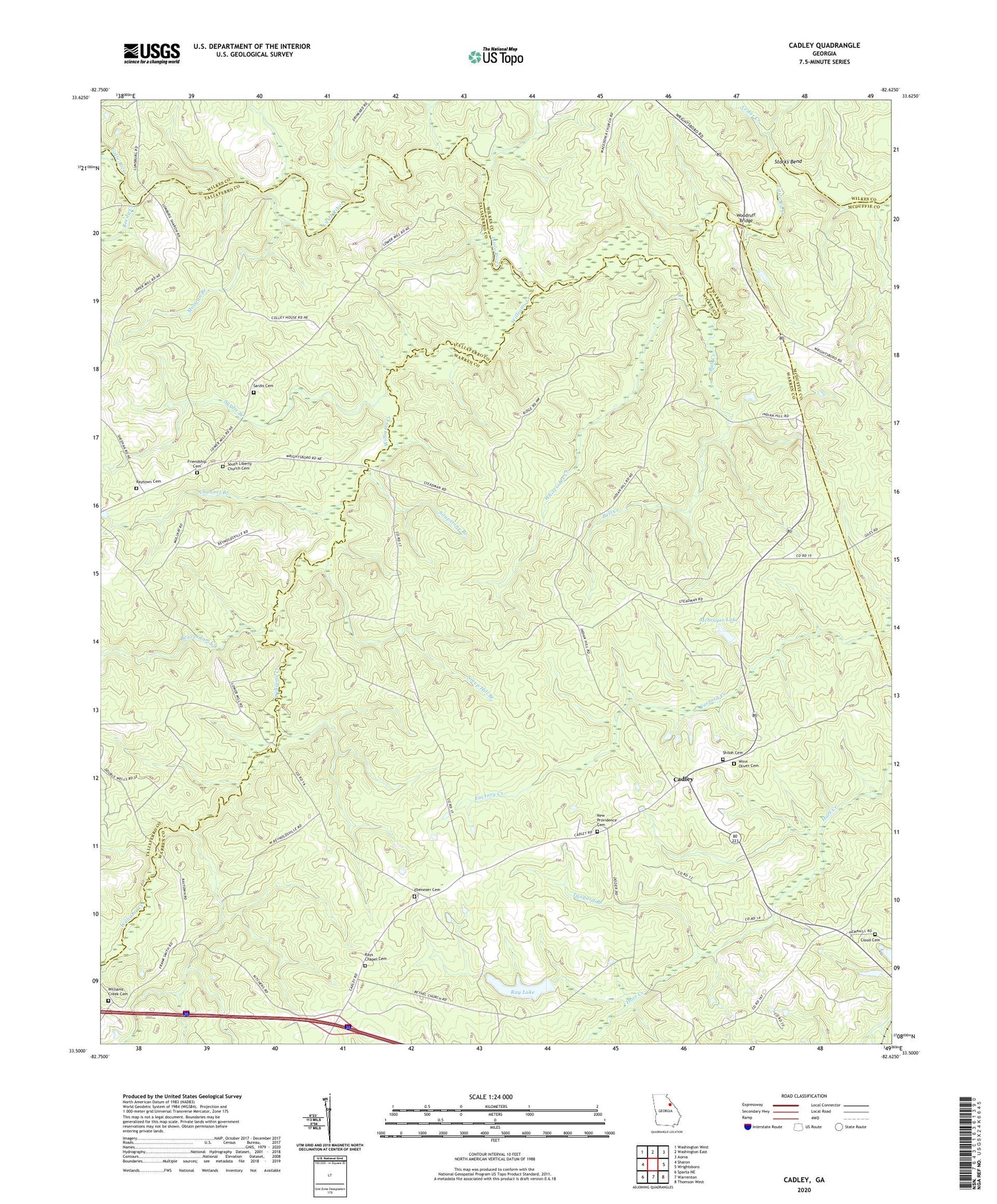
2024 topographic map quadrangle Cadley in the state of Georgia. Scale: 1:24000. Based on the newly updated USGS 7.5' US Topo map series, this map is in the following counties: Warren, Taliaferro, Wilkes, McDuffie. The map contains contour data, water features, and other items you are used to seeing on USGS maps, but also has updated roads and other features. This is the next generation of topographic maps. Printed on high-quality waterproof paper with UV fade-resistant inks.
Quads adjacent to this one:
West: Sharon
Northwest: Washington West
North: Washington East
Northeast: Aonia
East: Wrightsboro
Southeast: Thomson West
South: Warrenton
Southwest: Sparta NE
This map covers the same area as the classic USGS quad with code o33082e6.
Contains the following named places: Beaverdam Creek, Bull Creek, Cadley, Camak Division, Cedar Creek, Channel Branch, Cloud Cemetery, Dyers Mill, Ebenezer Baptist Church, Ebenezer Cemetery, Fountain Campground, Friendship Cemetery, Friendship Church, Indian Hill Church, Mcbrayer Lake, Mcbrayer Lake Dam, Morgan Branch, New Providence Cemetery, New Providence Church, North Prong Williams Creek, Ray Dam, Ray Lake, Rays Chapel Cemetery, Raytown Cemetery, Raytown Church, Reedy Creek, Sardis Branch, Sardis Cemetery, Sardis Church, Shiloh Cemetery, Shiloh Church, Soapstone Branch, South Liberty Church Cemetery, Steep Hill Branch, Storks Bend, Tanyard Branch, Thigpen, Whitesides Creek, Williams Creek, Williams Creek Cemetery, Williams Creek Church, Winn Oliver Cemetery, Woodruff Bridge