MyTopo
Sibbie Georgia US Topo Map
Couldn't load pickup availability
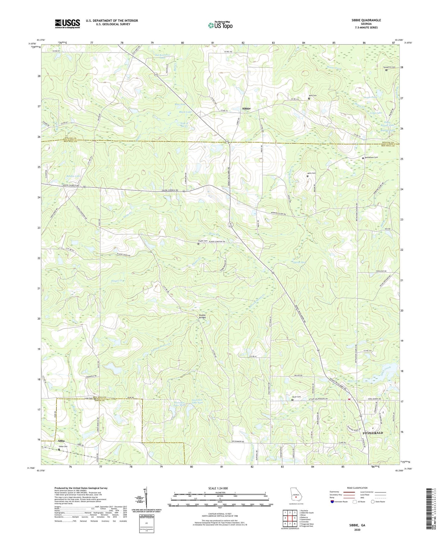
2024 topographic map quadrangle Sibbie in the state of Georgia. Scale: 1:24000. Based on the newly updated USGS 7.5' US Topo map series, this map is in the following counties: Ben Hill, Wilcox, Irwin. The map contains contour data, water features, and other items you are used to seeing on USGS maps, but also has updated roads and other features. This is the next generation of topographic maps. Printed on high-quality waterproof paper with UV fade-resistant inks.
Quads adjacent to this one:
West: Rebecca
Northwest: Rochelle
North: Abbeville South
Northeast: Rhine
East: Queensland
Southeast: Fitzgerald East
South: Fitzgerald West
Southwest: Irwinville
This map covers the same area as the classic USGS quad with code o31083g3.
Contains the following named places: Abba, Abba Church, Baptize Lake, Ben Hill County Farm, Ben Hill County Volunteer Fire Department Station 5, Bethlehem Cemetery, Bethlehem Church, Black Lake, Blue Sink, Devils Den, Double Bridges, Gibbs Cemetery, Long Lake, Luke Cemetery, Mims Cemetery, Mount Pilgrim Church, Ocean Pond, Old Rountree Lake, Piney Woods Lake, Player Cemetery, Player Creek, Providence Church, Queensland Division, Reid Cemetery, Reubin Lake, Rinor Cemetery, Sibbie, Sink of the Creek, Snowden Dam One, Snowden Dam Two, Snowden Lake East, Snowden Lake East Dam, Snowden Lake West, Snowden Lake West Dam, Stone Creek, Tomberlin Cemetery, Vaughn Taylor School, Ware Pond