MyTopo
Rochelle Georgia US Topo Map
Couldn't load pickup availability
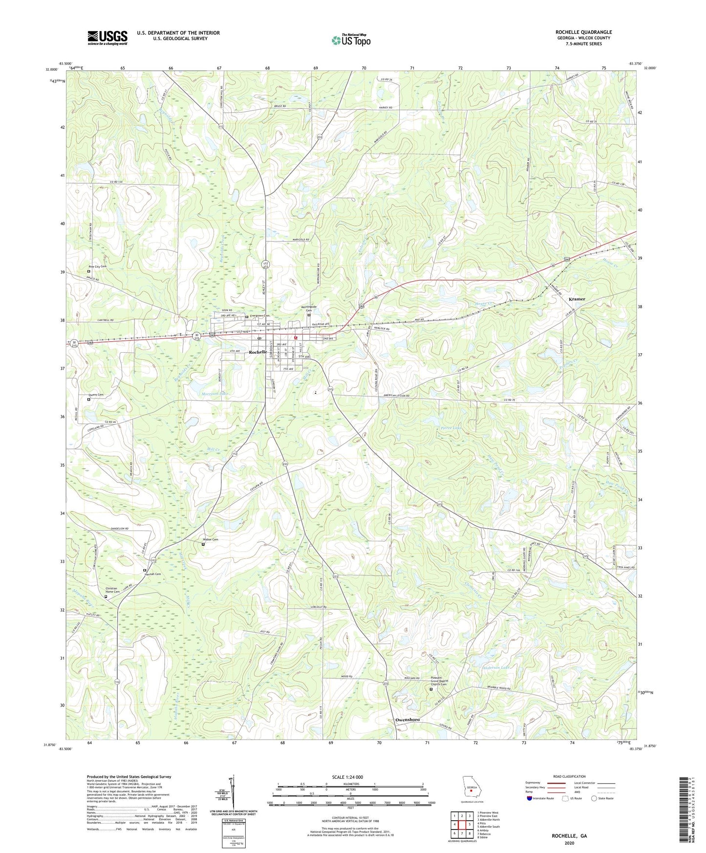
2024 topographic map quadrangle Rochelle in the state of Georgia. Scale: 1:24000. Based on the newly updated USGS 7.5' US Topo map series, this map is in the following counties: Wilcox. The map contains contour data, water features, and other items you are used to seeing on USGS maps, but also has updated roads and other features. This is the next generation of topographic maps. Printed on high-quality waterproof paper with UV fade-resistant inks.
Quads adjacent to this one:
West: Pitts
Northwest: Pineview West
North: Pineview East
Northeast: Abbeville North
East: Abbeville South
Southeast: Sibbie
South: Rebecca
Southwest: Amboy
This map covers the same area as the classic USGS quad with code o31083h4.
Contains the following named places: Anderson Lake, Anderson Lake Dam, Christian Home Cemetery, Christian Home Church, City of Rochelle, Evergreen Cemetery, Evergreen Missionary Baptist Church, Excelsior School, First Baptist Church, Hannah Cemetery, King of Kings Church, Kramer, Kramer Baptist Church, Kramer Methodist Church, Lawson Lake West, Lawson Lake West Dam, Mill Creek, Morningside Cemetery, Morrison Lake, Morrison Lake Dam, Owens Cemetery, Owensboro, Pierce Lake, Pierce Lake Dam, Pine City Cemetery, Pine City Church, Pleasant Grove Baptist Church Cemetery, Pleasant Grove Church, Reynolds Creek, Rochelle, Rochelle City Jail, Rochelle Division, Rochelle Elementary School, Rochelle Police Department, Rochelle Post Office, Rochelle Volunteer Fire Department Station 1, Walker Cemetery, Wilcox County, Wilcox County High School, ZIP Code: 31079