MyTopo
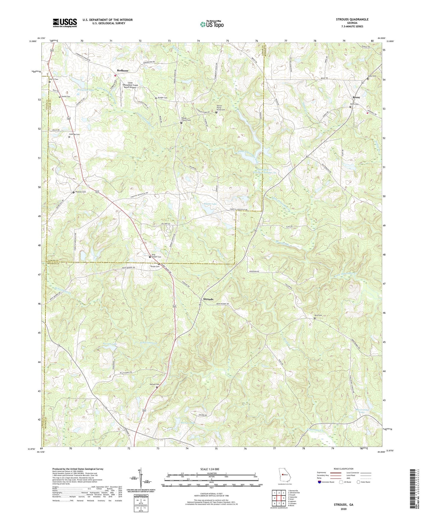
Strouds Georgia US Topo Map
Couldn't load pickup availability
2024 topographic map quadrangle Strouds in the state of Georgia. Scale: 1:24000. Based on the newly updated USGS 7.5' US Topo map series, this map is in the following counties: Monroe, Lamar, Upson. The map contains contour data, water features, and other items you are used to seeing on USGS maps, but also has updated roads and other features. This is the next generation of topographic maps. Printed on high-quality waterproof paper with UV fade-resistant inks.
Quads adjacent to this one:
West: Yatesville
Northwest: Barnesville
North: Johnstonville
Northeast: Forsyth
East: Smarr
Southeast: Moran
South: Culloden
Southwest: Logtown
This map covers the same area as the classic USGS quad with code o32084h1.
Contains the following named places: Abercrombie Lake, Abercrombie Lake Dam, Bird Cemetery, Brent, Brent Cemetery, Harris Cemetery, Horns Crossroads, King Chapel Cemetery, Kings Chapel Methodist Church, Lamar County Fire Department and Rescue Station 2 Redbone, Little Tobesofkee Creek Ranch Airport, Mangham Lake, Mangham Lake Dam, Monroe County Fire Department Station 8, Mount Pleasant Church, Mountain Branch, New Macedonia Church, Orange Grove Church, Owen Cemetery, Parker Chapel School, Parkers Chapel African Methodist Episcopal Church, Person Cemetery, Pierson Cemetery, Pierson Lake, Pierson Lake Dam, Pippin Lake, Pippin Lake Dam, Pringle Cemetery, Ramah Church, Ramah Church Cemetery, Redbone, Russellville Church, Russellville School, Sardis Cemetery, Sardis Church, Sardis School, Sharon Church, Shattles Cemetery, Sheran - Horne - Smith Cemetery, Stallings Cemetery, Strouds, Sugar Hill Church, Sugar Hill School, Tabernacle Church, Tobesofkee Creek Structure Number 70, Tobesofkee Creek Structure Number 70 Dam, Wolf Creek, Wood Creek