MyTopo
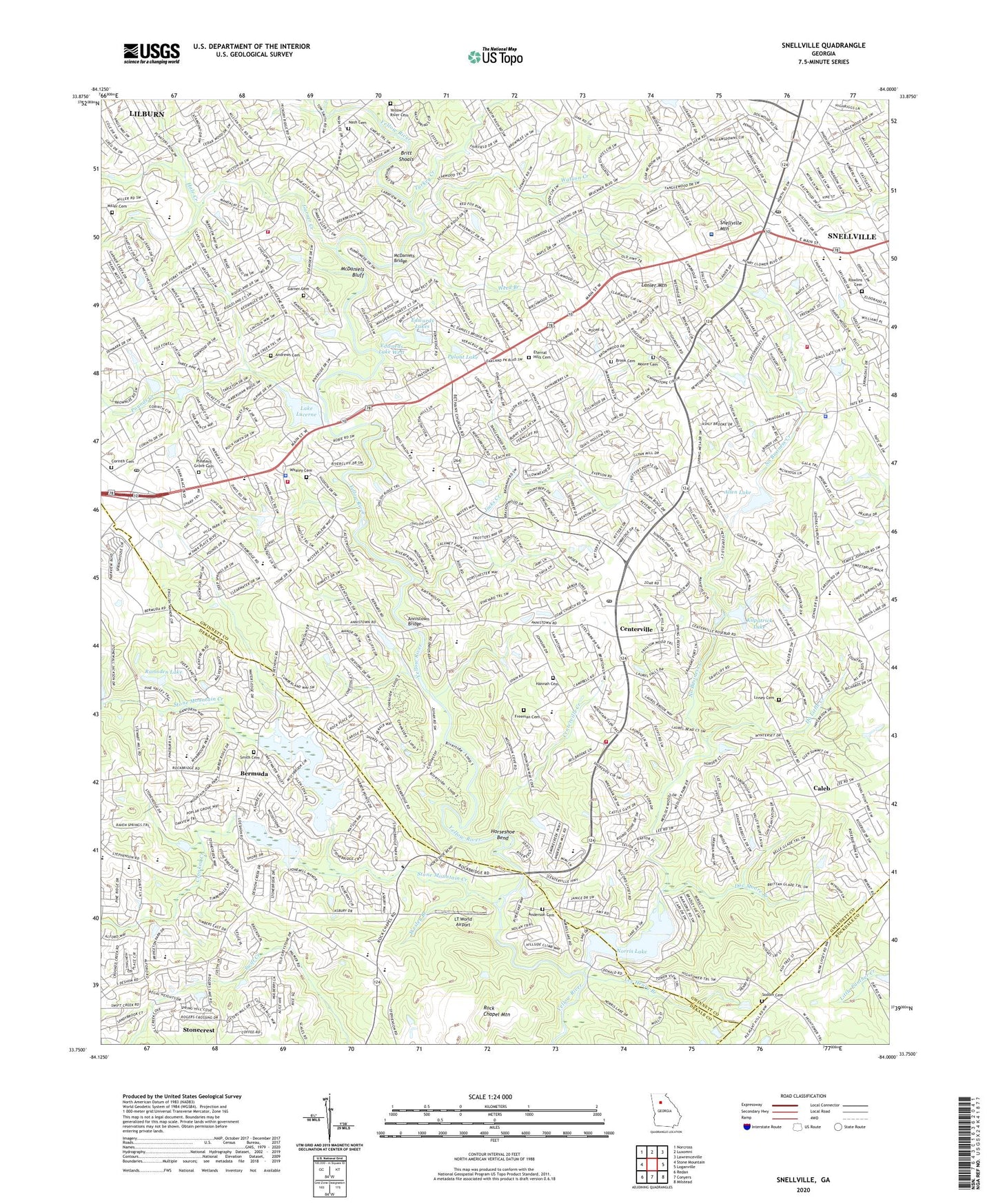
Snellville Georgia US Topo Map
Couldn't load pickup availability
2024 topographic map quadrangle Snellville in the state of Georgia. Scale: 1:24000. Based on the newly updated USGS 7.5' US Topo map series, this map is in the following counties: Gwinnett, DeKalb, Rockdale. The map contains contour data, water features, and other items you are used to seeing on USGS maps, but also has updated roads and other features. This is the next generation of topographic maps. Printed on high-quality waterproof paper with UV fade-resistant inks.
Quads adjacent to this one:
West: Stone Mountain
Northwest: Norcross
North: Luxomni
Northeast: Lawrenceville
East: Loganville
Southeast: Milstead
South: Conyers
Southwest: Redan
This map covers the same area as the classic USGS quad with code o33084g1.
Contains the following named places: Allen Dam, Allen Lake, Anchor Church, Anderson Cemetery, Andrews Cemetery, Anniston Road Baptist Church, Annistown Bridge, Annistown Church, Annistown Elementary School, Arbor Ridge, Berean Church, Bermuda, Bethany Church, Brandington Forest, Brisco Park, Britt Plaza Shopping Center, Britt Shoals, Brook Cemetery, Caleb, Caleb Heliport, Caleb Road Church, Camp Creek Elementary School, Camp Creek Estates, Castlewood Mobile Home Park, Cedar Creek, Centerville, Centerville Branch Post Office, Centerville Creek, Centerville Elementary School, Centerville School, Church of Redeemer, City of Snellville, Corinth Cemetery, Corinth Church, Corinth Hills, Country Square, County Line Church, Crooked Creek, Cross of Calvary Church, Cumberland Forest, Dekalb County Station 25 Fire Station, Deshon Plaza Shopping Center, Do Little Creek, Doc Moore Branch, Eastmont Shopping Center, Edwards Lake West, Edwards Lake West Dam, Edwards Lakes, Elizabeth H Williams Public Library, Eternal Hills Cemetery, Evangel Community Church, Evergreen Montessori School, Everson Corners Shopping Center, Faith Outreach Academy, Faith Outreach Church, First Christian Church, Five Forks Shopping Center, Freeman Cemetery, Full Gospel Church, Garner Cemetery, Garner Creek, Good Shepherd Church, Grace Church, Gwinnett Christian Academy, Gwinnett Community Hospital, Gwinnett County Fire and Emergency Services Station 12, Gwinnett County Fire and Emergency Services Station 22, Gwinnett County Fire and Emergency Services Station 3, Gwinnett County Fire and Emergency Services Station 6, Gwinnett County Police Department District 2 Southside Precinct, Gwinnett County Station 6 Fire Station, Gwinnett Vocational Training Center, Gwinnstone, Hale Creek, Hannah Cemetery, Henry Partee Elementary School, Heritage Preparatroy Christian Academy, Hickory Hills, His Academy Christian School, Horseshoe Bend, Innsbrook, Innsbrook West, Jacks Creek, Killian Hill Village Shopping Center, Kilpatrick Dam, Kilpatrick Lake, Lake Lucerne, Lake Lucerne Estates, Lanier Mountain, Laurel Creek, Lee - Nash Burying Ground, Lee Henry Branch, Lenora, Lenora Church, Living Waters Christian Academy, Livsey Cemetery, Lochwolde, LT World Airport, Lucerne Baptist Church, Macedonia Church, Mason Woods, McDaniels Bluff, McDaniels Bridge, McGuires, Meadow Hills, Miller Cemetery, Monterey Acres, Moore Cemetery, Mountain Cove, Mountain East Shopping Center, Mountain Park Elementary School, Mountain Park Library, Mountain Park Park, Mountain Park Place Shopping Center, Mountain Park Post Office, Mountain View Tabernacle, Mountain View Village Shopping Center, New Bethel Church, New Bethel School, New London Plaza Shopping Center, No Business Creek, Norris Lake, Norris Lake Church, Norris Lake Dam, Norris Lake Shores, Oakland Village Shopping Center, Opossum Lake Dam, Park Place Square Shopping Center, Parkview High School, Performing Arts and Lifeskills Academy of Georgia, Pine Ridge Elementary School, Pleasant Grove Cemetery, Pounds Creek, Princeton Elementary School, Pylant Dam, Pylant Lake, Quinn Ridge, R D Head Elementary School, R L Norton Elementary School, Rainbow Estates, Ramsden Lake, Ramsden Lake Dam, Rawlins Cemetery, Rivercliff Village Shopping Center, Rivermist, Rock Bridge, Rock Bridge Church, Rock Chapel, Rock Chapel Church, Rock Chapel Elementary School, Rock Chapel Mountain, Rock Chapel Park, Rockbridge, Rockbridge Road Church, Saint Matthew Church, Sardum, Scenic Mountain, Scenic Square Shopping Center, Shiloh Baptist Church, Shiloh Elementary School, Shiloh Farms, Shiloh High School, Shiloh Middle School, Smith Cemetery, Smoke Creek Mobile Home Park, Snell Park, Snellville, Snellville Christian Academy, Snellville Christian Church, Snellville Church of Christ, Snellville City Hall, Snellville Middle School, Snellville Mountain, Snellville Oaks Shopping Center, Snellville Pavillion Shopping Center, Snellville Plaza Shopping Center, Snellville Police Department, Snellville Post Office, Sodom Cemetery, South Gwinnett High School, Stephenson High School, Stephenson Middle School, Stone Mountain Creek, Stone Mountain Park Lake, Stone Mountain Park Lake Dam, Stone Mountain Square Shopping Center, Stone Mountain-Britt Memorial Airport, Stonebridge Crossing Shopping Center, Stonebridge Village Shopping Center, Stonebridge Walk Shopping Center, Stonemont, Summer Place, Swift Creek, The Drake School, The Landings, The Moorings, Timber Trace, Trickum School, Trinity Church, True Gospel Baptist Church, Turkey Creek, Twin Village, W C Britt Elementary School, Watson Creek, Weed Branch, Wesley Branch, Whaley Cemetery, White Oak Church, Williams Place, Wisteria Village Shopping Center, Wynbrooke Elementary School, Yellow River, Yellow River Cemetery, Yellow River Church, Zoar Church, ZIP Codes: 30039, 30047, 30078


