MyTopo
Stockton Georgia US Topo Map
Couldn't load pickup availability
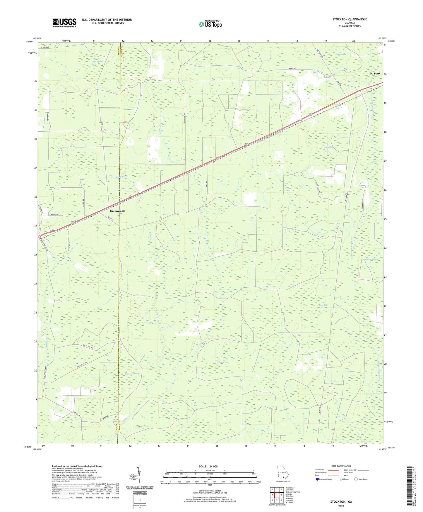
2024 topographic map quadrangle Stockton in the state of Georgia. Scale: 1:24000. Based on the newly updated USGS 7.5' US Topo map series, this map is in the following counties: Clinch, Lanier. The map contains contour data, water features, and other items you are used to seeing on USGS maps, but also has updated roads and other features. This is the next generation of topographic maps. Printed on high-quality waterproof paper with UV fade-resistant inks.
Quads adjacent to this one:
West: Naylor
Northwest: Lakeland
North: Sirmans
Northeast: Homerville West
East: Du Pont
Southeast: Thelma
South: Haylow
Southwest: Howell
This map covers the same area as the classic USGS quad with code o30082h8.
Contains the following named places: Buck Creek, Clothespole Bay, Epsey Bay, Fish Pond, Greenwood, James Branch Fire Station, Johnson Bay, Lightsey Bay, New Prospect Church, Pigeon Bay, Stockton, Timmerman Bay, ZIP Codes: 31630, 31649