MyTopo
Du Pont Georgia US Topo Map
Couldn't load pickup availability
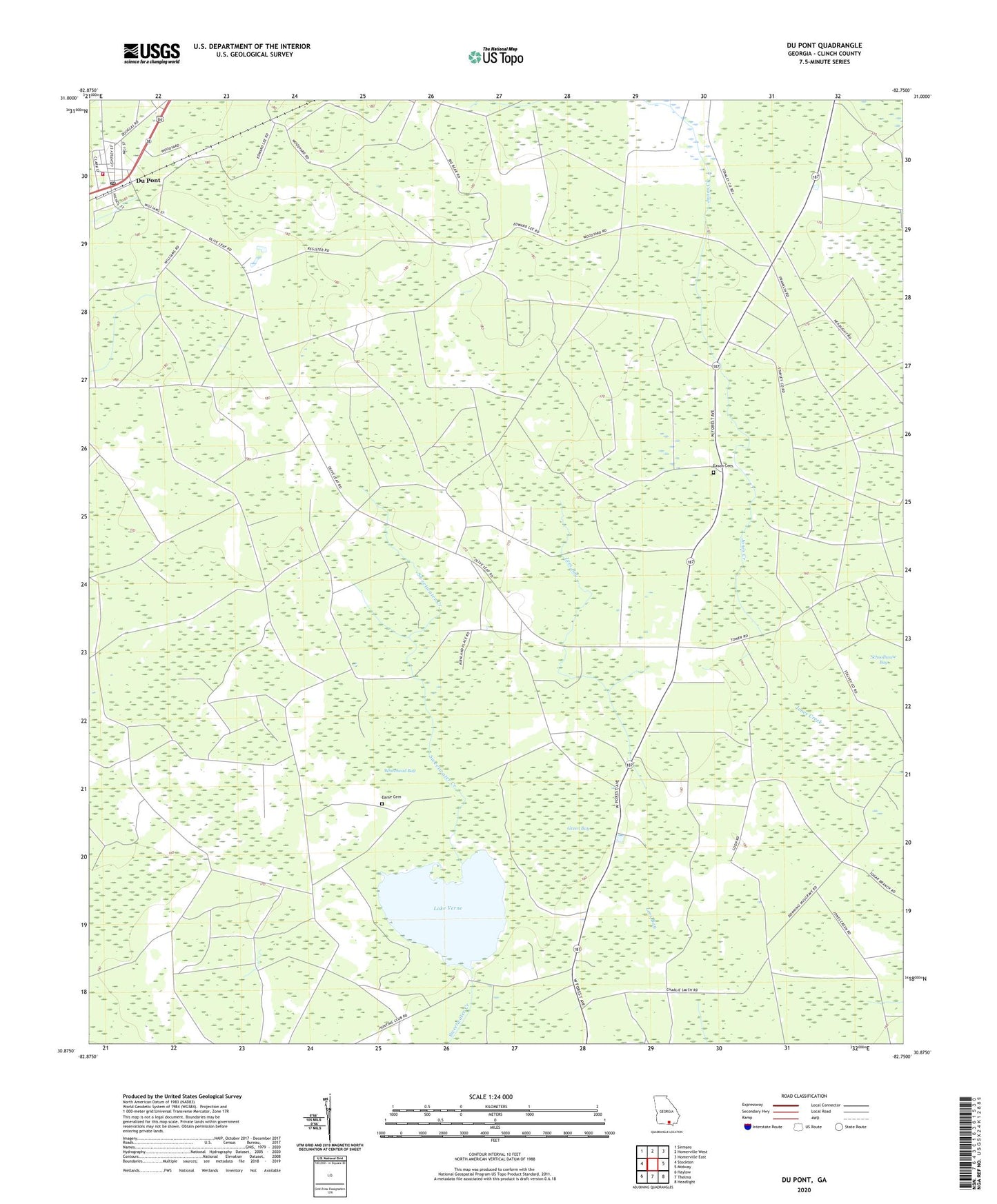
2024 topographic map quadrangle Du Pont in the state of Georgia. Scale: 1:24000. Based on the newly updated USGS 7.5' US Topo map series, this map is in the following counties: Clinch. The map contains contour data, water features, and other items you are used to seeing on USGS maps, but also has updated roads and other features. This is the next generation of topographic maps. Printed on high-quality waterproof paper with UV fade-resistant inks.
Quads adjacent to this one:
West: Stockton
Northwest: Sirmans
North: Homerville West
Northeast: Homerville East
East: Midway
Southeast: Headlight
South: Thelma
Southwest: Haylow
This map covers the same area as the classic USGS quad with code o30082h7.
Contains the following named places: Clinch County Fire Department - Dupont Volunteer Fire Station, Dame Cemetery, Du Pont, Du Pont Methodist Church, Du Pont Post Office, DuPont School, Eason Cemetery, Green Bay, Lake Verne, Lake Verne Dam, Olive Leaf Church, Town of Du Pont