MyTopo
Homerville West Georgia US Topo Map
Couldn't load pickup availability
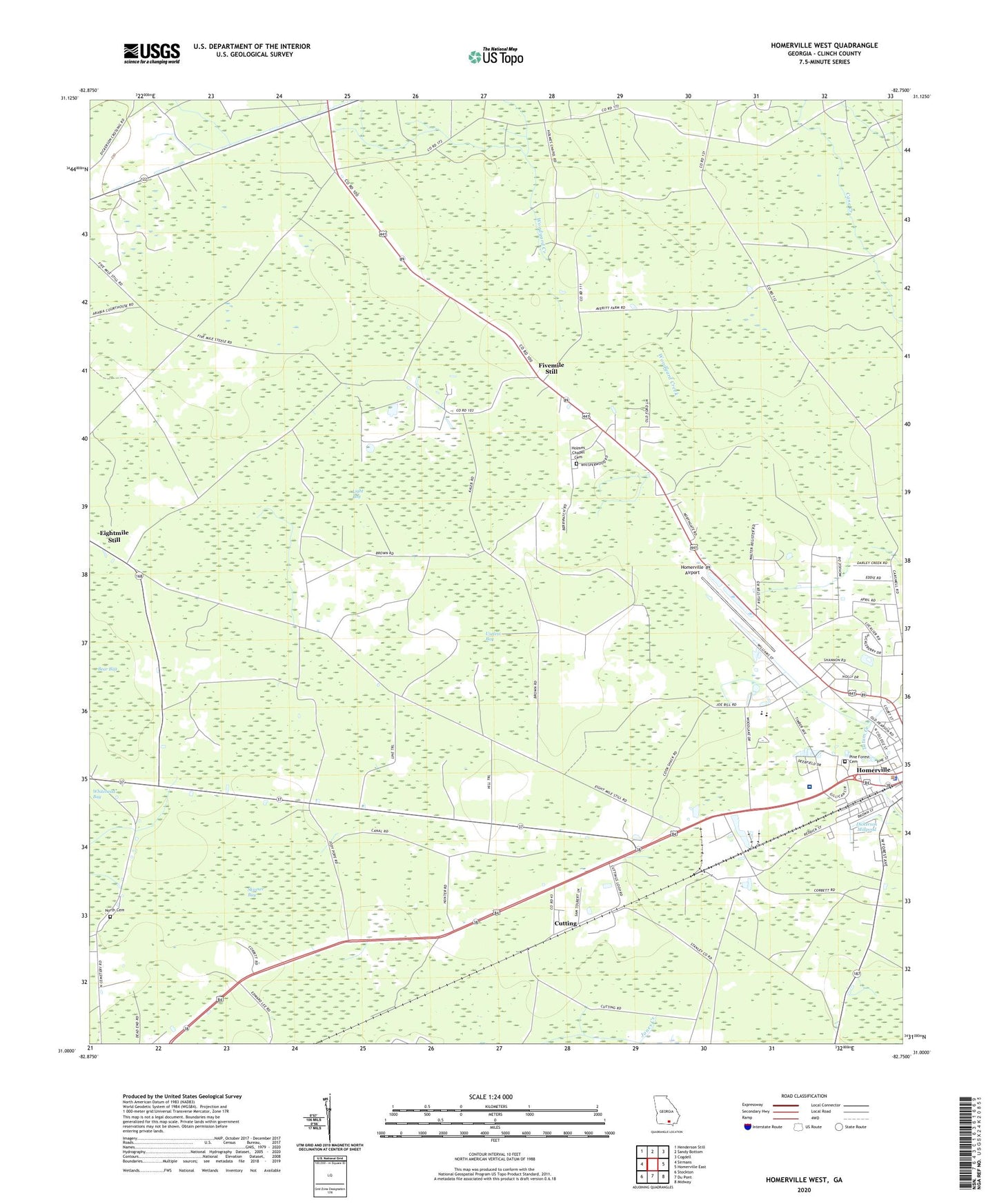
2024 topographic map quadrangle Homerville West in the state of Georgia. Scale: 1:24000. Based on the newly updated USGS 7.5' US Topo map series, this map is in the following counties: Clinch. The map contains contour data, water features, and other items you are used to seeing on USGS maps, but also has updated roads and other features. This is the next generation of topographic maps. Printed on high-quality waterproof paper with UV fade-resistant inks.
Quads adjacent to this one:
West: Sirmans
Northwest: Henderson Still
North: Sandy Bottom
Northeast: Cogdell
East: Homerville East
Southeast: Midway
South: Du Pont
Southwest: Stockton
This map covers the same area as the classic USGS quad with code o31082a7.
Contains the following named places: Bear Bay, Clinch County Elementary School, Clinch County High School, Clinch County Middle School, Clinch County Pre-School, Clinch County Public Library, Clinch Memorial Hospital, Cutting, Dupont Full Gospel Mission, First Assembly of God Church, Fivemile Still, Gillicon, Holmes Chapel, Holmes Chapel Cemetery, Homerville Airport, Homerville and Clinch County Recreation Park, Homerville Division, Homerville Elementary School, Homerville Police Department, Homerville State Prison, Light Bay, North Cemetery, Pine Forest Cemetery, Skinner Bay, Trinity Baptist Church, Useless Bay, WBTY-FM (Homerville), ZIP Code: 31634