MyTopo
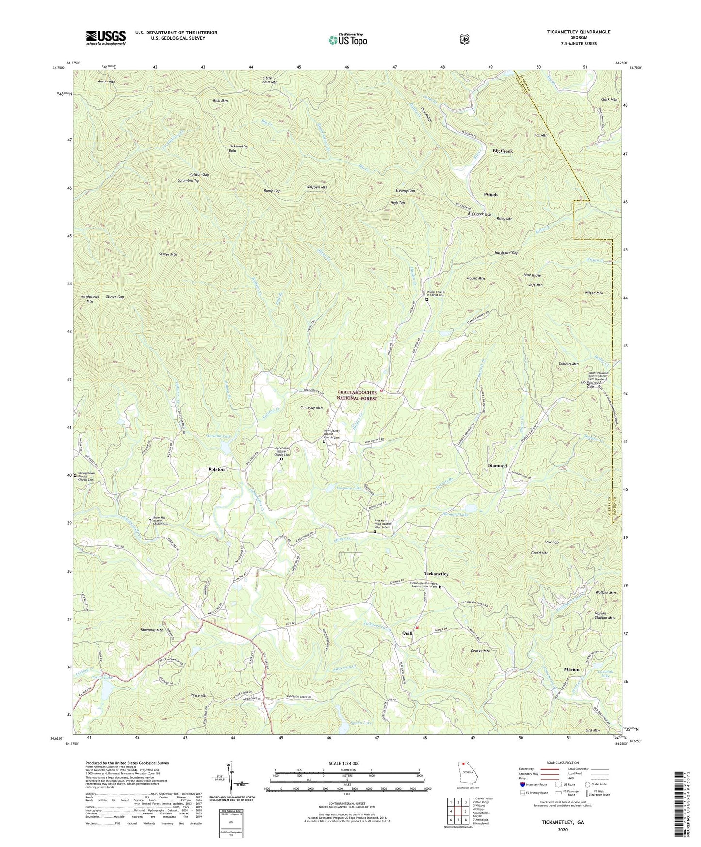
Tickanetley Georgia US Topo Map
Couldn't load pickup availability
Also explore the Tickanetley Forest Service Topo of this same quad for updated USFS data
2024 topographic map quadrangle Tickanetley in the state of Georgia. Scale: 1:24000. Based on the newly updated USGS 7.5' US Topo map series, this map is in the following counties: Gilmer, Fannin. The map contains contour data, water features, and other items you are used to seeing on USGS maps, but also has updated roads and other features. This is the next generation of topographic maps. Printed on high-quality waterproof paper with UV fade-resistant inks.
Quads adjacent to this one:
West: Ellijay
Northwest: Cashes Valley
North: Blue Ridge
Northeast: Wilscot
East: Noontootla
Southeast: Nimblewill
South: Amicalola
Southwest: Dyke
This map covers the same area as the classic USGS quad with code o34084f3.
Contains the following named places: Aaron Mountain, Anderson Creek, Bearden Creek, Big Creek, Big Creek Church, Big Creek Gap, Big Creek School, Blue Ridge Church, Blue Ridge School, Bucktown School, Butler Creek, Cartecay Mountain, Cartecay River Watershed Structure Number Five Dam, Cartecay River Watershed Structure Number Six Dam, Cartecay Watershed Dam Number 10, Cartecay Watershed Dam Number Eight, Cartecay Watershed Dam Number One, Cartecay Watershed Dam Number Three, Christian Church, Clark Mountain, Clarks Mill, Colbert Mountain, Columbia Top, Diamond, Diamond Lake, Doublehead Gap, East Liberty Church, East New Hope Baptist Church Cemetery, Fox Mountain, Garland Lake, Garrett Branch, George Mountain, Gilmer County Fire Department Station 4, Gould Mountain, Hardslate Gap, High Top, Holden Creek, Jeff Mountain, Jesus Church Cemetery, Kimmons Mountain, Little Bald Mountain, Long Branch, Low Gap, Lowman Lake, Macedonia Baptist Church Cemetery, Macedonia Church, Marion, Marion Clayton Mountain, Mathis Chapel School, Mount Pleasant Baptist Church Cemetery Number 2, Mount Pleasant Church, New Liberty Baptist Church Cemetery, New Liberty Church, Noblin Lake, Oliver Creek, Pine Ridge, Pink Branch, Pisgah, Pisgah Church, Pisgah Church of Christ Cemetery, Postell Lake, Protection, Quill, Ramp Gap, Reese Mountain, Rich Mountain, Rich Mountain Division, Rich Mountain Wilderness, Rich Mountain Wildlife Management Area, Riley Mountain, River Hill Baptist Church Cemetery, River Hill Church, Roger Laurel Branch, Rolston, Rolston Creek, Rolston Gap, Rolston School, Round Mountain, Roy, Salem School, Scrougetown Baptist Church Cemetery, Simons Branch, Stanley Mill, Steamy Gap, Stover Creek, Stover Gap, Stover Mountain, Tickanetley, Tickanetley Bald, Tickanetley Creek, Tickanetley Primitive Baptist Church, Tickanetley Primitive Baptist Church Cemetery, Turniptown Mountain, Twiggs School, Vandegriff Creek, Weaver Creek, Wilson Mountain, Wolfpen Mountain, ZIP Code: 30536