
MyTopo
Tybee Island North Georgia US Topo Map
Couldn't load pickup availability
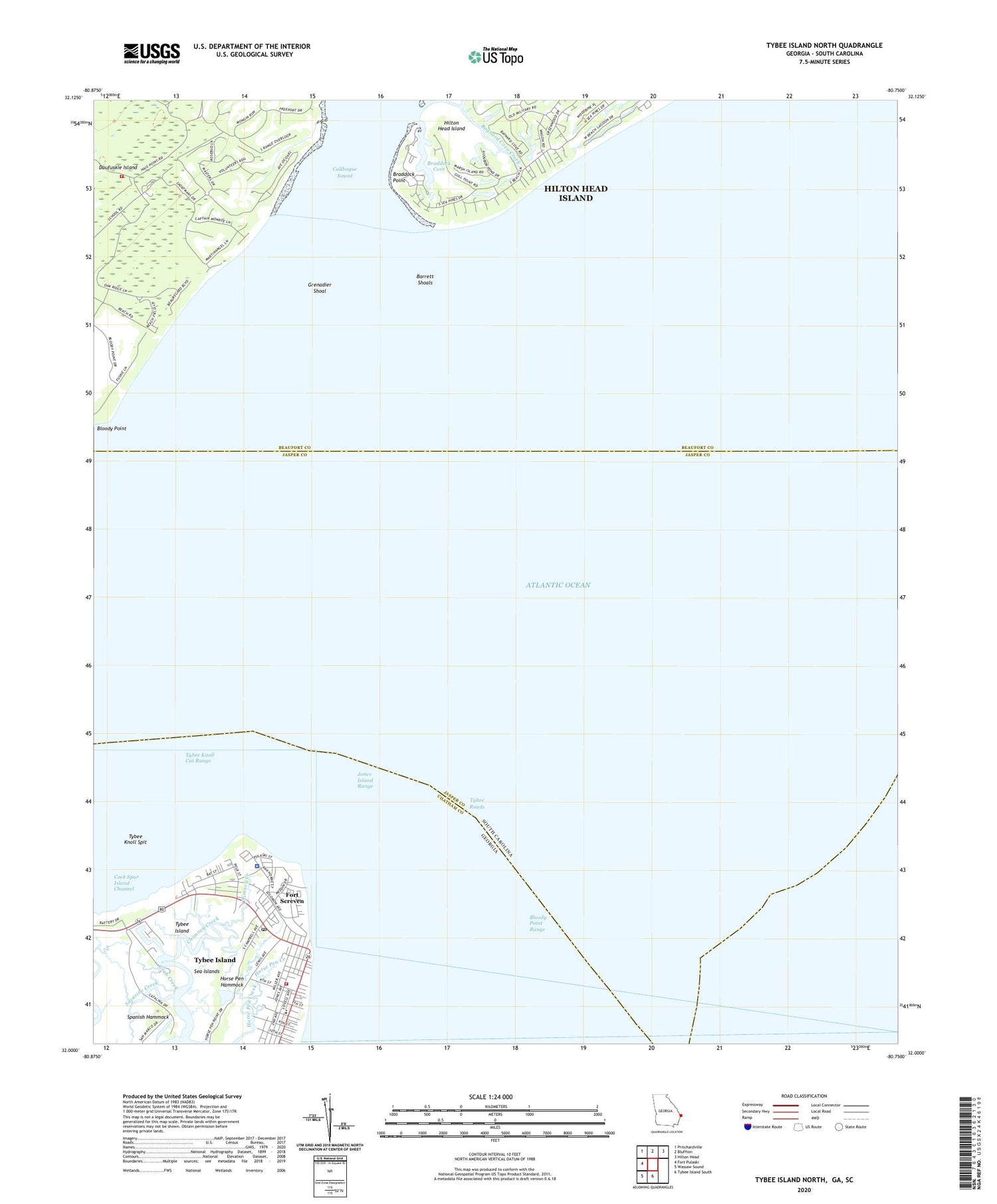
2024 topographic map quadrangle Tybee Island North in the states of South Carolina, Georgia. Scale: 1:24000. Based on the newly updated USGS 7.5' US Topo map series, this map is in the following counties: Chatham, Beaufort, Jasper. The map contains contour data, water features, and other items you are used to seeing on USGS maps, but also has updated roads and other features. This is the next generation of topographic maps. Printed on high-quality waterproof paper with UV fade-resistant inks.
Quads adjacent to this one:
Northwest: Pritchardville
North: Bluffton
Northeast: Hilton Head
South: Tybee Island South
Southwest: Wassaw Sound
Contains the following named places: Barrett Shoals, Battery Backus, Battery Brumby, Battery Fenwick, Battery Gantt, Battery Garland, Battery Habersham, Baynard Cove Creek, Bloody Point Range, Braddock Cove, Braddock Point, Calibogue Creek, Calibogue Sound, Chimney Creek, City of Tybee Island, Cock Spur Island Channel, Crab Creek, Daufuskie Island, Daufuskie Island Census Designated Place, Daufuskie Island Fire Department, Fort Screven, Fort Screven Historic District, Grenadier Shoal, Horse Pen Hammock, Jones Island Range, Lazaretto, Live Oak Public Library System Tybee Island Branch, New River, Saint Michael's Elementary School, Savannah River, Sazarine Creek, South Beach Villas, South Jetty, South Sea Pines, Spanish Hammock, Tybee Elementary School, Tybee Island, Tybee Island City Jail, Tybee Island City Marshal's Office, Tybee Island Fire Department, Tybee Island Police Department, Tybee Island Post Office, Tybee Knoll Cut Range, Tybee Knoll Spit, Tybee Lighthouse, Tybee Museum, Tybee Roads, ZIP Codes: 29915, 31328


