MyTopo
Waleska Georgia US Topo Map
Couldn't load pickup availability
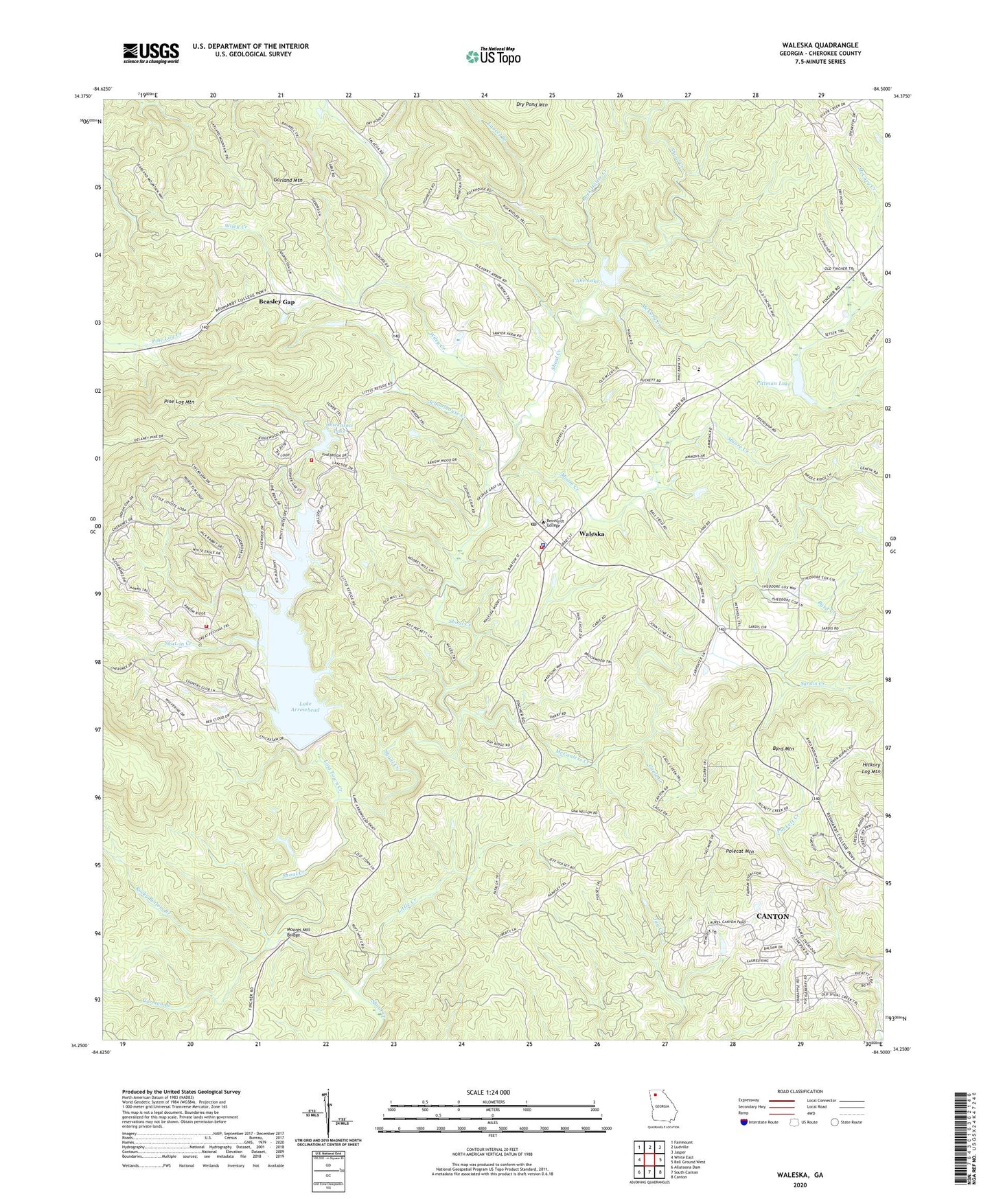
2024 topographic map quadrangle Waleska in the state of Georgia. Scale: 1:24000. Based on the newly updated USGS 7.5' US Topo map series, this map is in the following counties: Cherokee. The map contains contour data, water features, and other items you are used to seeing on USGS maps, but also has updated roads and other features. This is the next generation of topographic maps. Printed on high-quality waterproof paper with UV fade-resistant inks.
Quads adjacent to this one:
West: White East
Northwest: Fairmount
North: Ludville
Northeast: Jasper
East: Ball Ground West
Southeast: Canton
South: South Canton
Southwest: Allatoona Dam
This map covers the same area as the classic USGS quad with code o34084c5.
Contains the following named places: Beasley Gap, Brier Patch Church, Byrd Creek, Byrd Mountain, Cagle Creek, Cherokee County Fire and Emergency Services Station 12, Cherokee County Fire Department Station 2, Cherokee County Sheriff's Office Waleska Precinct, Chickasaw Lake, Chickasaw Lake Dam, City of Waleska, Cline Lake, Dry Pond Mountain, Garland Mountain, Garland Mountain School, Gorman Branch, Hickory Log Mountain, Lake Arrowhead, Lake Arrowhead Dam, Lake Arrowhead Volunteer Fire Department, Laurel Branch, Little Creek, Little Refuge Cemetery, Lost Town Creek, McCanless Creek, McCory Creek, Moore Airstrip, Moore Creek, Moore School, Moores Mill Bridge, Mount Zion Church, New Friendship Church, Olive Vine Church, Pittman Lake, Pleasant Arbor Church, Pleasant Union Church, Polecat Mountain, R M Moore Elementary School, Refuge Church, Reinhardt College, Rock House Creek, Rocky Bottom Branch, Sardis Baptist Church, Sardis Creek, Schoolhouse Creek, Shoal Creek Baptist Church, Shut-in Creek, Stamp Shoal Creek Structure Number One Dam, Stamp Shoal Creek Structure Number Two Dam, Waleska, Waleska Church, Waleska Division, Waleska Post Office, Wiley Creek, ZIP Code: 30183