MyTopo
South Canton Georgia US Topo Map
Couldn't load pickup availability
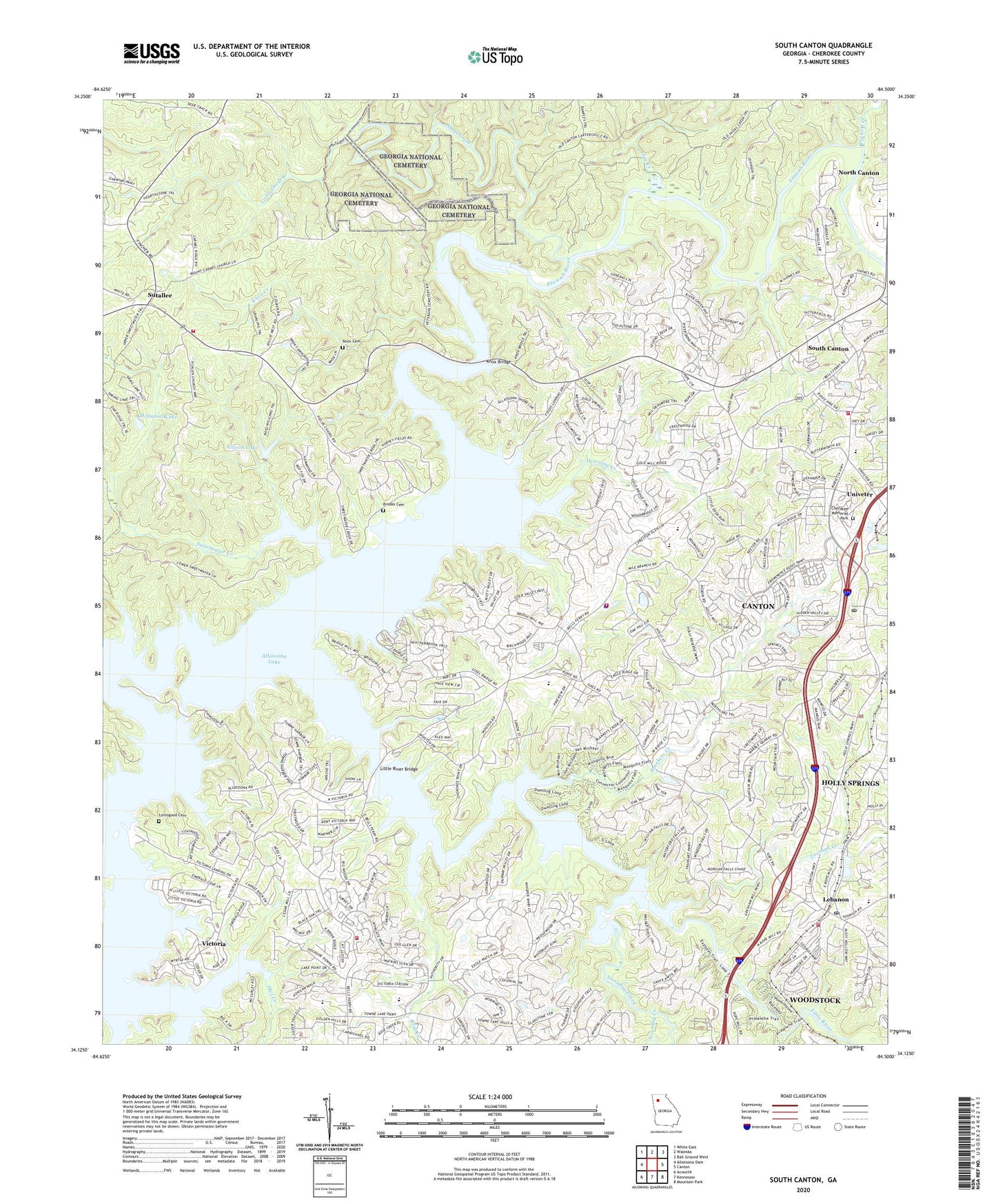
2024 topographic map quadrangle South Canton in the state of Georgia. Scale: 1:24000. Based on the newly updated USGS 7.5' US Topo map series, this map is in the following counties: Cherokee. The map contains contour data, water features, and other items you are used to seeing on USGS maps, but also has updated roads and other features. This is the next generation of topographic maps. Printed on high-quality waterproof paper with UV fade-resistant inks.
Quads adjacent to this one:
West: Allatoona Dam
Northwest: White East
North: Waleska
Northeast: Ball Ground West
East: Canton
Southeast: Mountain Park
South: Kennesaw
Southwest: Acworth
This map covers the same area as the classic USGS quad with code o34084b5.
Contains the following named places: American Heritage Academy, Bascomb Elementary School, Bells Ferry Church, Blankets Creek, Boling Park, Boston Elementary School, Brooks Cemetery, Calvary Community Church, Canton Corners Shopping Center, Canton Division, Canton Elementary School, Canton Fire Department Station 11, Cherokee, Cherokee Christian Fellowship Church, Cherokee County Park, Cherokee County Sheriff's Office Bridgemill Precinct, Cherokee High School, Cherokee Memorial Park, Cherokee Mill, Cherokee Mine, Christian Praise Center, Clarkston Mine, Community Christian School, Crossroads High and Middle School, Cushing Memorial Park, Downing Creek, Downing Creek Placer Mine, Dunwoody Methodist Youth Camp, Ellison Lake, Ellison Lake Dam, Ficklen Church, Fields Chapel, Fields Landing, Freedom Middle School, Georgia National Cemetery, Grace Church, Greene Lake, Greene Lake Dam, Hightower Church Cemetery, Hobgood Park, Holly Springs, Holly Springs Methodist Church, Holly Springs Police Department, Holly Springs Post Office, Hopewell Church, Joseph Knox Elementary School, Jug Creek, Kellogg Creek, Knox Bridge, Knox Cemetery, Knox Creek, Lake Allatoona Managed Hunting Area, Land Mark Church, Lebanon, Lebanon Post Office, Lebanon United Methodist Church, Liberty Elementary School, Little River, Little River Bridge, Little River Landing, Little Shoal Creek, Lovingood Cemetery, Macou Prospect, McDaniel Lake, McDaniel Lake Dam, Mount Carmel Church, New Bethel Baptist Church, New Hightower Church, New Victoria Church, Noonday Baptist Association Camp, Noonday Creek, Oak Grove Fire Department, Oakdale Church, Owl Creek, Puckett Creek, Putnam Mine, Rehobeth Christian Academy, Rose Creek, Rose Creek Shopping Center, Saint Clements Church, Shoal Creek, Sixes Elementary School, Sixes Methodist Church, Sixes Mine, South Canton, Sutallee, Sutallee Volunteer Fire Department, Sweetwater Church, Sweetwater Creek, Sweetwater Creek Campground, Teasley Middle School, The Cross Full Gospel Church, Three Hundred and One Mine, Toonigh Baptist Church, Toonigh Church of God, Toonigh Creek, Towne Lake Village Shopping Center, Univeter, Victoria, Victoria Landing, WCHK-FM (Canton), Whispering Pines Camp, Woodstock Fire Department Station 24, ZIP Code: 30114