MyTopo
Punaluu Hawaii US Topo Map
Couldn't load pickup availability
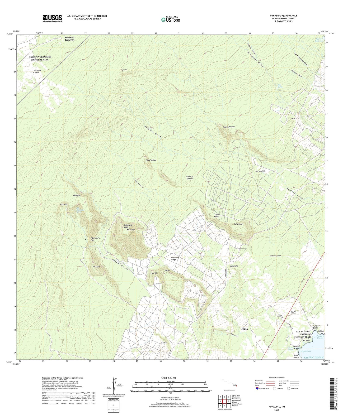
2024 topographic map quadrangle Punaluu in the state of Hawaii. Scale: 1:24000. Based on the newly updated USGS 7.5' US Topo map series, this map is in the following counties: Hawaii. The map contains contour data, water features, and other items you are used to seeing on USGS maps, but also has updated roads and other features. This is the next generation of topographic maps. Printed on high-quality waterproof paper with UV fade-resistant inks.
Quads adjacent to this one:
West: Puuokeokeo
Northwest: Alika Cone
North: Puukinikini
Northeast: Wood Valley
East: Pahala
South: Naalehu
Southwest: Kahuku Ranch
This map covers the same area as the classic USGS quad with code o19155b5.
Contains the following named places: Ala Kahakai National Historic Trail, 'Alili, 'Alili Spring, 'Enuhe Ridge, Higashi Camp, Hilea, Hilea Iki, Hilea Nui, Hokuloa Church, Ka'alaiki, Kahiolo, Ka'ie'ie Heiau, Kaiholena, Kaiholena Ridge, Kaimuokanaka, Kane'ele'ele Heiau, Kapukini, Kau Division, Ka'u Forest Reserve, Kaumaike'ohu, Kawahine Ridge, Keaiwa Reservoir, Koloa Beach, Lae'opuhili, Lower Moaula Camp, Makaalia, Makaka Ravine, Makakakopumoa'ula, Makanau, Middle Moa'ula Camp, Mohokea 1-2, Mountain House, Mountain House Trail, Nanu'amai'a, Napu'ukulua, Ninole, Ninole Cove, Ninole Gulch, Ninole Springs, Ninole-Wailau Homesteads, Old Plantation Spring, Pakanaka, Pakua, Palimuku, Pane'ene'e Pali, Puehu, Punalu'u, Punalu'u Beach, Punalu'u Beach Park, Punalu'u Harbor, Punalu'u Kahawai, Pu'u'enuhe, Pu'uiki, Pu'umoa, Pu'uone, Sea Mountain Golf Club, Upper Pa'au'au Airport, Wailau Hawaiian Home Land, ZIP Code: 96772