MyTopo
Hualalai Hawaii US Topo Map
Couldn't load pickup availability
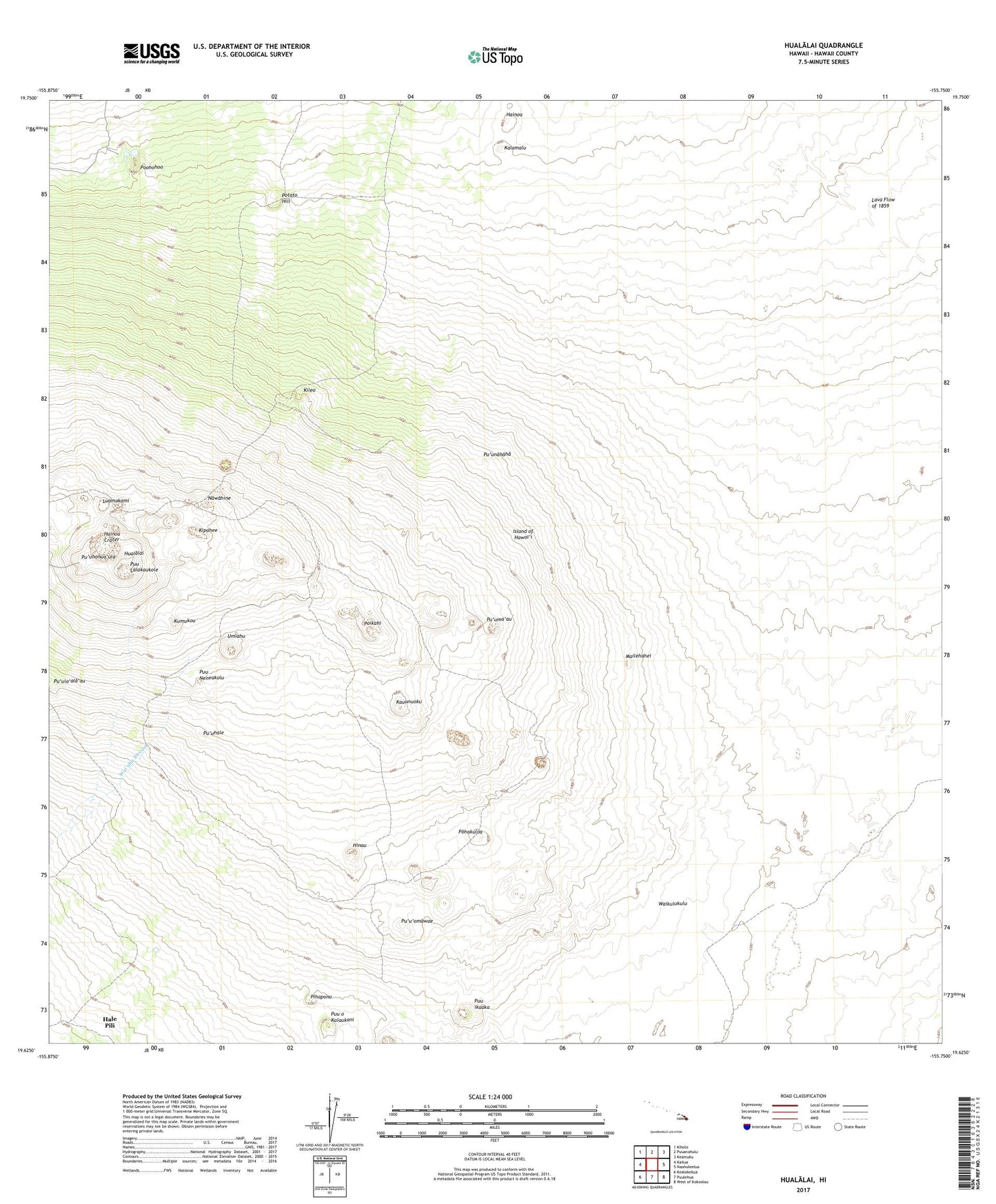
2024 topographic map quadrangle Hualalai in the state of Hawaii. Scale: 1:24000. Based on the newly updated USGS 7.5' US Topo map series, this map is in the following counties: Hawaii. The map contains contour data, water features, and other items you are used to seeing on USGS maps, but also has updated roads and other features. This is the next generation of topographic maps. Printed on high-quality waterproof paper with UV fade-resistant inks.
Quads adjacent to this one:
West: Kailua
Northwest: Kiholo
North: Puuanahulu
Northeast: Keamuku
East: Naohuleelua
Southeast: West of Kokoolau
South: Puulehua
Southwest: Kealakekua
This map covers the same area as the classic USGS quad with code o19155f7.
Contains the following named places: Ahua'umi Heiau, Hainoa, Hainoa Crater, Hale Pili, Halelaau, Hinau, Hualalai, Kalamalu, Ka'upulehu Forest Reserve, Kauunuoku, Kileo, Kipahee, Kumukou, Luamakami, Mailehahei, Nawahine, North Kona District, Pihapono, Pohakuloa, Poikahi, Poohohoo, Potato Hill, Puu Ikaaka, Puu Lalakaukole, Puu Neneakolu, Puu o Kalaukani, Pu'uhale, Pu'uhonua'ula, Pu'ula'ala'au, Pu'uma'au, Pu'unahaha, Pu'u'omawae, Shangri-La, Umiahu, Wahapele, Waikulukulu