MyTopo
Keamuku Hawaii US Topo Map
Couldn't load pickup availability
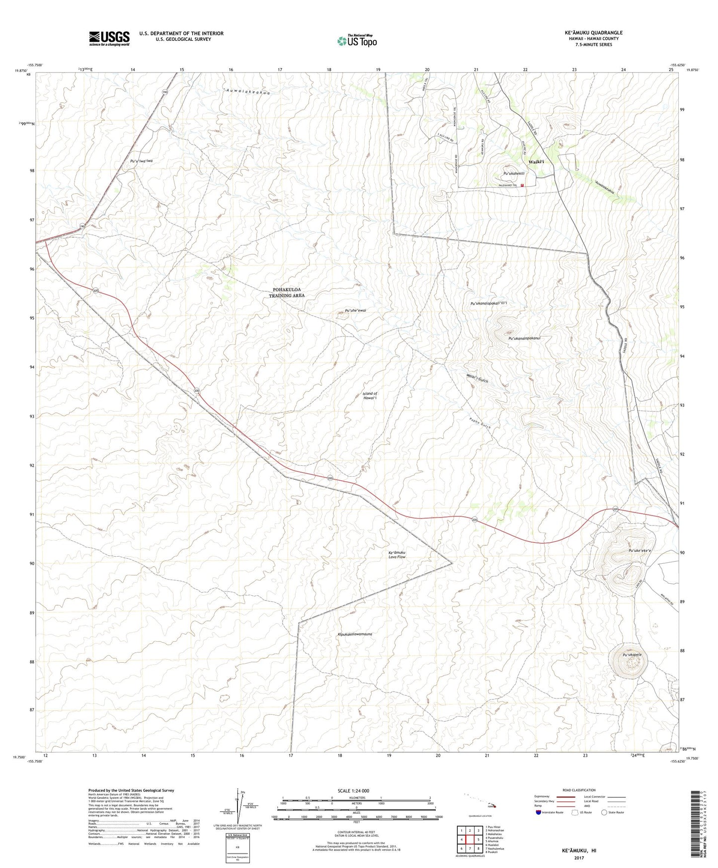
2024 topographic map quadrangle Keamuku in the state of Hawaii. Scale: 1:24000. Based on the newly updated USGS 7.5' US Topo map series, this map is in the following counties: Hawaii. The map contains contour data, water features, and other items you are used to seeing on USGS maps, but also has updated roads and other features. This is the next generation of topographic maps. Printed on high-quality waterproof paper with UV fade-resistant inks.
Quads adjacent to this one:
West: Puuanahulu
Northwest: Puu Hinai
North: Nohonaohae
Northeast: Makahalau
East: Ahumoa
Southeast: Puukoli
South: Naohuleelua
Southwest: Hualalai
This map covers the same area as the classic USGS quad with code o19155g6.
Contains the following named places: Ke'amuku, Keonehehe'e, Kilohana Girl Scout Camp, Kipukakalawamauna, Lucy Henriques Medical Center Heliport, Pu'uhe'ewai, Pu'u'iwa'iwa, Pu'ukahekili, Pu'ukanalopakali'ili'i, Pu'ukanalopakanui, Pu'ukapele, Pu'uke'eke'e, Pu'uke'eke'e Game Management Area, Waiki'i, Waiki'i Gulch, Waikii Paddock Game Management Area, Waiki'i Pump Station, Waikii Volunteer Fire Station 09A, ZIP Code: 96743