MyTopo
Nohonaohae Hawaii US Topo Map
Couldn't load pickup availability
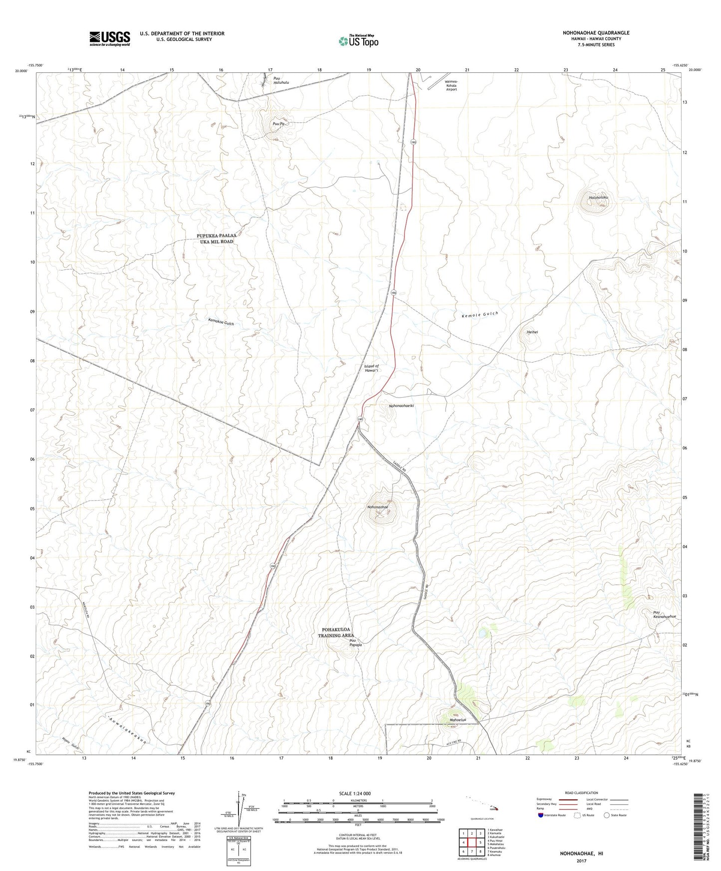
2024 topographic map quadrangle Nohonaohae in the state of Hawaii. Scale: 1:24000. Based on the newly updated USGS 7.5' US Topo map series, this map is in the following counties: Hawaii. The map contains contour data, water features, and other items you are used to seeing on USGS maps, but also has updated roads and other features. This is the next generation of topographic maps. Printed on high-quality waterproof paper with UV fade-resistant inks.
Quads adjacent to this one:
West: Puu Hinai
Northwest: Kawaihae
North: Kamuela
Northeast: Kukuihaele
East: Makahalau
Southeast: Ahumoa
South: Keamuku
Southwest: Puuanahulu
This map covers the same area as the classic USGS quad with code o19155h6.
Contains the following named places: Heihei, Holoholoku, Kemole Gulch, Mahoelua, Nohonaohae, Nohonaohaeiki, Old Aalii Pump Station, Pa Aalii Pump Station, Pakila Pump Station, Puu Keanahuehue, Puu Papapa, Pu'uhuluhulu, Pu'upa, Saddle Road Junction, South Kohala Division, Waikoloa, Waimea-Kohala Airport