MyTopo
Puu Hinai Hawaii US Topo Map
Couldn't load pickup availability
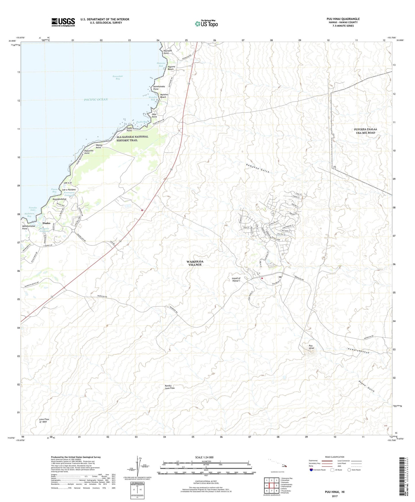
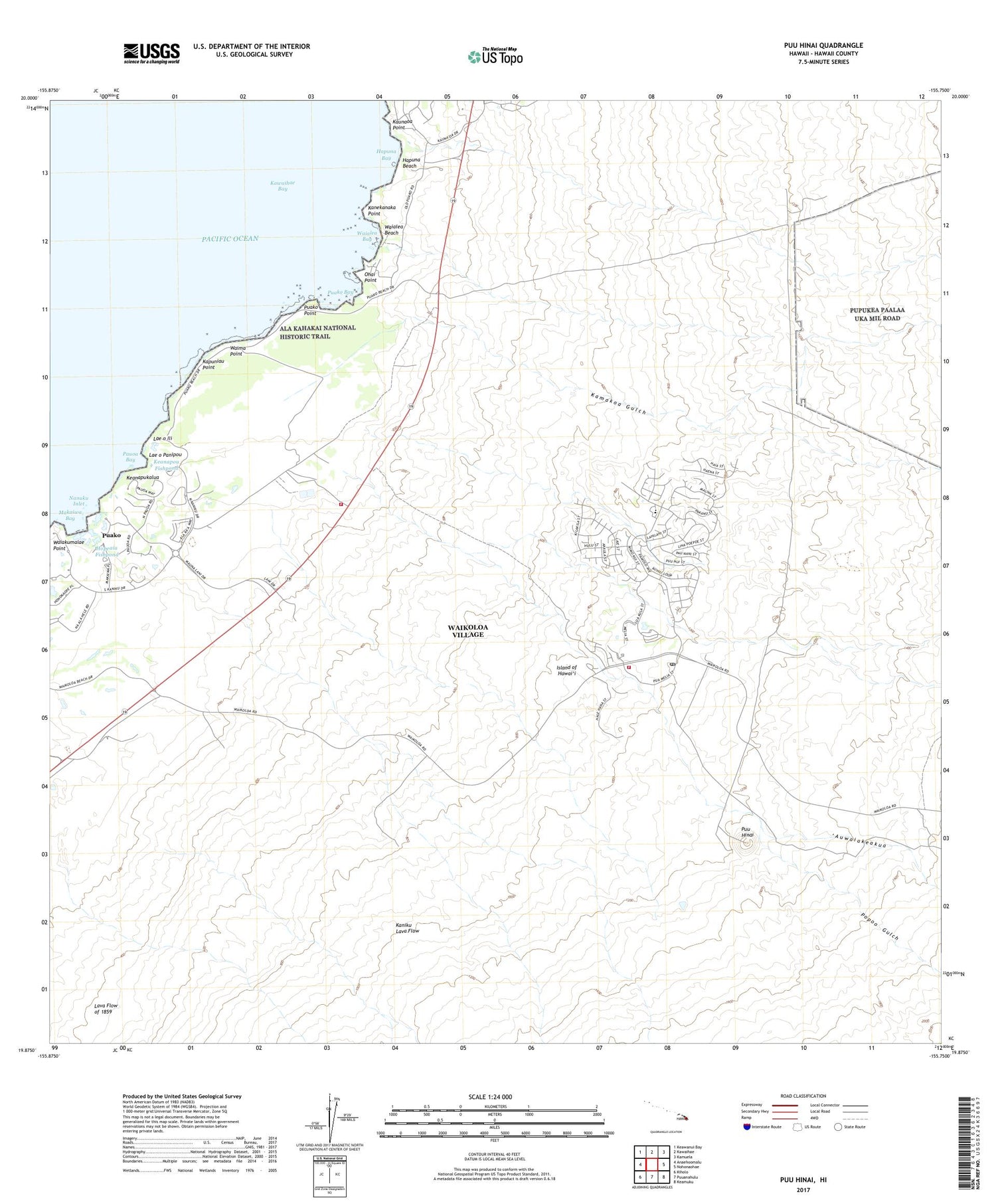
2024 topographic map quadrangle Puu Hinai in the state of Hawaii. Scale: 1:24000. Based on the newly updated USGS 7.5' US Topo map series, this map is in the following counties: Hawaii. The map contains contour data, water features, and other items you are used to seeing on USGS maps, but also has updated roads and other features. This is the next generation of topographic maps. Printed on high-quality waterproof paper with UV fade-resistant inks.
Quads adjacent to this one:
West: Anaehoomalu
Northwest: Keawanui Bay
North: Kawaihae
Northeast: Kamuela
East: Nohonaohae
Southeast: Keamuku
South: Puuanahulu
Southwest: Kiholo
This map covers the same area as the classic USGS quad with code o19155h7.
Contains the following named places: Auwaiakeakua, Hapuna Bay, Hapuna Beach, Hapuna Beach State Recreation Area, Hawaii County Fire Department Station 14 South Kohala, Hawaii Fire Department Station 16 Waikoloa, Hokuloa Church, Hopeaia Fishpond, Kalahuipua'a, Kamakoa Gulch, Kanekanaka Point, Kaniku Lava Flow, Kapuniau Point, Kauna'oa Point, Kawaihae Bay, Keanapou Fishpond, Keanapukalua, Lae o Ili, Lae o Panipou, Lahuipuaa, Lalamilo, Makaiwa Bay, Manoku Fishpond, Nanuku Inlet, Ohai Point, Papakonani Boat Landing, Pauoa Bay, Popoo Gulch, Puako, Puako Bay, Puako Census Designated Place, Puako Keamuku Trail, Puako Point, Pu'uhana'i, South Kohala District, Waiakumalae Point, Waialea Bay, Waialea Beach, Waikoloa, Waikoloa Airport, Waikoloa Heliport, Waikoloa Post Office, Waikoloa Village, Waikoloa Village Census Designated Place, Waima Point, Waipuhi Fishpond