MyTopo
Wood Valley Hawaii US Topo Map
Couldn't load pickup availability
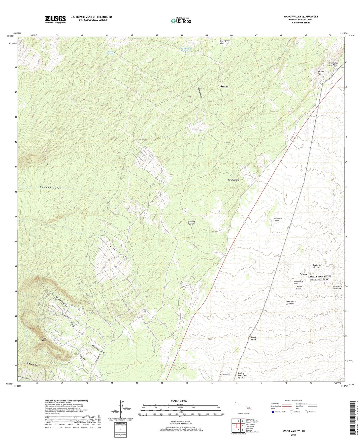
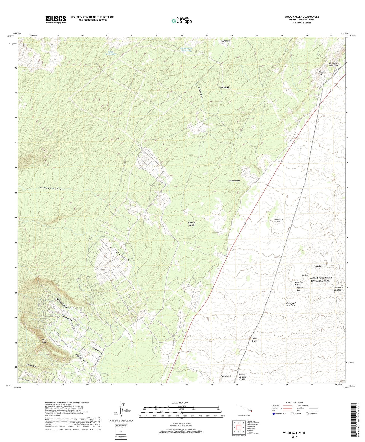
2024 topographic map quadrangle Wood Valley in the state of Hawaii. Scale: 1:24000. Based on the newly updated USGS 7.5' US Topo map series, this map is in the following counties: Hawaii. The map contains contour data, water features, and other items you are used to seeing on USGS maps, but also has updated roads and other features. This is the next generation of topographic maps. Printed on high-quality waterproof paper with UV fade-resistant inks.
Quads adjacent to this one:
West: Puukinikini
Northwest: Mauna Loa
North: Kipukapakekake
Northeast: Kilauea Crater
East: Kau Desert
Southeast: Naliikakani Point
South: Pahala
Southwest: Punaluu
This map covers the same area as the classic USGS quad with code o19155c4.
Contains the following named places: Ahulili, 'Ainapo, Halfway House, Ipu'u Ridge, Ka'ili'ula, Kaopapawai Waterhole, Kapapala, Kapapala Camp, Kapapala Ranch, Keakapulu Flat, Kealaalea Hills, Kilauea Gulch, Makakupu, Makakupu Gulch, Pakoa Waterhole, Peleli'ili'i Gulch, Ponohohoa Chasms, Pu'ukoa, Pu'ukou, Pu'ukuanene, Pu'unahaha, Uewale Gulch, Wai'akaloa Gulch, Waihaka Gulch, Waimuku, Wood Valley, Wood Valley Camp, Wood Valley Homesteads, Yellow Cone, ZIP Code: 96777