MyTopo
Aberdeen Idaho US Topo Map
Couldn't load pickup availability
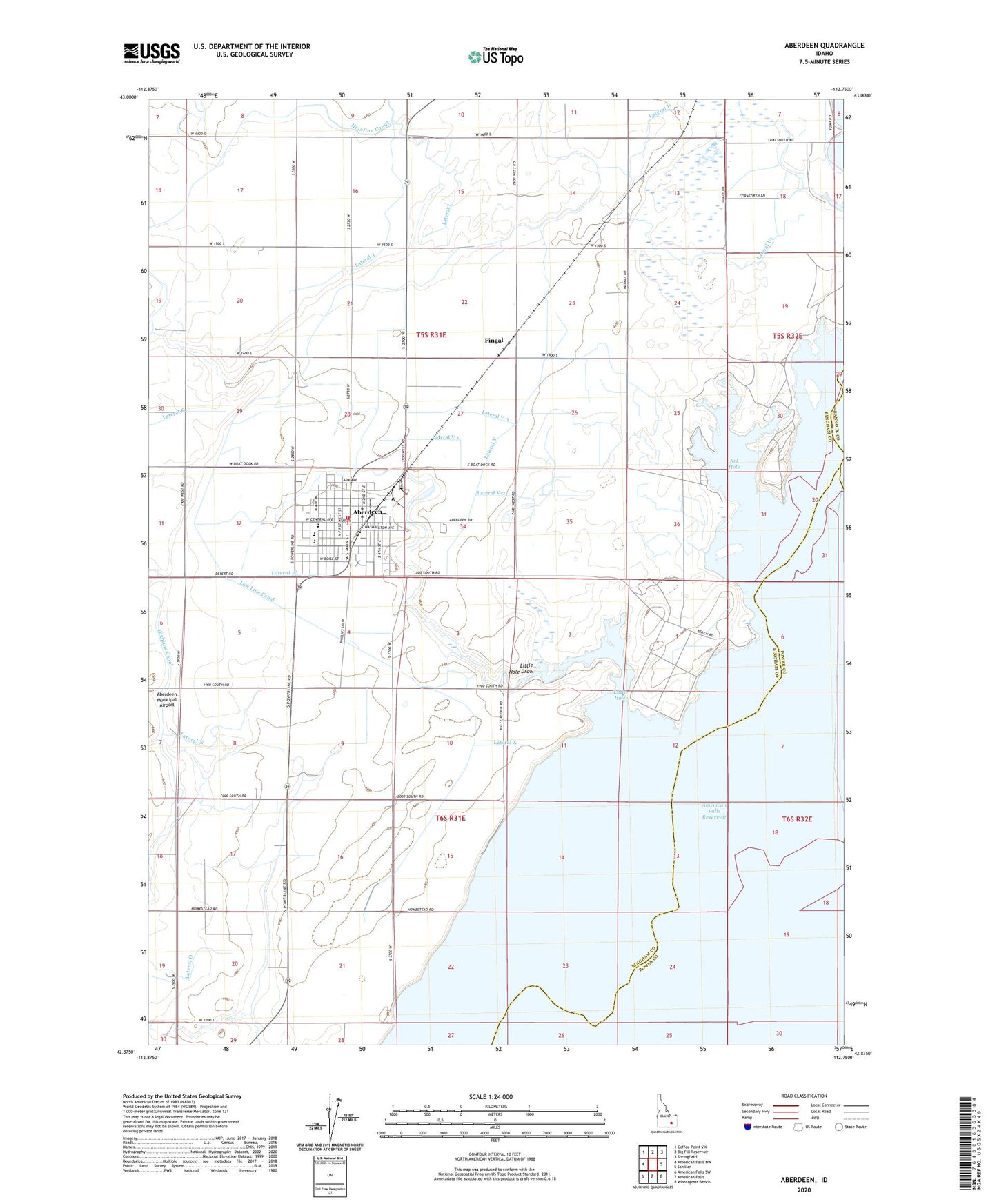
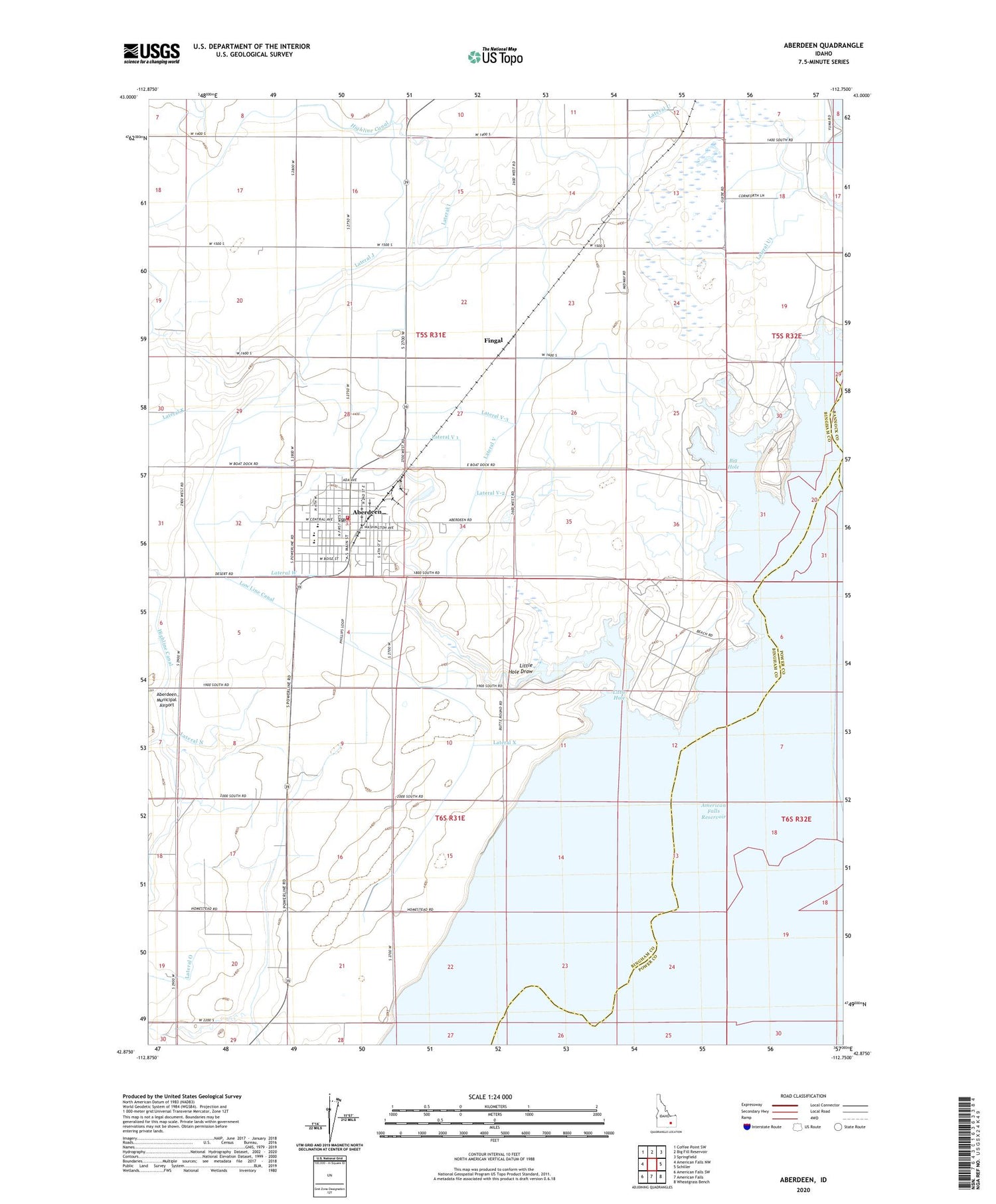
2024 topographic map quadrangle Aberdeen in the state of Idaho. Scale: 1:24000. Based on the newly updated USGS 7.5' US Topo map series, this map is in the following counties: Bingham, Power, Bannock. The map contains contour data, water features, and other items you are used to seeing on USGS maps, but also has updated roads and other features. This is the next generation of topographic maps. Printed on high-quality waterproof paper with UV fade-resistant inks.
Quads adjacent to this one:
West: American Falls NW
Northwest: Coffee Point SW
North: Big Fill Reservoir
Northeast: Springfield
East: Schiller
Southeast: Wheatgrass Bench
South: American Falls
Southwest: American Falls SW
This map covers the same area as the classic USGS quad with code o42112h7.
Contains the following named places: Aberdeen, Aberdeen - Springfield Fire Department, Aberdeen Cemetery, Aberdeen Division, Aberdeen Elementary School, Aberdeen High School, Aberdeen Police Department, Aberdeen Post Office, Aberdeen Wasteway Canal, Big Hole, City of Aberdeen, Fingal, Lateral I, Lateral J, Lateral K, Lateral N, Lateral O, Lateral U, Lateral U1, Lateral V, Lateral V 1, Lateral V-2, Lateral V-3, Lateral V4, Lateral W, Lateral X, Lateral Y, Lateral Y-1, Lateral Y-2, Lateral Y-3, Lateral Z, Little Hole, Little Hole Draw, Low Line Canal, Portneuf River, Sterling Wildlife Management Area