MyTopo
Wheatgrass Bench Idaho US Topo Map
Couldn't load pickup availability
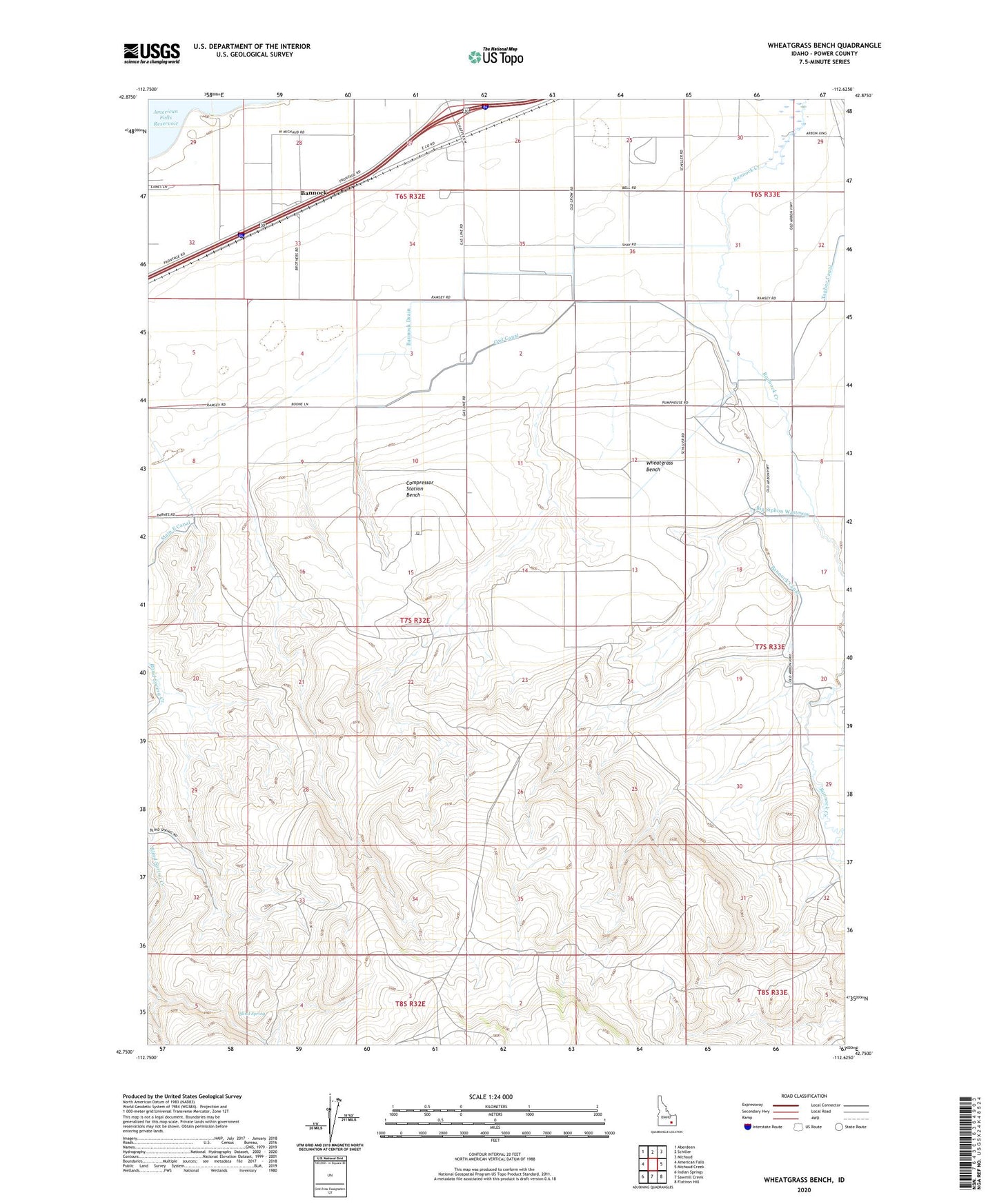
2024 topographic map quadrangle Wheatgrass Bench in the state of Idaho. Scale: 1:24000. Based on the newly updated USGS 7.5' US Topo map series, this map is in the following counties: Power. The map contains contour data, water features, and other items you are used to seeing on USGS maps, but also has updated roads and other features. This is the next generation of topographic maps. Printed on high-quality waterproof paper with UV fade-resistant inks.
Quads adjacent to this one:
West: American Falls
Northwest: Aberdeen
North: Schiller
Northeast: Michaud
East: Michaud Creek
Southeast: Flatiron Hill
South: Sawmill Creek
Southwest: Indian Springs
Contains the following named places: Arbon Crossing, Bannock, Bannock Canal, Bannock Drain, Bannock Pumping Station, Big Siphon Wasteway, Blind Spring, Compressor Station Bench, E 10.5 Lateral, Fort Hall Division, High Lift Line, Low Lift Line, Owl Canal, Sun Dance Ground, Wheatgrass Bench, ZIP Code: 83204