MyTopo
American Falls Idaho US Topo Map
Couldn't load pickup availability
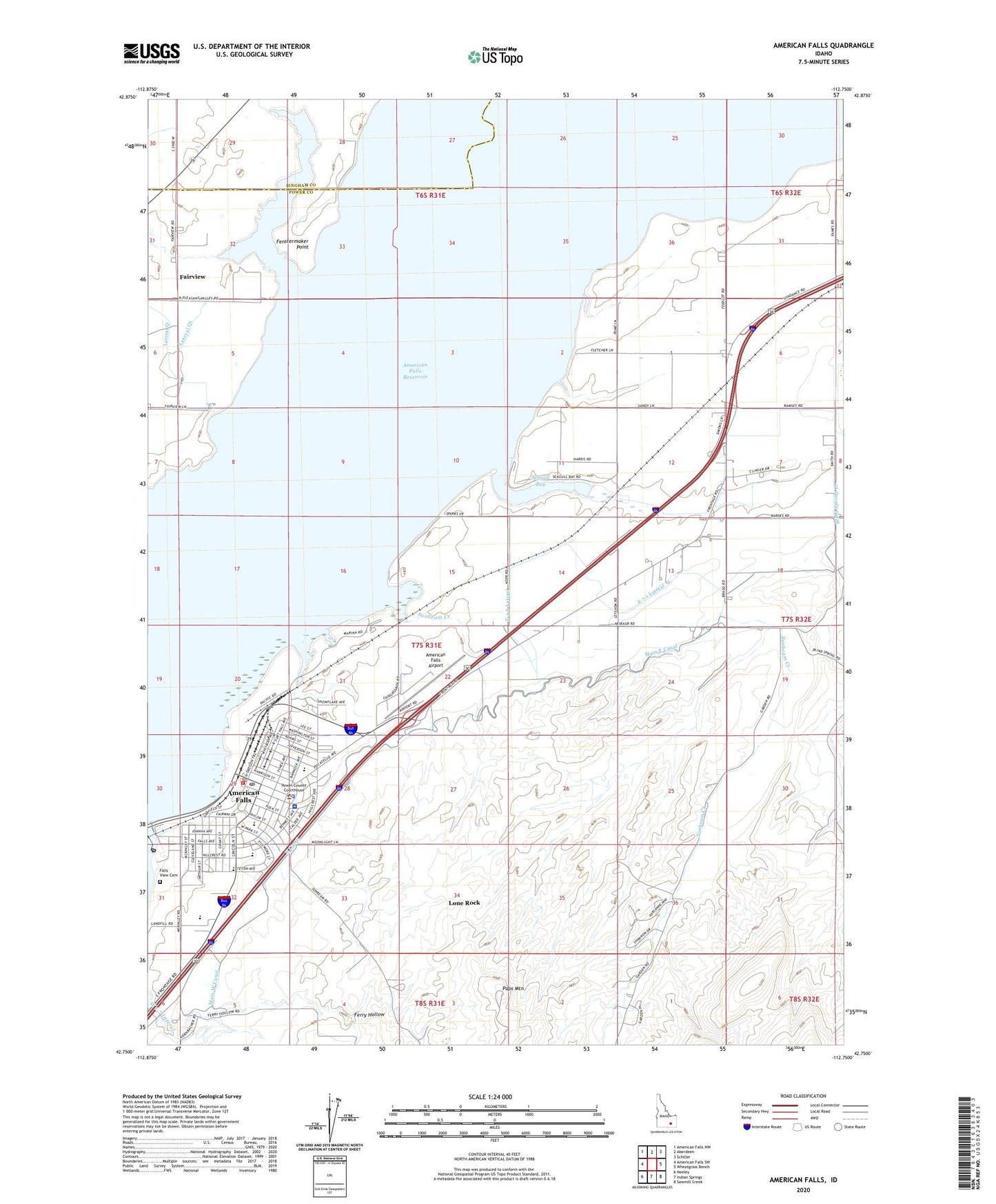
2024 topographic map quadrangle American Falls in the state of Idaho. Scale: 1:24000. Based on the newly updated USGS 7.5' US Topo map series, this map is in the following counties: Power, Bingham. The map contains contour data, water features, and other items you are used to seeing on USGS maps, but also has updated roads and other features. This is the next generation of topographic maps. Printed on high-quality waterproof paper with UV fade-resistant inks.
Quads adjacent to this one:
West: American Falls SW
Northwest: American Falls NW
North: Aberdeen
Northeast: Schiller
East: Wheatgrass Bench
Southeast: Sawmill Creek
South: Indian Springs
Southwest: Neeley
This map covers the same area as the classic USGS quad with code o42112g7.
Contains the following named places: American Falls, American Falls Airport, American Falls Fire Department, American Falls High School, American Falls Police Department, American Falls Post Office, American Falls Rural Fire Department, Blind Spring Creek, City of American Falls, E 3.0 Lateral, E 4.6 Lateral, E 7.1 Lateral, East Canal, Fairview, Falls View Cemetery, Fenstermaker Point, Hillcrest Elementary School, Lateral Q Spill, Lateral Q1, Lone Rock, Main East Canal, Paps Mountain, Park View Shopping Center, Power County Emergency Medical Services American Falls, Power County Fairgrounds, Power County Hospital, Power County Sheriff's Office, Seagull Bay, Spill Q, Spill Q1, Sunbeam Creek, W 1.7 Lateral, William Thomas Middle School