MyTopo
Arbon Idaho US Topo Map
Couldn't load pickup availability
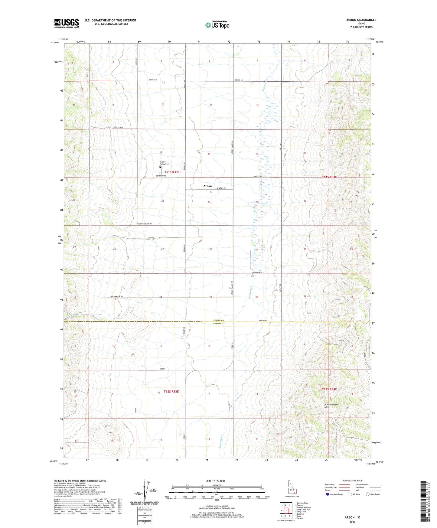
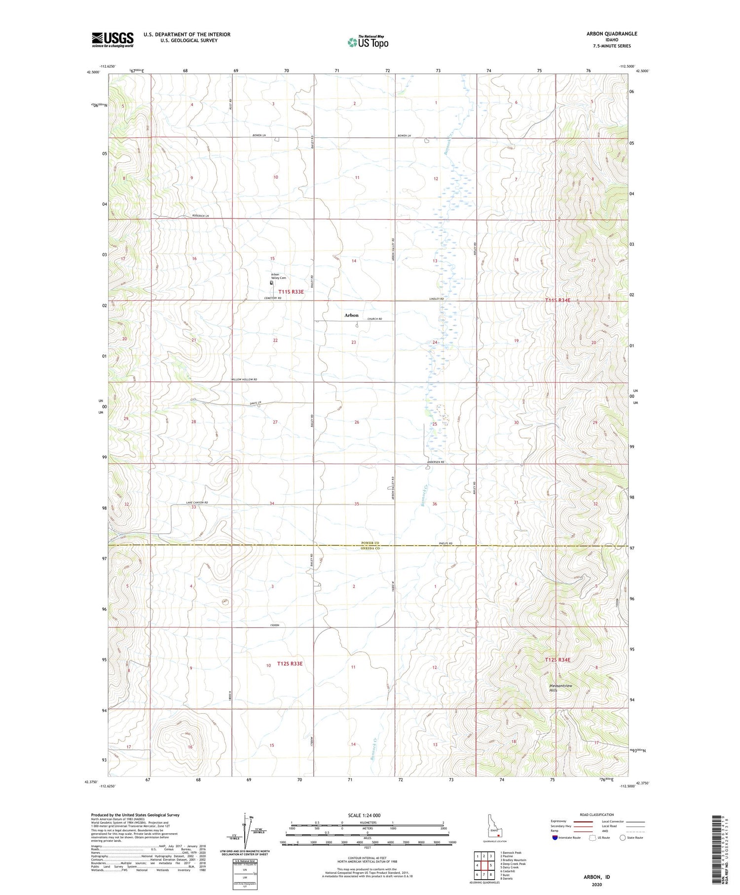
2023 topographic map quadrangle Arbon in the state of Idaho. Scale: 1:24000. Based on the newly updated USGS 7.5' US Topo map series, this map is in the following counties: Power, Oneida. The map contains contour data, water features, and other items you are used to seeing on USGS maps, but also has updated roads and other features. This is the next generation of topographic maps. Printed on high-quality waterproof paper with UV fade-resistant inks.
Quads adjacent to this one:
West: Deep Creek Peak
Northwest: Bannock Peak
North: Pauline
Northeast: Bradley Mountain
East: Dairy Creek
Southeast: Daniels
South: Buist
Southwest: Cedarhill
This map covers the same area as the classic USGS quad with code o42112d5.
Contains the following named places: Arbon, Arbon Valley Cemetery