MyTopo
Pauline Idaho US Topo Map
Couldn't load pickup availability
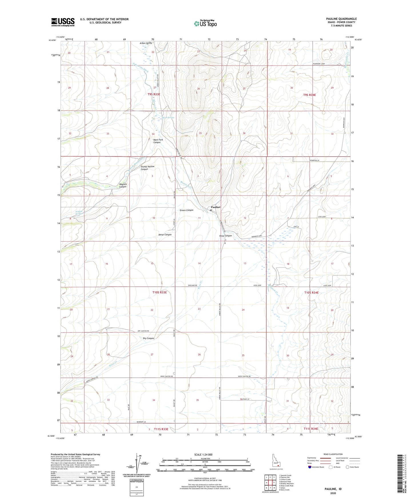
2023 topographic map quadrangle Pauline in the state of Idaho. Scale: 1:24000. Based on the newly updated USGS 7.5' US Topo map series, this map is in the following counties: Power. The map contains contour data, water features, and other items you are used to seeing on USGS maps, but also has updated roads and other features. This is the next generation of topographic maps. Printed on high-quality waterproof paper with UV fade-resistant inks.
Quads adjacent to this one:
West: Bannock Peak
Northwest: Sawmill Creek
North: Flatiron Hill
Northeast: Clifton Creek
East: Bradley Mountain
Southeast: Dairy Creek
South: Arbon
Southwest: Deep Creek Peak
This map covers the same area as the classic USGS quad with code o42112e5.
Contains the following named places: Arbon Division, Arbon Elementary School, Arbon Post Office, Arbon Valley, Cedar Well, Dorys Canyon, Dry Canyon, Green Canyon, Knox Canyon, Knox Creek, Pabawena Ditch, Pauline, Rock Springs, Stump Hollow Canyon, Waylett Canyon, Waylett Spring, West Fork Bannock Creek, West Fork Canyon, ZIP Code: 83212