MyTopo
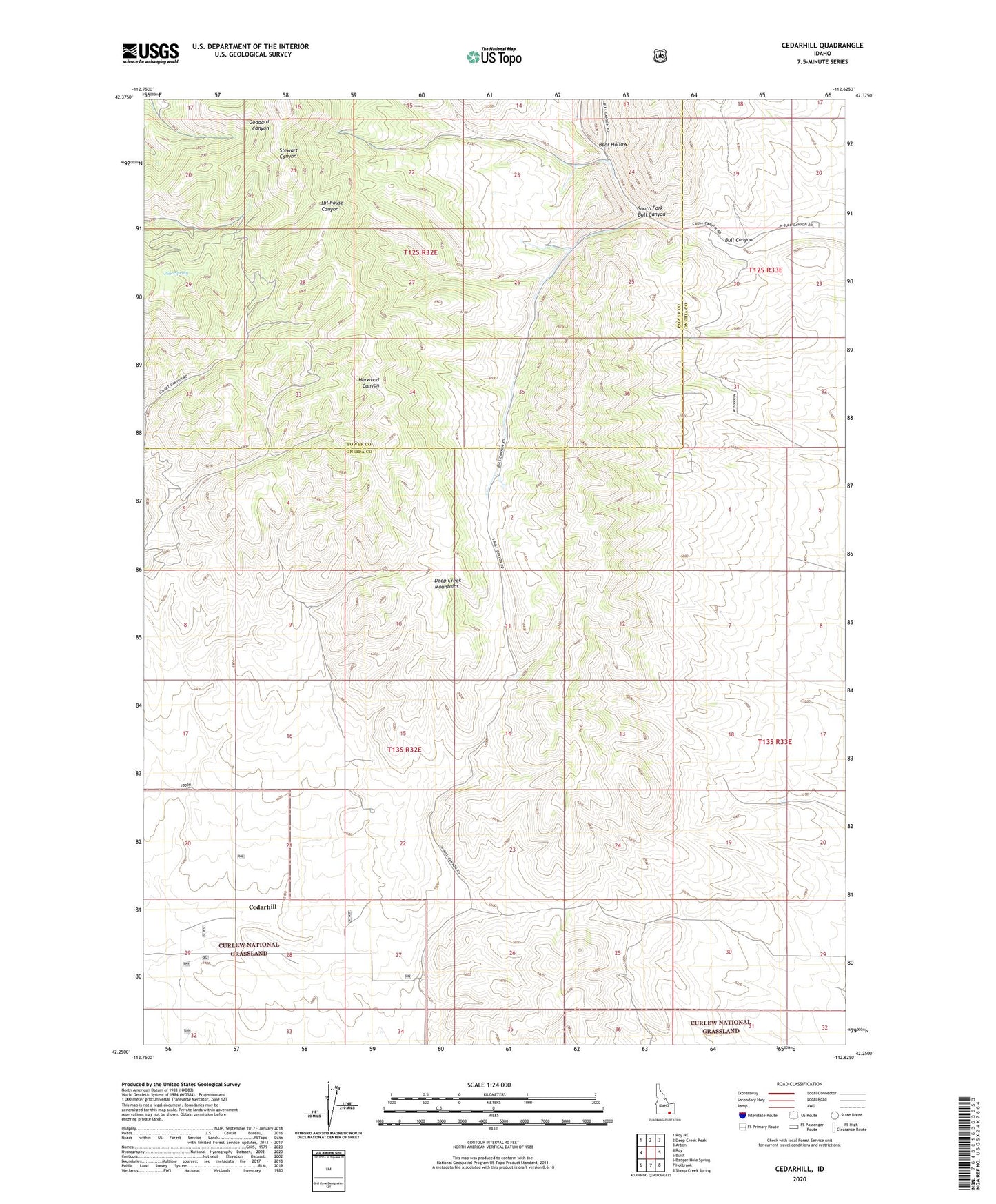
Cedarhill Idaho US Topo Map
Couldn't load pickup availability
Also explore the Cedarhill Forest Service Topo of this same quad for updated USFS data
2024 topographic map quadrangle Cedarhill in the state of Idaho. Scale: 1:24000. Based on the newly updated USGS 7.5' US Topo map series, this map is in the following counties: Oneida, Power. The map contains contour data, water features, and other items you are used to seeing on USGS maps, but also has updated roads and other features. This is the next generation of topographic maps. Printed on high-quality waterproof paper with UV fade-resistant inks.
Quads adjacent to this one:
West: Roy
Northwest: Roy NE
North: Deep Creek Peak
Northeast: Arbon
East: Buist
Southeast: Sheep Creek Spring
South: Holbrook
Southwest: Badger Hole Spring
This map covers the same area as the classic USGS quad with code o42112c6.
Contains the following named places: Bear Hollow, Bull Canyon, Cedarhill, Pine Spring, South Fork Bull Canyon, ZIP Code: 83243