MyTopo
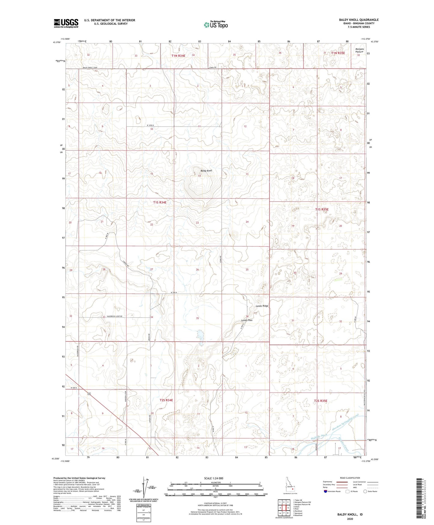
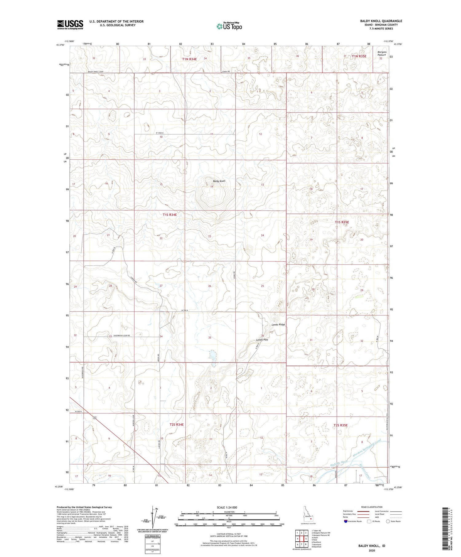
Baldy Knoll Idaho US Topo Map
Couldn't load pickup availability
2023 topographic map quadrangle Baldy Knoll in the state of Idaho. Scale: 1:24000. Based on the newly updated USGS 7.5' US Topo map series, this map is in the following counties: Bingham. The map contains contour data, water features, and other items you are used to seeing on USGS maps, but also has updated roads and other features. This is the next generation of topographic maps. Printed on high-quality waterproof paper with UV fade-resistant inks.
Quads adjacent to this one:
West: Olsen
Northwest: Taber NE
North: Morgans Pasture NW
Northeast: Morgans Pasture NE
East: Rose
Southeast: Blackfoot
South: Moreland
Southwest: Rockford
This map covers the same area as the classic USGS quad with code o43112c4.
Contains the following named places: Baldy Knoll, Highline Ditch, Lemhi Pass, Lemhi Ridge