MyTopo
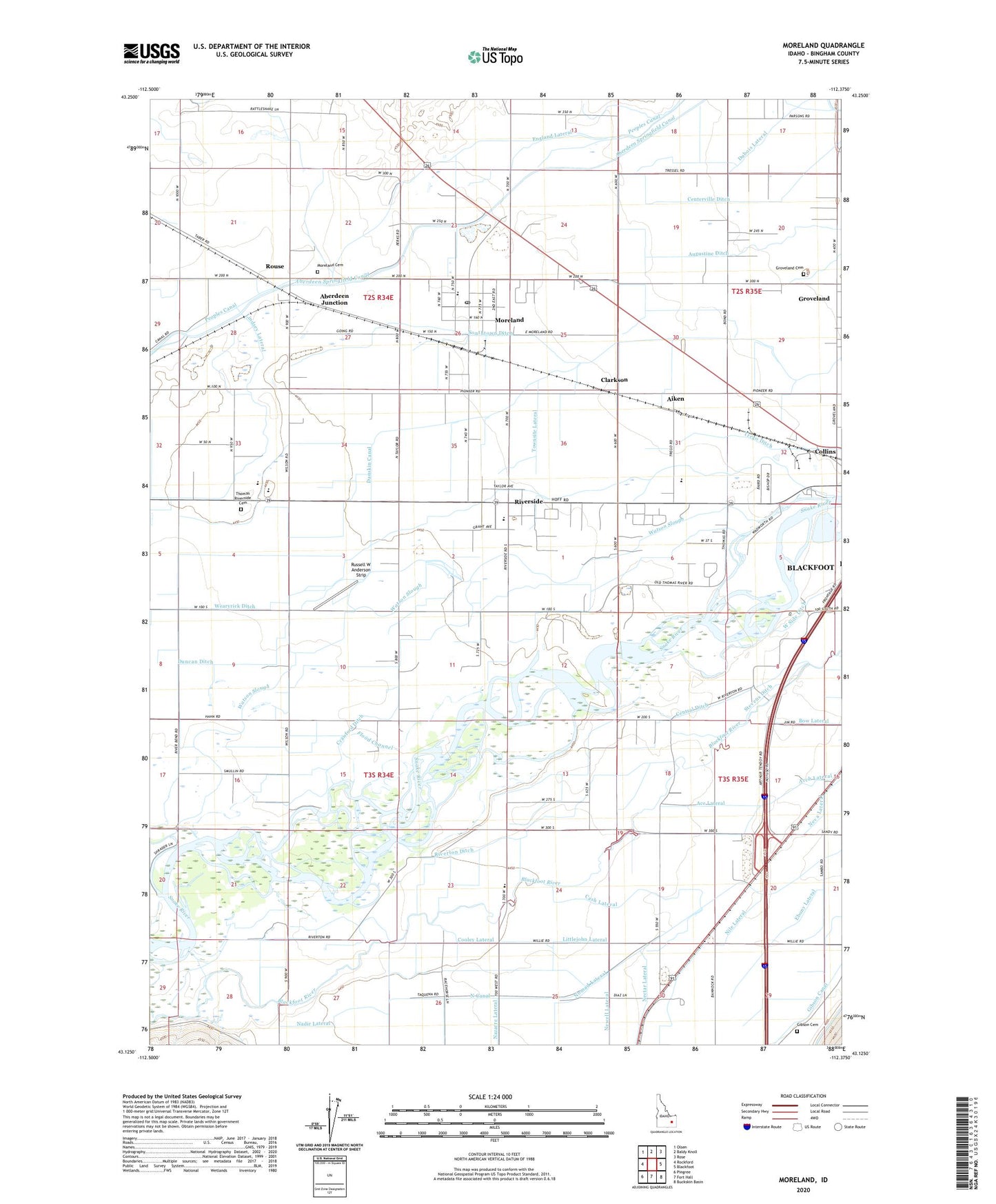
Moreland Idaho US Topo Map
Couldn't load pickup availability
2023 topographic map quadrangle Moreland in the state of Idaho. Scale: 1:24000. Based on the newly updated USGS 7.5' US Topo map series, this map is in the following counties: Bingham. The map contains contour data, water features, and other items you are used to seeing on USGS maps, but also has updated roads and other features. This is the next generation of topographic maps. Printed on high-quality waterproof paper with UV fade-resistant inks.
Quads adjacent to this one:
West: Rockford
Northwest: Olsen
North: Baldy Knoll
Northeast: Rose
East: Blackfoot
Southeast: Buckskin Basin
South: Fort Hall
Southwest: Pingree
This map covers the same area as the classic USGS quad with code o43112b4.
Contains the following named places: Aberdeen Junction, Ace Lateral, Aiken, Arch Lateral, Augustine Ditch, Bingham County, Bow Lateral, Cash Lateral, Central Ditch, Clarkson, Collins, Cooley Lateral, Crawford Ditch, Danskin Canal, Dubois Lateral, Duncan Ditch, Ebony Lateral, England Lateral, Flood Channel, Gibson Cemetery, Groveland Cemetery, Groveland Census Designated Place, Lindsey Lateral, Littlejohn Lateral, Moreland, Moreland Cemetery, Moreland Census Designated Place, Moreland Division, Moreland Elementary School, Moreland Post Office, Nadir Lateral, Nectar Lateral, Nile Lateral, Nomad Lateral, North Canal, Peoples Canal, Peterson, Riverside, Riverside Census Designated Place, Riverside Elementary School, Riverton Access Area, Riverton Ditch, Rouse, Russell W Anderson Strip, Snake River High School, Snake River Junior High School, Southtown Ditch, Stevens Ditch, Thomas Riverside Cemetery, Townsite Lateral, Wearyrick Ditch