MyTopo
Rockford Idaho US Topo Map
Couldn't load pickup availability
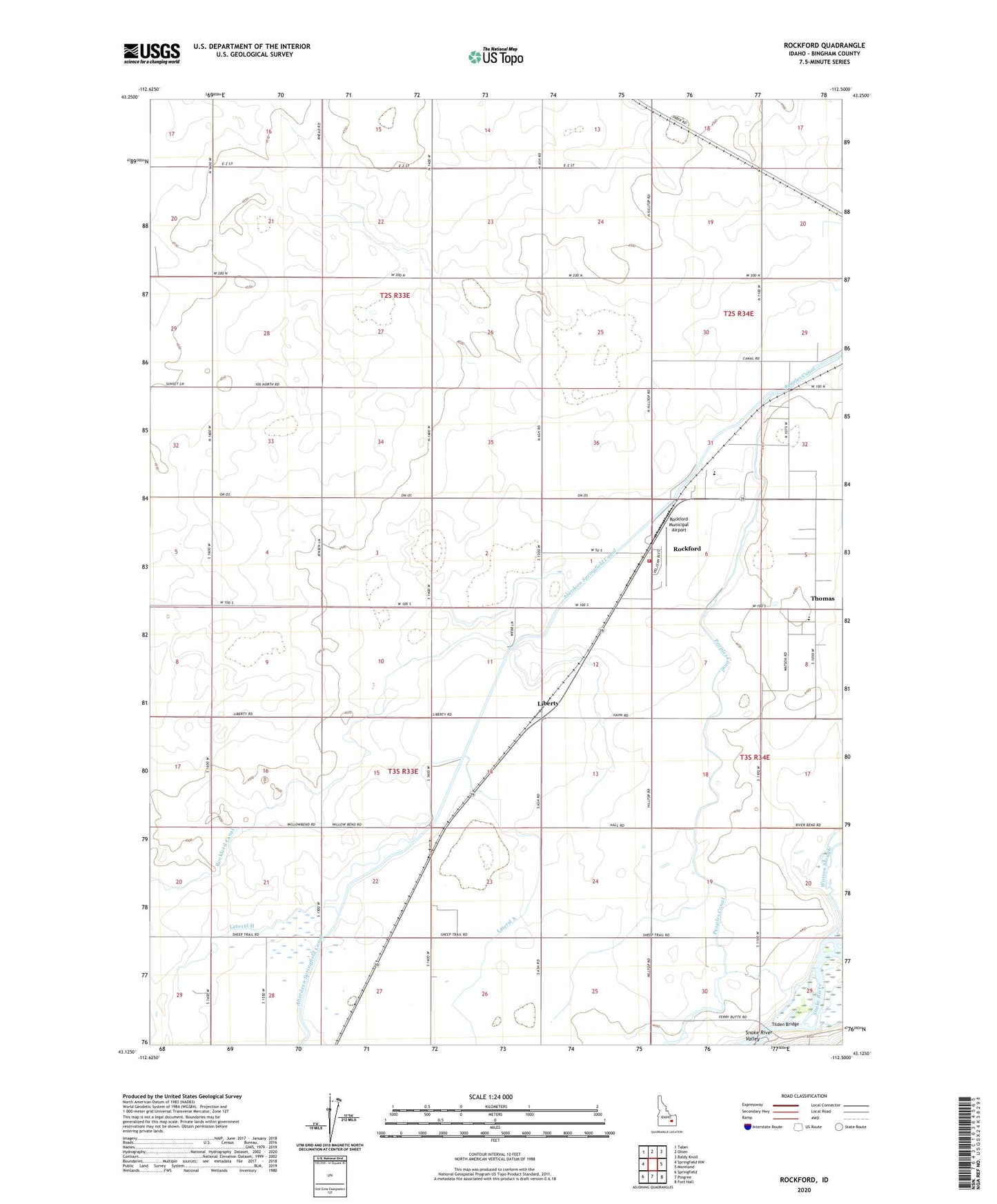
2023 topographic map quadrangle Rockford in the state of Idaho. Scale: 1:24000. Based on the newly updated USGS 7.5' US Topo map series, this map is in the following counties: Bingham. The map contains contour data, water features, and other items you are used to seeing on USGS maps, but also has updated roads and other features. This is the next generation of topographic maps. Printed on high-quality waterproof paper with UV fade-resistant inks.
Quads adjacent to this one:
West: Springfield NW
Northwest: Taber
North: Olsen
Northeast: Baldy Knoll
East: Moreland
Southeast: Fort Hall
South: Pingree
Southwest: Springfield
This map covers the same area as the classic USGS quad with code o43112b5.
Contains the following named places: Aberdeen Springfield Canal, Blackfoot Fire Department Station 2, Blackfoot River, Ferry Butte Access Area, Lateral A, Lateral H, Liberty, Rockford, Rockford Canal, Rockford Census Designated Place, Rockford Municipal Airport, Snake River Junior High School, Snake River Middle School, Thomas, Tilden Bridge, Watson Slough