MyTopo
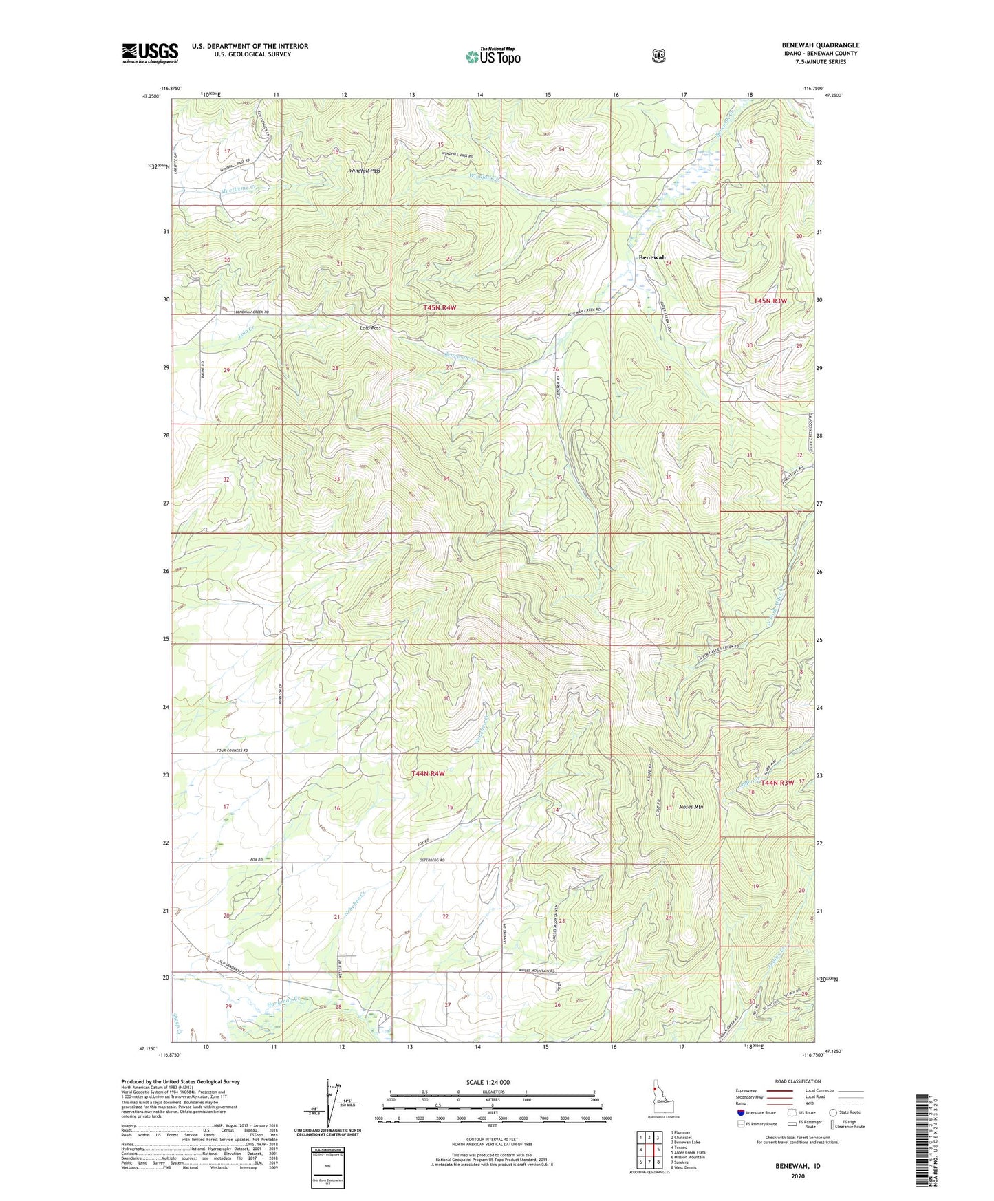
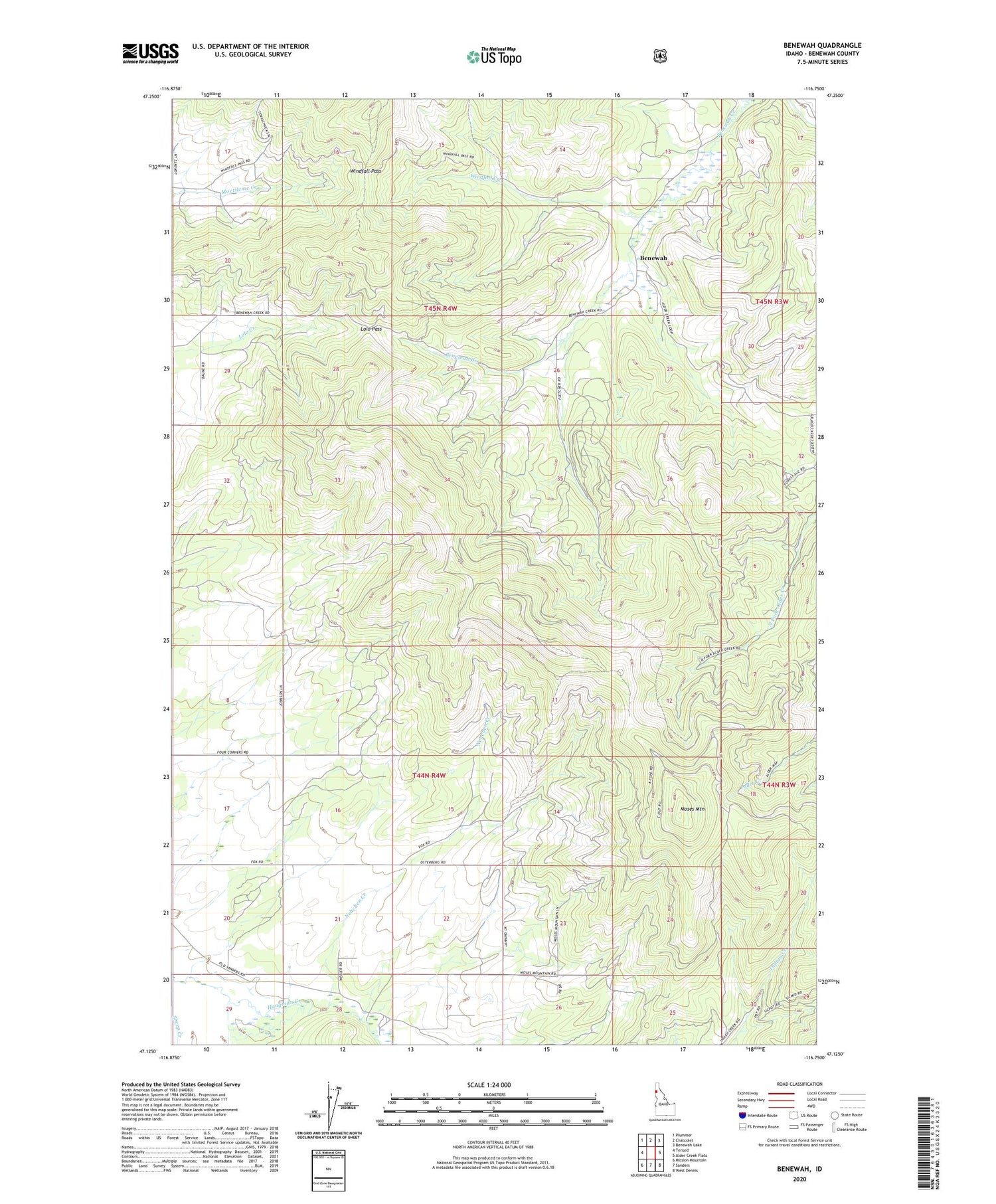
Benewah Idaho US Topo Map
Couldn't load pickup availability
Also explore the Benewah Forest Service Topo of this same quad for updated USFS data
2024 topographic map quadrangle Benewah in the state of Idaho. Scale: 1:24000. Based on the newly updated USGS 7.5' US Topo map series, this map is in the following counties: Benewah. The map contains contour data, water features, and other items you are used to seeing on USGS maps, but also has updated roads and other features. This is the next generation of topographic maps. Printed on high-quality waterproof paper with UV fade-resistant inks.
Quads adjacent to this one:
West: Tensed
Northwest: Plummer
North: Chatcolet
Northeast: Benewah Lake
East: Alder Creek Flats
Southeast: West Dennis
South: Sanders
Southwest: Mission Mountain
This map covers the same area as the classic USGS quad with code o47116b7.
Contains the following named places: Benewah, Hnp'ekwle'n Meadow, Lolo Pass, Moses Mountain, Nehchen Creek, Ni'nsi' Meadow, Sheep Creek, Windfall Creek, Windfall Pass, ZIP Code: 83870