MyTopo
Plummer Idaho US Topo Map
Couldn't load pickup availability
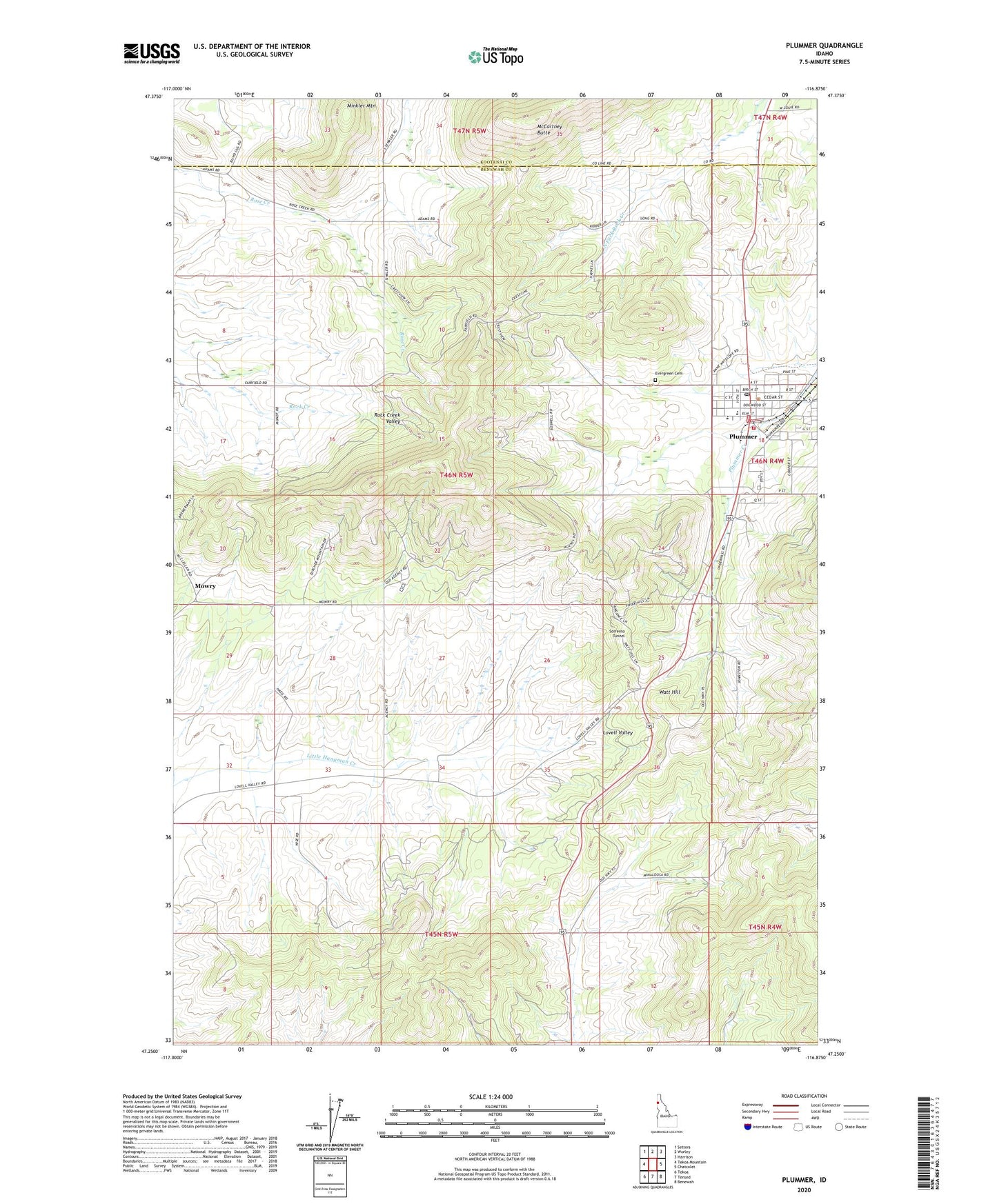
2024 topographic map quadrangle Plummer in the state of Idaho. Scale: 1:24000. Based on the newly updated USGS 7.5' US Topo map series, this map is in the following counties: Benewah, Kootenai. The map contains contour data, water features, and other items you are used to seeing on USGS maps, but also has updated roads and other features. This is the next generation of topographic maps. Printed on high-quality waterproof paper with UV fade-resistant inks.
Quads adjacent to this one:
West: Tekoa Mountain
Northwest: Setters
North: Worley
Northeast: Harrison
East: Chatcolet
Southeast: Benewah
South: Tensed
Southwest: Tekoa
This map covers the same area as the classic USGS quad with code o47116c8.
Contains the following named places: Chief MOC-TEL-ME Rest Area, City of Plummer, Coeur d'Alene Indian Tribal Headquarters, Evergreen Cemetery, Gateway Fire Protection District, Hn'ya)pqi'nn, Khwele' Grounds, Lakeside Elementary School, Lakeside Junior and Senior High School, McCartney Butte, Minkler Mountain, Mowry, Plummer, Plummer Division, Plummer Post Office, Sorrento Tunnel, Watt Hill, ZIP Code: 83851